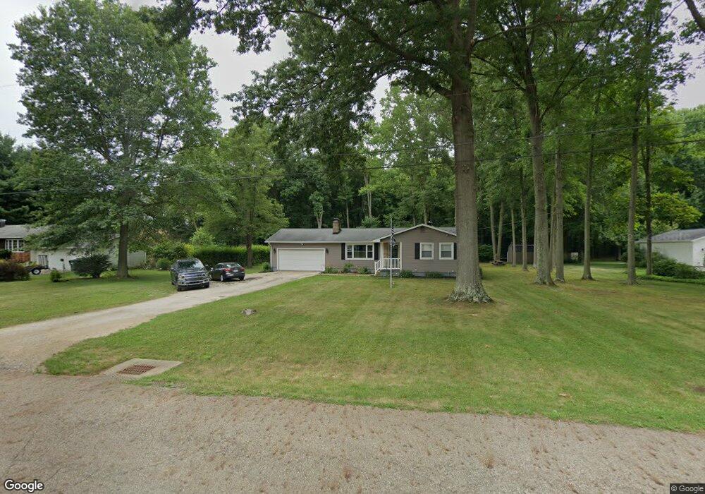
12415 Beula St NE Alliance, OH 44601
Estimated Value: $227,538 - $268,000
3
Beds
2
Baths
1,452
Sq Ft
$166/Sq Ft
Est. Value
About This Home
This home is located at 12415 Beula St NE, Alliance, OH 44601 and is currently estimated at $241,635, approximately $166 per square foot. 12415 Beula St NE is a home located in Stark County with nearby schools including Marlington High School and Regina Coeli/St Joseph School.
Ownership History
Date
Name
Owned For
Owner Type
Purchase Details
Closed on
Aug 18, 2003
Sold by
Bank One Na
Bought by
Cathey Kelsi J
Current Estimated Value
Home Financials for this Owner
Home Financials are based on the most recent Mortgage that was taken out on this home.
Original Mortgage
$80,000
Outstanding Balance
$35,408
Interest Rate
5.69%
Mortgage Type
Purchase Money Mortgage
Estimated Equity
$206,227
Purchase Details
Closed on
May 2, 2002
Sold by
Zutall Christopher S
Bought by
The First National Bank Of Chicago and Bankboston Home Equity Loan Trust 1999-1
Purchase Details
Closed on
Apr 18, 2002
Sold by
Zufall Christopher S and Zufall Shannon D
Bought by
The First National Bank Of Chicago and Bankboston Home Equity Loan Trust 1999-1
Create a Home Valuation Report for This Property
The Home Valuation Report is an in-depth analysis detailing your home's value as well as a comparison with similar homes in the area
Home Values in the Area
Average Home Value in this Area
Purchase History
| Date | Buyer | Sale Price | Title Company |
|---|---|---|---|
| Cathey Kelsi J | $85,000 | Sovereign Title Agency Llc | |
| The First National Bank Of Chicago | $72,000 | -- | |
| The First National Bank Of Chicago | $72,000 | -- |
Source: Public Records
Mortgage History
| Date | Status | Borrower | Loan Amount |
|---|---|---|---|
| Open | Cathey Kelsi J | $80,000 |
Source: Public Records
Tax History Compared to Growth
Tax History
| Year | Tax Paid | Tax Assessment Tax Assessment Total Assessment is a certain percentage of the fair market value that is determined by local assessors to be the total taxable value of land and additions on the property. | Land | Improvement |
|---|---|---|---|---|
| 2025 | -- | $76,200 | $23,380 | $52,820 |
| 2024 | -- | $76,200 | $23,380 | $52,820 |
| 2023 | $1,849 | $52,510 | $12,430 | $40,080 |
| 2022 | $1,856 | $52,510 | $12,430 | $40,080 |
| 2021 | $1,862 | $52,510 | $12,430 | $40,080 |
| 2020 | $1,781 | $44,770 | $10,710 | $34,060 |
| 2019 | $1,769 | $44,770 | $10,710 | $34,060 |
| 2018 | $1,772 | $44,770 | $10,710 | $34,060 |
| 2017 | $1,696 | $40,120 | $10,190 | $29,930 |
| 2016 | $1,477 | $34,940 | $11,310 | $23,630 |
| 2015 | $1,406 | $34,940 | $11,310 | $23,630 |
| 2014 | $1,285 | $29,160 | $9,450 | $19,710 |
| 2013 | $639 | $29,160 | $9,450 | $19,710 |
Source: Public Records
Map
Nearby Homes
- 10666 Wilma Ave NE
- 0 Meadow St NE
- 13334 Cindy St NE
- 12355 Edison St NE
- 11960 Freshley Ave NE
- 11480 Aebi Ave NE
- 13109 Edison St NE
- 12252 Snode St NE
- 12415 Snode St NE
- 0 W Main St Unit 5090123
- 1430 Westwood Ave
- 000 Klinger Ave
- 2081 Marwood Cir
- 0 Reeder Ave NE
- 14422 Sturbridge Rd NE
- 432 Johnson Ave
- 2377 Ansley St Unit 2377
- 0 Homestead Ave NE
- 000 Meadowbrook Ave
- 0 Meadowbrook Ave
- 12395 Beula St NE
- 10935 Dot Ave NE
- 12435 Beula St NE
- 12435 Beula St NE
- 10936 Dot Ave NE
- 10920 Dot Ave NE
- 10935 Barcus Ave NE
- 10905 Dot Ave NE
- 10921 Barcus Ave NE
- 10891 Dot Ave NE
- 10905 Barcus Ave NE
- 10890 Dot Ave NE
- 12495 Beula St NE
- 10891 Barcus Ave NE
- 10936 Barcus Ave NE
- 10871 Dot Ave NE
- 10870 Dot Ave NE
- 10920 Barcus Ave NE
- 12515 Beula St NE
- 10871 Barcus Ave NE