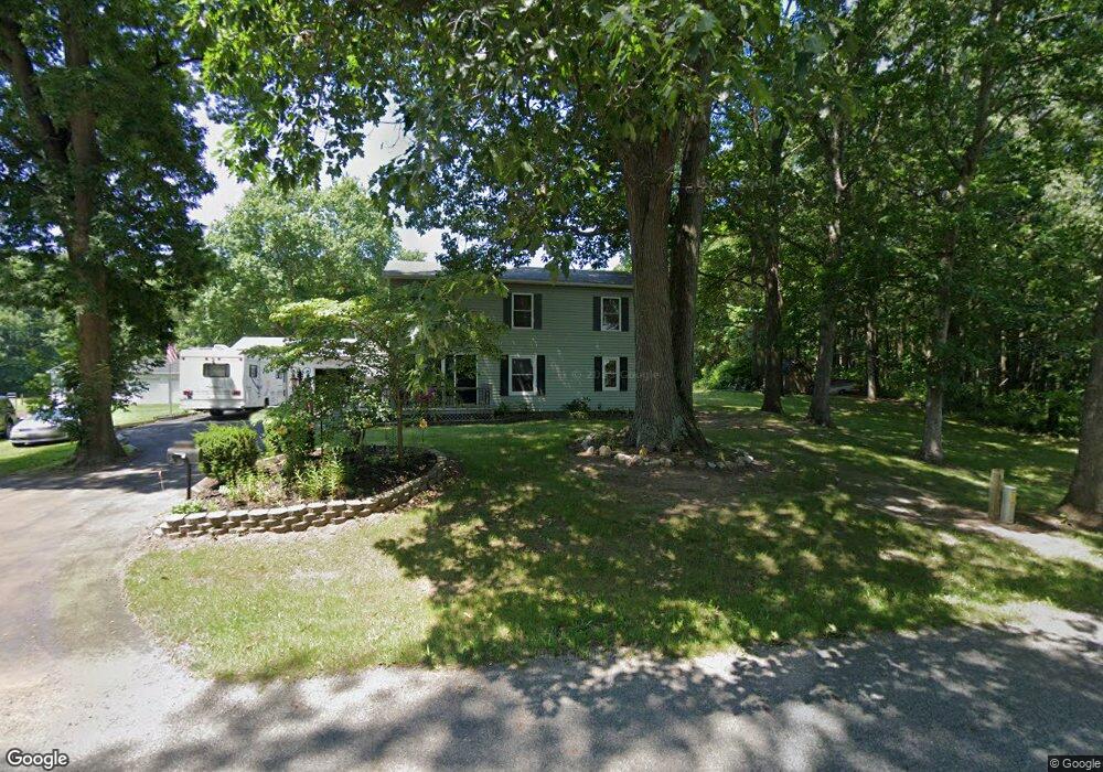
12416 Pardee Rd Sawyer, MI 49125
Estimated Value: $417,000 - $584,028
4
Beds
3
Baths
2,332
Sq Ft
$224/Sq Ft
Est. Value
About This Home
This home is located at 12416 Pardee Rd, Sawyer, MI 49125 and is currently estimated at $523,009, approximately $224 per square foot. 12416 Pardee Rd is a home located in Berrien County with nearby schools including River Valley Middle/High School.
Ownership History
Date
Name
Owned For
Owner Type
Purchase Details
Closed on
Dec 19, 2012
Sold by
Bates Albert G and Bates Cheryl L
Bought by
Bates Albert George and Bates Cheryl Lynn
Current Estimated Value
Purchase Details
Closed on
Oct 6, 1993
Purchase Details
Closed on
Oct 1, 1976
Purchase Details
Closed on
Jun 1, 1975
Create a Home Valuation Report for This Property
The Home Valuation Report is an in-depth analysis detailing your home's value as well as a comparison with similar homes in the area
Purchase History
| Date | Buyer | Sale Price | Title Company |
|---|---|---|---|
| Bates Albert George | -- | None Available | |
| -- | $100 | -- | |
| -- | $24,000 | -- | |
| -- | $17,000 | -- |
Source: Public Records
Tax History
| Year | Tax Paid | Tax Assessment Tax Assessment Total Assessment is a certain percentage of the fair market value that is determined by local assessors to be the total taxable value of land and additions on the property. | Land | Improvement |
|---|---|---|---|---|
| 2025 | $2,009 | $229,500 | $0 | $0 |
| 2024 | $874 | $207,700 | $0 | $0 |
| 2023 | $833 | $175,700 | $0 | $0 |
| 2022 | $793 | $136,600 | $0 | $0 |
| 2021 | $1,795 | $124,200 | $37,400 | $86,800 |
| 2020 | $1,711 | $126,300 | $0 | $0 |
| 2019 | $1,692 | $111,300 | $44,400 | $66,900 |
| 2018 | $1,394 | $111,300 | $0 | $0 |
| 2017 | $1,379 | $104,700 | $0 | $0 |
| 2016 | $1,272 | $105,000 | $0 | $0 |
| 2015 | $1,282 | $113,700 | $0 | $0 |
| 2014 | $691 | $101,400 | $0 | $0 |
Source: Public Records
Map
Nearby Homes
- 2362 Browntown Rd
- 3334 W Glendora Rd
- 11545 Landon Rd
- 4509 Hanover Rd
- 210 W Wagner Rd
- 1294 W Glendora Rd
- 0 W Wagner Rd Unit 26000020
- 5650 Lily Ln
- 3990 Sugarsand Ln
- 3995 Sugarsand Ln
- 4043 Sugarsand Ln
- 4019 Sugarsand Ln
- 5831 Browntown Rd
- 4596 Vista Dr
- 9847 Quail Run Ct
- 12435 Sandpiper Ln
- 12843 S Wolcott Ave
- 5935 Sawyer Rd
- 6010 Migiel Ln
- VL-0 Baldwin Rd
- 12592 Pardee Rd
- 12486 Pardee Rd
- 12606 Pardee Rd
- 12205 Sandridge Rd
- 12533 Sandridge Rd
- 0 Sandridge Rd
- 12453 Sandridge Rd
- 12453 Sandridge Rd
- 12681 Pardee Rd
- 3513 Browntown Rd
- 3361 Browntown Rd
- 12125 Sandridge Rd
- 3007 Browntown Rd
- 3085 Browntown Rd
- 3065 Browntown Rd
- 12601 Sandridge Rd
- 12601 Sandridge Rd
- 12869 Pardee Rd
- 3501 Sawyer Rd
- 3033 Browntown Rd
Your Personal Tour Guide
Ask me questions while you tour the home.