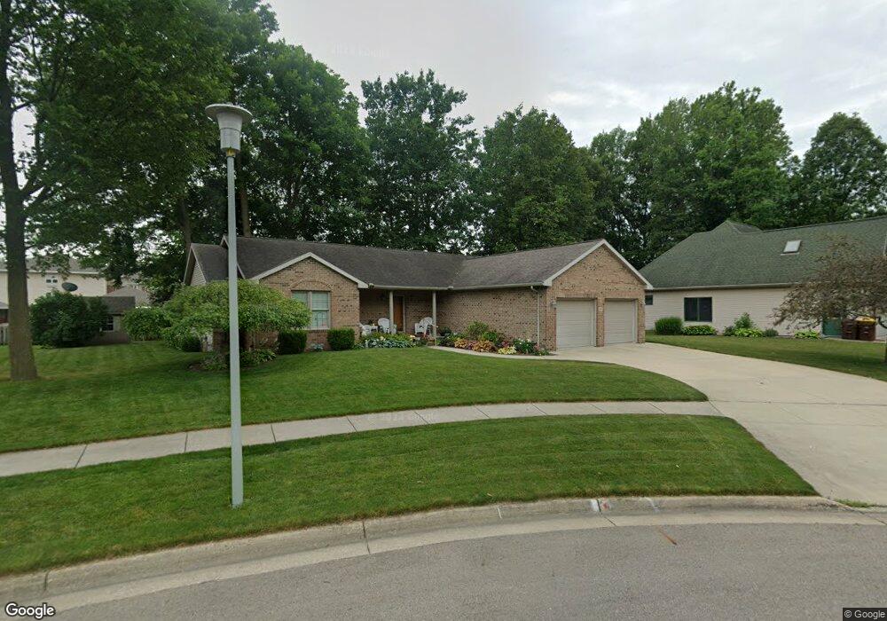
1242 Astwood Mews Ln Saint Johns, MI 48879
Estimated Value: $345,000 - $371,000
3
Beds
2
Baths
1,542
Sq Ft
$232/Sq Ft
Est. Value
About This Home
This home is located at 1242 Astwood Mews Ln, Saint Johns, MI 48879 and is currently estimated at $358,208, approximately $232 per square foot. 1242 Astwood Mews Ln is a home located in Clinton County with nearby schools including St. Johns High School and St Joseph Catholic School.
Ownership History
Date
Name
Owned For
Owner Type
Purchase Details
Closed on
Oct 1, 2025
Sold by
Thompson Marvin and Thompson Joy
Bought by
Thompson Marvin and Thompson Joy
Current Estimated Value
Purchase Details
Closed on
Sep 11, 2024
Sold by
Hollis Dee and Hollis Bonna Lee
Bought by
Thompson Marvin and Thompson Joy
Purchase Details
Closed on
Nov 8, 2021
Sold by
Hollis Dee and Hollis Bonna Lee
Bought by
Hollis Dee And Bonna Lee Cooper Joint Living and Cooper
Purchase Details
Closed on
Aug 13, 2003
Sold by
Lanterman Kathleen S
Bought by
Dee Hollis and Bonna Lee Cooper Joint Lv T
Home Financials for this Owner
Home Financials are based on the most recent Mortgage that was taken out on this home.
Original Mortgage
$35,920
Interest Rate
5.47%
Mortgage Type
Seller Take Back
Create a Home Valuation Report for This Property
The Home Valuation Report is an in-depth analysis detailing your home's value as well as a comparison with similar homes in the area
Home Values in the Area
Average Home Value in this Area
Purchase History
| Date | Buyer | Sale Price | Title Company |
|---|---|---|---|
| Thompson Marvin | -- | None Listed On Document | |
| Thompson Marvin | $360,000 | Title Professionals Group Llc | |
| Hollis Dee And Bonna Lee Cooper Joint Living | -- | None Listed On Document | |
| Dee Hollis | $44,900 | Fatic |
Source: Public Records
Mortgage History
| Date | Status | Borrower | Loan Amount |
|---|---|---|---|
| Previous Owner | Dee Hollis | $35,920 |
Source: Public Records
Tax History Compared to Growth
Tax History
| Year | Tax Paid | Tax Assessment Tax Assessment Total Assessment is a certain percentage of the fair market value that is determined by local assessors to be the total taxable value of land and additions on the property. | Land | Improvement |
|---|---|---|---|---|
| 2025 | $4,239 | $156,500 | $14,500 | $142,000 |
| 2024 | $2,893 | $148,600 | $14,500 | $134,100 |
| 2023 | $2,720 | $134,400 | $0 | $0 |
| 2022 | $3,806 | $122,600 | $12,700 | $109,900 |
| 2021 | $3,717 | $115,700 | $10,900 | $104,800 |
| 2020 | $3,591 | $109,700 | $10,000 | $99,700 |
| 2019 | $3,473 | $106,100 | $10,000 | $96,100 |
| 2018 | $3,268 | $96,500 | $10,000 | $86,500 |
| 2017 | -- | $96,700 | $10,000 | $86,700 |
| 2016 | -- | $89,000 | $11,200 | $77,800 |
| 2015 | -- | $81,600 | $0 | $0 |
| 2011 | -- | $90,700 | $0 | $0 |
Source: Public Records
Map
Nearby Homes
- 1260 Astwood Mews Ln
- 1350 Wildcat Rd
- 1107 Sunview Dr
- 700 E Townsend Rd
- 1275 Fieldstone Dr
- 903 E State St
- 502 E Mcconnell St
- 1105 S Wight St
- 706 E Railroad St
- 204 N Whittemore St
- 606 E Railroad St
- 1455 W Hyde Rd
- 501 S Clinton Ave
- 306 S Swegles St
- 1300 Superior Dr Unit 1
- 1396 Superior Dr Unit 28
- 1398 Superior Dr Unit 27
- 301 E Walker St
- 106 W Oak St
- 511 S Church St
- 1222 Astwood Mews Ln
- 1250 Astwood Mews Ln
- 1200 Astwood Mews Ln
- 1241 Astwood Mews Ln
- 1221 Astwood Mews Ln
- 1249 Astwood Mews Ln
- 1188 Astwood Mews Ln
- 1199 Astwood Mews Ln
- 1185 Astwood Mews Ln
- 1166 Astwood Mews Ln
- 1177 Astwood Mews Ln
- 1240 Wildcat Rd
- 1156 Astwood Mews Ln
- 1202 Wildcat Rd
- 1248 Wildcat Rd
- 1155 Astwood Mews Ln
- 1170 Wildcat Rd
- 1148 Astwood Mews Ln
- 1160 Wildcat Rd