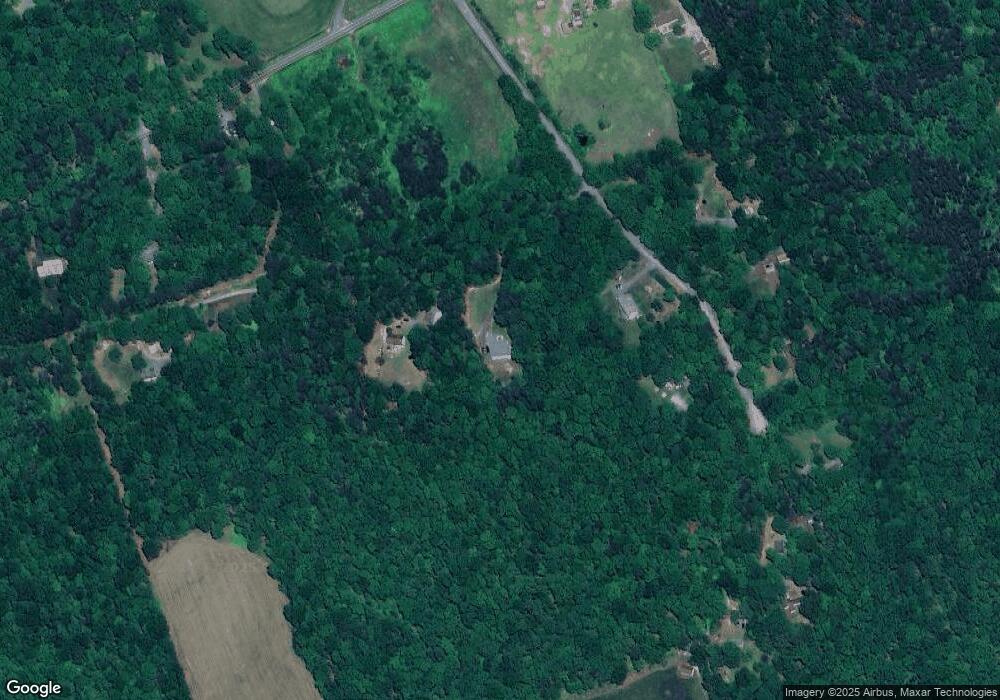
12420 Homestead Dr Locust Grove, VA 22508
Lake Wilderness NeighborhoodEstimated Value: $395,000 - $670,000
4
Beds
5
Baths
2,288
Sq Ft
$236/Sq Ft
Est. Value
About This Home
This home is located at 12420 Homestead Dr, Locust Grove, VA 22508 and is currently estimated at $540,527, approximately $236 per square foot. 12420 Homestead Dr is a home located in Spotsylvania County with nearby schools including Brock Road Elementary School, Ni River Middle School, and Riverbend High School.
Ownership History
Date
Name
Owned For
Owner Type
Purchase Details
Closed on
Jan 7, 2008
Sold by
Meadows James
Bought by
Blount Randy
Current Estimated Value
Home Financials for this Owner
Home Financials are based on the most recent Mortgage that was taken out on this home.
Original Mortgage
$300,000
Outstanding Balance
$190,449
Interest Rate
6.27%
Mortgage Type
Construction
Estimated Equity
$350,078
Create a Home Valuation Report for This Property
The Home Valuation Report is an in-depth analysis detailing your home's value as well as a comparison with similar homes in the area
Home Values in the Area
Average Home Value in this Area
Purchase History
| Date | Buyer | Sale Price | Title Company |
|---|---|---|---|
| Blount Randy | $69,000 | -- |
Source: Public Records
Mortgage History
| Date | Status | Borrower | Loan Amount |
|---|---|---|---|
| Open | Blount Randy | $300,000 |
Source: Public Records
Tax History Compared to Growth
Tax History
| Year | Tax Paid | Tax Assessment Tax Assessment Total Assessment is a certain percentage of the fair market value that is determined by local assessors to be the total taxable value of land and additions on the property. | Land | Improvement |
|---|---|---|---|---|
| 2025 | $3,514 | $478,500 | $74,600 | $403,900 |
| 2024 | $3,514 | $478,500 | $74,600 | $403,900 |
| 2023 | $3,099 | $401,600 | $63,300 | $338,300 |
| 2022 | $2,963 | $401,600 | $63,300 | $338,300 |
| 2021 | $2,992 | $369,700 | $57,600 | $312,100 |
| 2020 | $2,992 | $369,700 | $57,600 | $312,100 |
| 2019 | $2,917 | $344,200 | $51,900 | $292,300 |
| 2018 | $2,867 | $344,200 | $51,900 | $292,300 |
| 2017 | $5,005 | $331,000 | $51,900 | $279,100 |
| 2016 | $4,195 | $331,000 | $51,900 | $279,100 |
| 2015 | $2,516 | $338,500 | $46,300 | $292,200 |
| 2014 | $2,516 | $338,500 | $46,300 | $292,200 |
Source: Public Records
Map
Nearby Homes
- 11402 Railroad Ln
- 11400 Railroad Ln
- 13037 Orange Plank Rd
- 11726 Robin Woods Cir
- 11708 Robin Woods Cir
- 11120 Brandermill Park
- 11205 Hawks Place
- 10901 Brandermill Park
- 11708 Eagle Ridge Dr
- 11710 Southview Ct
- 11601 Turman Mews Way
- 11603 Southview Ct
- 11208 Knolls End
- 11201 Knolls End
- 11202 Preswick Ln
- 11302 Radcliff Terrace
- 11428 Orange Plank Rd
- 11405 Frosty Knoll Ct
- 11326 Oakville Ln
- 11402 Chivalry Chase Ln
- 12500 Homestead Dr
- 11418 Railroad Ln
- 11414 Railroad Ln
- 11419 Railroad Ln
- 11425 Railroad Ln
- 11410 Railroad Ln
- 12520 Homestead Dr
- 11413 Railroad Ln
- 12518 Orange Plank Rd
- 12520 Orange Plank Rd
- 12510 Orange Plank Rd
- 12604 Orange Plank Rd
- 12600 Homestead Dr
- 12608 Orange Plank Rd
- 12436 Orange Plank Rd
- 11406 Railroad Ln
- 11401 Railroad Ln
- 12444 Orange Plank Rd
- 12616 Orange Plank Rd
- 12700 Homestead Dr
