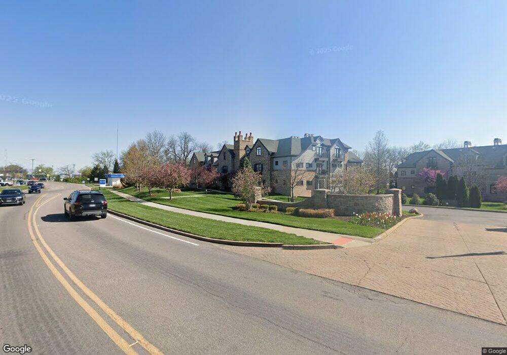
12420 Rott-2d1 Rd Unit 2D Sunset Hills, MO 63127
Estimated Value: $598,000 - $825,000
3
Beds
2
Baths
2,740
Sq Ft
$265/Sq Ft
Est. Value
About This Home
This home is located at 12420 Rott-2d1 Rd Unit 2D, Sunset Hills, MO 63127 and is currently estimated at $727,306, approximately $265 per square foot. 12420 Rott-2d1 Rd Unit 2D is a home located in St. Louis County with nearby schools including Crestwood Elementary School, Truman Middle School, and Lindbergh High School.
Ownership History
Date
Name
Owned For
Owner Type
Purchase Details
Closed on
Jan 29, 2024
Sold by
Bamberger Philip Revocable Living Trust
Bought by
Theodore R Vielhaber R and Theodore Kathleen M
Current Estimated Value
Purchase Details
Closed on
Mar 14, 2023
Sold by
Philip Bamberger Revocable Living Trust and Bamberger Philip
Bought by
Philip Bamberger Revocable Living Trust and Vielhaber Theodore R
Purchase Details
Closed on
Nov 22, 2022
Sold by
Albert W And Joyce A Seufert Living Trus
Bought by
Philip Bamberger Revocable Living Trust
Purchase Details
Closed on
Jun 4, 2010
Sold by
Novus Laumeier Development Co L L C
Bought by
Seufert Joyce A and The Albert W & Joyce A Seufert Living Tr
Create a Home Valuation Report for This Property
The Home Valuation Report is an in-depth analysis detailing your home's value as well as a comparison with similar homes in the area
Home Values in the Area
Average Home Value in this Area
Purchase History
| Date | Buyer | Sale Price | Title Company |
|---|---|---|---|
| Theodore R Vielhaber R | -- | None Listed On Document | |
| Theodore R Vielhaber R | -- | None Listed On Document | |
| Philip Bamberger Revocable Living Trust | -- | None Listed On Document | |
| Philip Bamberger Revocable Living Trust | -- | None Listed On Document | |
| Philip Bamberger Revocable Living Trust | -- | True Title | |
| Seufert Joyce A | $569,000 | U S Title |
Source: Public Records
Tax History
| Year | Tax Paid | Tax Assessment Tax Assessment Total Assessment is a certain percentage of the fair market value that is determined by local assessors to be the total taxable value of land and additions on the property. | Land | Improvement |
|---|---|---|---|---|
| 2025 | $7,550 | $122,100 | $24,000 | $98,100 |
| 2024 | $7,550 | $105,580 | $12,500 | $93,080 |
| 2023 | $7,550 | $105,580 | $12,500 | $93,080 |
| 2022 | $7,277 | $98,100 | $20,010 | $78,090 |
| 2021 | $7,241 | $98,100 | $20,010 | $78,090 |
| 2020 | $7,211 | $94,320 | $20,010 | $74,310 |
| 2019 | $7,192 | $94,320 | $20,010 | $74,310 |
| 2018 | $7,054 | $86,480 | $9,990 | $76,490 |
| 2017 | $6,979 | $86,480 | $9,990 | $76,490 |
| 2016 | $6,335 | $78,560 | $18,010 | $60,550 |
| 2015 | $6,250 | $78,560 | $18,010 | $60,550 |
| 2014 | -- | $88,350 | $32,490 | $55,860 |
Source: Public Records
Map
Nearby Homes
- 12420 Rott Rd Unit 1B
- 12420 Rott Rd Unit 2B
- 12420 Rott Rd Unit 2A
- 12415 Court Dr
- 118 Monica Dr
- 8822 Lynn Ln
- 12685 Alberts Laumeier Ct
- 232 Rayburn Ave
- 403 Rayburn Ave
- 402 Spears St
- 408 Spears St
- 301 Memphis St
- 338 Memphis St
- 421 Spears St
- 8820 Anaconda Dr
- 362 Memphis St
- 343 Memphis St
- 12932 Sunset Bluff Ct
- 433 Spears St
- 367 Memphis St
- 12420 Rott-2a1 Rd Unit 2A
- 124440 Rott-3c2 Rd Unit 3C
- 12420 Rott-1d1 Unit 1D
- 12420 Rott Rd Unit 1A
- 12420 Rott Rd Unit 1D
- 12420 Rott Rd Unit 1C
- 12420 Rott Rd Unit 3C
- 12420 Rott Rd Unit 3B
- 12420 Rott Rd Unit 3A
- 12420 Rott Rd Unit 2D
- 12420 Rott Rd Unit 2C
- 12420 Rott-2b1 Rd Unit 2B
- 12420 Rott-1b1 Unit 1B
- 12420 Rott-1c1 Unit 1C
- 12420 Rott Bld 2 Rd Unit 1B
- 12420Bld 2 Rott Rd Unit 1B
- 12420 Rott-2c1 Rd Unit 2C
- 12420 Rott-3b1 Unit 3B
- 12420 Rott-3c1 Rd Unit 3C
- 12420 Rott-3a1 Unit 3A
Your Personal Tour Guide
Ask me questions while you tour the home.