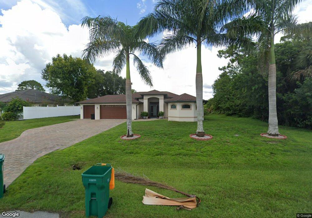
12422 Defender Dr Port Charlotte, FL 33953
Northwest Port Charlotte NeighborhoodEstimated Value: $355,010 - $520,000
--
Bed
2
Baths
1,533
Sq Ft
$283/Sq Ft
Est. Value
About This Home
This home is located at 12422 Defender Dr, Port Charlotte, FL 33953 and is currently estimated at $434,503, approximately $283 per square foot. 12422 Defender Dr is a home located in Charlotte County with nearby schools including Liberty Elementary School, Murdock Middle School, and Port Charlotte High School.
Ownership History
Date
Name
Owned For
Owner Type
Purchase Details
Closed on
Jun 26, 2014
Sold by
Petrone Ted and Petrone Linda S
Bought by
Petrone Ted and Petrone Linda S
Current Estimated Value
Purchase Details
Closed on
Feb 22, 2013
Sold by
Allen Robert C and Allen Francine A
Bought by
Petrone Ted and Petrone Linda S
Purchase Details
Closed on
Aug 21, 2009
Sold by
Farrington William M and Farrington Laticia A
Bought by
Allen Robert C and Allen Francine A
Purchase Details
Closed on
Dec 15, 1999
Sold by
Hopwood Patricia A
Bought by
Farrington William M and Farrington Laticia A
Create a Home Valuation Report for This Property
The Home Valuation Report is an in-depth analysis detailing your home's value as well as a comparison with similar homes in the area
Home Values in the Area
Average Home Value in this Area
Purchase History
| Date | Buyer | Sale Price | Title Company |
|---|---|---|---|
| Petrone Ted | -- | Attorney | |
| Petrone Ted | $30,000 | Msc Title Inc | |
| Allen Robert C | $25,000 | Attorney | |
| Farrington William M | $10,000 | -- |
Source: Public Records
Tax History Compared to Growth
Tax History
| Year | Tax Paid | Tax Assessment Tax Assessment Total Assessment is a certain percentage of the fair market value that is determined by local assessors to be the total taxable value of land and additions on the property. | Land | Improvement |
|---|---|---|---|---|
| 2023 | $3,047 | $181,738 | $0 | $0 |
| 2022 | $3,008 | $176,445 | $0 | $0 |
| 2021 | $2,686 | $171,306 | $0 | $0 |
| 2020 | $2,640 | $168,941 | $0 | $0 |
| 2019 | $2,542 | $165,143 | $0 | $0 |
| 2018 | $2,333 | $162,064 | $0 | $0 |
| 2017 | $2,308 | $158,731 | $0 | $0 |
| 2016 | $2,293 | $155,466 | $0 | $0 |
| 2015 | $2,241 | $151,499 | $0 | $0 |
| 2014 | $807 | $29,240 | $0 | $0 |
Source: Public Records
Map
Nearby Homes
- 12359 Corporal Cir
- 12256 Corporal Cir
- 1392 Liggett Cir
- 12281 Greenleaf Ln
- 12345 Greenleaf Ln
- 12360 Greenleaf Ln
- 1288 Wheatley St
- 12280 Greenleaf Ln
- 12393 Koenig Ln
- 12262 Toynbee Ln
- 12468 Koenig Ln
- 12477 Koenig Ln
- 12453 Koenig Ln
- 12332 Corporal Cir
- 12301 Endicott Ln Unit 10
- 12306 Defender Dr
- 12357 Koenig Ln
- 12373 Toynbee Ln
- 12349 Toynbee Ln
- 12266 Defender Dr
- 12432 Defender Dr
- 12412 Defender Dr
- 12401 Defender Dr
- 12440 Defender Dr
- 12402 Defender Dr
- 12419 Defender Dr
- 12216 Corporal Cir
- 1233 Wheatley St
- 12200 Corporal Cir
- 12456 Defender Dr
- 12386 Defender Dr
- 12211 Corporal Cir
- 12455 Defender Dr
- 1235 Davenport Dr
- 12184 Corporal Cir
- 1225 Davenport Dr
- 1248 Wheatley St
- 1256 Wheatley St
- 12369 Defender Dr
- 12370 Defender Dr