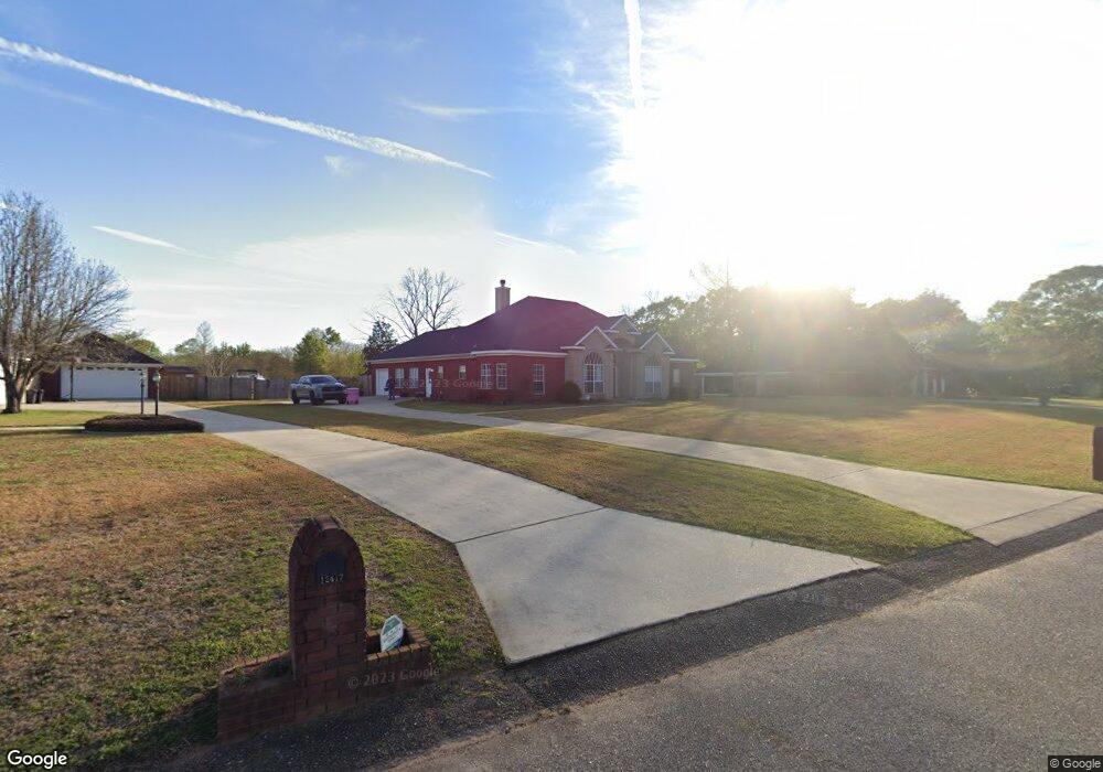
12427 Branson Rd N Mobile, AL 36695
Outer West Mobile NeighborhoodEstimated Value: $308,000 - $351,000
3
Beds
2
Baths
2,226
Sq Ft
$146/Sq Ft
Est. Value
About This Home
This home is located at 12427 Branson Rd N, Mobile, AL 36695 and is currently estimated at $324,832, approximately $145 per square foot. 12427 Branson Rd N is a home located in Mobile County with nearby schools including Hutchens Elementary School, Dawes Intermediate School, and Bernice J Causey Middle School.
Ownership History
Date
Name
Owned For
Owner Type
Purchase Details
Closed on
Oct 14, 2003
Sold by
Howell John A and Howell Amanda W
Bought by
Langan Covington Rhett Edward and Langan Covington Allison
Current Estimated Value
Home Financials for this Owner
Home Financials are based on the most recent Mortgage that was taken out on this home.
Original Mortgage
$153,000
Outstanding Balance
$70,847
Interest Rate
6.45%
Mortgage Type
Unknown
Estimated Equity
$253,985
Purchase Details
Closed on
Nov 28, 2001
Sold by
Chandler Raymond H and Chandler Lillian J
Bought by
Howell John A and Howell Amanda W
Purchase Details
Closed on
Mar 21, 2000
Sold by
Coastal Enterprises Inc
Bought by
Chandler Raymond H and Chandler Lillian J
Create a Home Valuation Report for This Property
The Home Valuation Report is an in-depth analysis detailing your home's value as well as a comparison with similar homes in the area
Home Values in the Area
Average Home Value in this Area
Purchase History
| Date | Buyer | Sale Price | Title Company |
|---|---|---|---|
| Langan Covington Rhett Edward | $180,000 | -- | |
| Howell John A | -- | -- | |
| Chandler Raymond H | -- | -- |
Source: Public Records
Mortgage History
| Date | Status | Borrower | Loan Amount |
|---|---|---|---|
| Open | Langan Covington Rhett Edward | $153,000 |
Source: Public Records
Tax History
| Year | Tax Paid | Tax Assessment Tax Assessment Total Assessment is a certain percentage of the fair market value that is determined by local assessors to be the total taxable value of land and additions on the property. | Land | Improvement |
|---|---|---|---|---|
| 2025 | $1,416 | $29,120 | $4,000 | $25,120 |
| 2024 | $1,416 | $25,920 | $4,000 | $21,920 |
| 2023 | $1,119 | $23,020 | $4,000 | $19,020 |
| 2022 | $961 | $21,200 | $4,000 | $17,200 |
| 2021 | $972 | $21,410 | $4,000 | $17,410 |
| 2020 | $916 | $20,260 | $4,000 | $16,260 |
| 2019 | $899 | $19,920 | $0 | $0 |
| 2018 | $909 | $20,120 | $0 | $0 |
| 2017 | $979 | $20,120 | $0 | $0 |
| 2016 | $927 | $20,500 | $0 | $0 |
| 2013 | $1,064 | $22,180 | $0 | $0 |
Source: Public Records
Map
Nearby Homes
- 2978 Branson Park Ct
- 0 Newman Rd Unit 25399577
- 0 Newman Rd Unit 7652668
- 0 Newman Rd Unit 7670125
- 0 Newman Rd Unit 25537843
- 12171 Yancey Glen Dr
- 3137 Busby Rd
- 13045 Oak Forge Dr
- 3221 Deer Crest Ct
- 0 Lakefront Dr Unit 7716851
- 13346 Deer Crest Ln
- 13163 Buckthorn Ct
- 13205 Hackberry Dr
- 3761 Lakefront Dr
- 3397 Deer Crest Dr
- 2865 Barlett Dr
- 11900 Liberty Dr S
- 3770 Lakefront Dr
- 2995 Barlett Dr
- 2119 Lumpkin Grove Ln Unit 2
- 12437 Branson Rd N
- 12417 Branson Rd N
- 12428 Branson Rd N
- 12407 Branson Rd N
- 12408 Branson Dr N
- 12418 Branson Rd N
- 2925 Branson Rd W
- 2915 Branson Rd W
- 12408 Branson Rd N
- 12438 Branson Rd N
- 2945 Branson Rd W
- 12397 Branson Rd N
- 12398 Branson Rd N
- 2965 Branson Rd W
- 2979 Branson Park Ct
- 2988 Branson Park Ct
- 12448 Branson Rd N
- 2985 Branson Rd W
- 2998 Branson Park Ct
- 12458 Branson Rd N
Your Personal Tour Guide
Ask me questions while you tour the home.