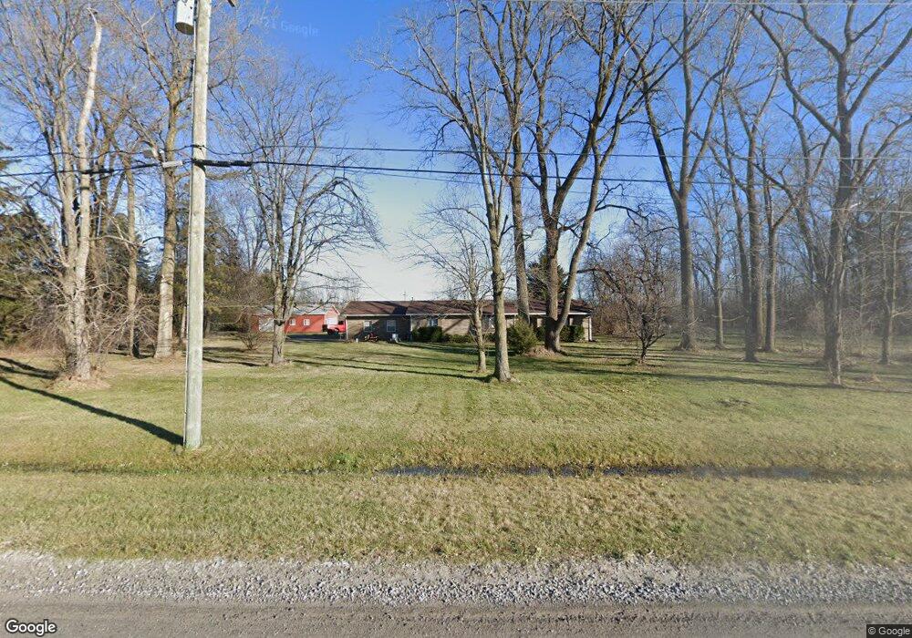
12428 Burns Rd Carleton, MI 48117
Estimated Value: $311,000 - $472,000
Studio
--
Bath
--
Sq Ft
439,956
Sq Ft
About This Home
This home is located at 12428 Burns Rd, Carleton, MI 48117 and is currently estimated at $399,858. 12428 Burns Rd is a home located in Monroe County with nearby schools including Airport Senior High School, St. Patrick Elementary School, and Carleton Community Baptist.
Ownership History
Date
Name
Owned For
Owner Type
Purchase Details
Closed on
Mar 12, 1997
Sold by
Orlandi Lorna D
Bought by
Bush Mark P
Current Estimated Value
Home Financials for this Owner
Home Financials are based on the most recent Mortgage that was taken out on this home.
Original Mortgage
$100,000
Interest Rate
7.95%
Mortgage Type
New Conventional
Purchase Details
Closed on
Mar 31, 1995
Sold by
Ash Timothy T
Bought by
Orlandi Lorna D
Home Financials for this Owner
Home Financials are based on the most recent Mortgage that was taken out on this home.
Original Mortgage
$108,000
Interest Rate
8.5%
Mortgage Type
New Conventional
Create a Home Valuation Report for This Property
The Home Valuation Report is an in-depth analysis detailing your home's value as well as a comparison with similar homes in the area
Home Values in the Area
Average Home Value in this Area
Purchase History
| Date | Buyer | Sale Price | Title Company |
|---|---|---|---|
| Bush Mark P | $175,000 | -- | |
| Orlandi Lorna D | $135,500 | -- |
Source: Public Records
Mortgage History
| Date | Status | Borrower | Loan Amount |
|---|---|---|---|
| Closed | Bush Mark P | $100,000 | |
| Previous Owner | Orlandi Lorna D | $108,000 |
Source: Public Records
Tax History
| Year | Tax Paid | Tax Assessment Tax Assessment Total Assessment is a certain percentage of the fair market value that is determined by local assessors to be the total taxable value of land and additions on the property. | Land | Improvement |
|---|---|---|---|---|
| 2025 | $1,525 | $195,600 | $195,600 | $0 |
| 2024 | $1,479 | $180,900 | $0 | $0 |
| 2023 | $1,409 | $142,000 | $0 | $0 |
| 2022 | $2,735 | $142,000 | $0 | $0 |
| 2021 | $2,635 | $139,900 | $0 | $0 |
| 2020 | $2,599 | $127,100 | $0 | $0 |
| 2019 | $2,550 | $127,100 | $0 | $0 |
| 2018 | $2,504 | $117,200 | $0 | $0 |
| 2017 | $2,361 | $117,200 | $0 | $0 |
| 2016 | $2,340 | $110,100 | $0 | $0 |
| 2015 | $2,229 | $95,900 | $0 | $0 |
| 2014 | $2,201 | $95,900 | $0 | $0 |
| 2013 | -- | $96,000 | $0 | $0 |
Source: Public Records
Map
Nearby Homes
- 12259 Eldora St
- 12464 Maxwell Rd
- 12361 Spencer Ln
- 1405 Cedarcrest Dr
- 12850 Crane St
- 12751 Jones St
- 13498 Exeter Rd
- 49 James Dr
- 1980 Oakville Waltz Rd
- 28503 Margaret Ln Unit 1
- 0 Oakville Waltz Rd Unit G50038710
- 13680 Martinsville Rd
- VACANT Oakville Waltz Rd
- 9601 Exeter Rd
- 36505 Bismark Rd
- 28264 Waltz Rd
- 27972 Waltz Rd
- 27750 Bell Rd
- 27125 Delos Rd
- 0 Carleton West Rd
- 12512 Burns Rd
- 12385 Burns Rd
- 12339 Burns Rd
- 12530 Burns Rd
- 12310 Burns Rd
- 12550 Burns Rd
- 12563 Burns Rd
- 12521 Burns Rd
- 12521 Burns Rd
- 12521 Burns Rd
- 12166 Burns Rd
- 12640 Burns Rd
- 12585 Burns Rd
- 12585 Burns Rd
- 2425 Carleton Rd W
- 2425 Carleton West Rd
- 12341 Knox Dr
- 12345 Knox Dr
- 2325 Carleton West Rd
- 2160 Maplecrest Dr
Your Personal Tour Guide
Ask me questions while you tour the home.