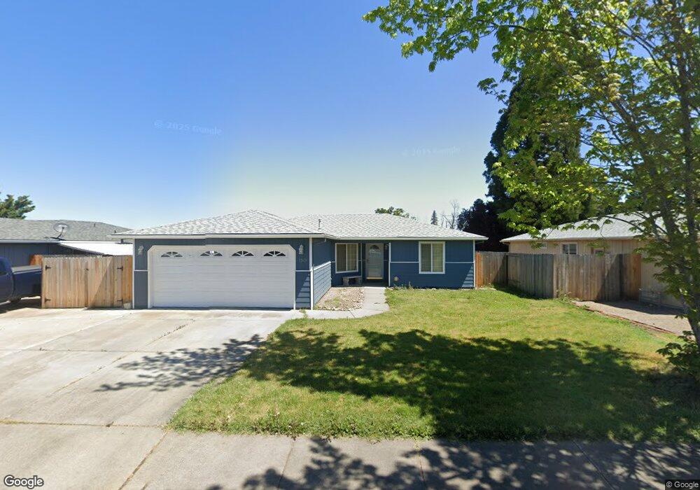
1243 Far West Ave Central Point, OR 97502
Estimated Value: $349,811 - $353,000
3
Beds
2
Baths
1,185
Sq Ft
$297/Sq Ft
Est. Value
About This Home
This home is located at 1243 Far West Ave, Central Point, OR 97502 and is currently estimated at $351,453, approximately $296 per square foot. 1243 Far West Ave is a home located in Jackson County with nearby schools including Howard Elementary School, McLoughlin Middle School, and North Medford High School.
Ownership History
Date
Name
Owned For
Owner Type
Purchase Details
Closed on
Apr 3, 2019
Sold by
Williams Douglas J and Williams Becky D
Bought by
Williams Becky D
Current Estimated Value
Purchase Details
Closed on
Jan 13, 1998
Sold by
Ames Thomas E and Ames Cynthia D
Bought by
Williams Douglas J and Williams Becky D
Home Financials for this Owner
Home Financials are based on the most recent Mortgage that was taken out on this home.
Original Mortgage
$89,200
Outstanding Balance
$15,467
Interest Rate
7.13%
Estimated Equity
$335,986
Create a Home Valuation Report for This Property
The Home Valuation Report is an in-depth analysis detailing your home's value as well as a comparison with similar homes in the area
Home Values in the Area
Average Home Value in this Area
Purchase History
| Date | Buyer | Sale Price | Title Company |
|---|---|---|---|
| Williams Becky D | -- | None Available | |
| Williams Douglas J | $97,000 | Amerititle |
Source: Public Records
Mortgage History
| Date | Status | Borrower | Loan Amount |
|---|---|---|---|
| Open | Williams Douglas J | $89,200 |
Source: Public Records
Tax History Compared to Growth
Tax History
| Year | Tax Paid | Tax Assessment Tax Assessment Total Assessment is a certain percentage of the fair market value that is determined by local assessors to be the total taxable value of land and additions on the property. | Land | Improvement |
|---|---|---|---|---|
| 2025 | $3,026 | $180,890 | $52,890 | $128,000 |
| 2024 | $3,026 | $175,630 | $51,360 | $124,270 |
| 2023 | $2,934 | $170,520 | $49,870 | $120,650 |
| 2022 | $2,861 | $170,520 | $49,870 | $120,650 |
| 2021 | $2,786 | $165,560 | $48,420 | $117,140 |
| 2020 | $2,716 | $160,740 | $47,010 | $113,730 |
| 2019 | $2,649 | $151,520 | $44,310 | $107,210 |
| 2018 | $2,580 | $147,110 | $43,020 | $104,090 |
| 2017 | $2,529 | $147,110 | $43,020 | $104,090 |
| 2016 | $2,475 | $138,670 | $40,560 | $98,110 |
| 2015 | $2,379 | $138,670 | $40,560 | $98,110 |
| 2014 | $2,290 | $130,720 | $38,240 | $92,480 |
Source: Public Records
Map
Nearby Homes
- 3119 Merriman Rd
- 811 O'Hare Pkwy
- 1025 Fairfield Ave
- 529 Black Bear Dr
- 1017 Fairfield Ave
- 959 Westrop Dr
- 2825 Howard Ave
- 1060 Hopkins Rd
- 246 Reanna Way
- 450 Midway Rd Unit 16
- 450 Midway Rd Unit 5
- 921 Pittview Ave
- 191 Mellecker Way
- 881 Westrop Dr
- 460 Federal Way
- 199 Mellecker Way
- 659 Herman Ave
- 2690 Cummings Ln
- 928 Brandi Way
- 2621 Merriman Rd Unit 3000
- 1243 Far Ave W
- 1251 Far West Ave
- 1239 Far West Ave
- 1251 Far Ave W
- 1257 Far West Ave
- 1235 Far West Ave
- 1257 Far Ave W
- 1246 Far Ave W
- 1246 Far West Ave
- 1242 Far West Ave
- 1271 Far West Ave
- 1229 Far West Ave
- 1254 Far Ave W
- 1271 Far Ave W
- 1254 Far West Ave
- 1238 Far West Ave
- 1260 Far Ave W
- 1260 Far West Ave
- 1230 Far West Ave
- 1225 Far West Ave