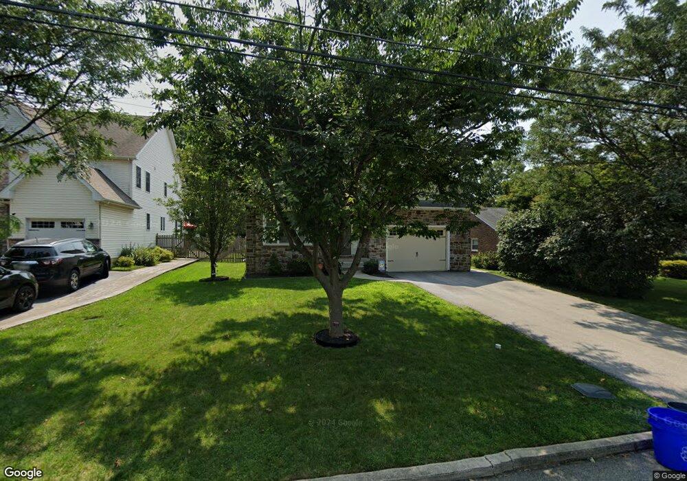
1243 Leedom Rd Havertown, PA 19083
Estimated Value: $761,000 - $1,003,000
4
Beds
3
Baths
2,700
Sq Ft
$325/Sq Ft
Est. Value
About This Home
This home is located at 1243 Leedom Rd, Havertown, PA 19083 and is currently estimated at $876,296, approximately $324 per square foot. 1243 Leedom Rd is a home located in Delaware County with nearby schools including Manoa Elementary School, Haverford Middle School, and Haverford Senior High School.
Ownership History
Date
Name
Owned For
Owner Type
Purchase Details
Closed on
Oct 11, 2022
Sold by
Mcerlean Kathleen A
Bought by
Tatham William T and Tatham Melissa
Current Estimated Value
Purchase Details
Closed on
Jun 22, 2018
Sold by
Falcone Joseph M and Falcone Cheryl A
Bought by
Tatham William T and Tatham Melissa
Purchase Details
Closed on
Aug 28, 2008
Sold by
Will Stephen R and Will Anne Marie
Bought by
Falcone Joseph M and Falcone Cheryl A
Home Financials for this Owner
Home Financials are based on the most recent Mortgage that was taken out on this home.
Original Mortgage
$230,000
Interest Rate
6.69%
Mortgage Type
Purchase Money Mortgage
Purchase Details
Closed on
Jan 10, 1997
Sold by
Barras Barbara R
Bought by
Will Stephen R and Will Anne Marie
Home Financials for this Owner
Home Financials are based on the most recent Mortgage that was taken out on this home.
Original Mortgage
$117,550
Interest Rate
7.46%
Mortgage Type
FHA
Create a Home Valuation Report for This Property
The Home Valuation Report is an in-depth analysis detailing your home's value as well as a comparison with similar homes in the area
Home Values in the Area
Average Home Value in this Area
Purchase History
| Date | Buyer | Sale Price | Title Company |
|---|---|---|---|
| Tatham William T | -- | -- | |
| Tatham William T | $579,000 | None Available | |
| Falcone Joseph M | $290,000 | Lawyers Title Insurance Corp | |
| Will Stephen R | $118,000 | Commonwealth Land Title Ins |
Source: Public Records
Mortgage History
| Date | Status | Borrower | Loan Amount |
|---|---|---|---|
| Previous Owner | Falcone Joseph M | $230,000 | |
| Previous Owner | Will Stephen R | $117,550 |
Source: Public Records
Tax History
| Year | Tax Paid | Tax Assessment Tax Assessment Total Assessment is a certain percentage of the fair market value that is determined by local assessors to be the total taxable value of land and additions on the property. | Land | Improvement |
|---|---|---|---|---|
| 2025 | $14,249 | $554,150 | $108,470 | $445,680 |
| 2024 | $14,249 | $554,150 | $108,470 | $445,680 |
| 2023 | $13,844 | $554,150 | $108,470 | $445,680 |
| 2022 | $13,520 | $554,150 | $108,470 | $445,680 |
| 2021 | $22,026 | $554,150 | $108,470 | $445,680 |
| 2020 | $15,635 | $336,399 | $61,850 | $274,549 |
| 2019 | $15,347 | $336,399 | $61,850 | $274,549 |
| 2018 | $16,787 | $374,390 | $0 | $0 |
| 2017 | $16,432 | $374,390 | $0 | $0 |
| 2016 | $2,055 | $374,390 | $0 | $0 |
| 2015 | $2,055 | $374,390 | $0 | $0 |
| 2014 | $2,097 | $374,390 | $0 | $0 |
Source: Public Records
Map
Nearby Homes
- 204 N Belfield Ave
- 1204 Ellston Rd
- 133 Clamar Ave
- 530 Grand Ave
- 85 Rodmor Rd
- 1136 Bon Air Rd
- 1549 Burmont Rd
- 1522 Steel Rd
- 1116 Blythe Ave
- 636 S Eagle Rd
- 400 Glendale Rd Unit D23
- 400 Glendale Rd Unit A 54
- 400 Glendale Rd Unit G33
- 400 Glendale Rd Unit H32
- 1117 Belfield Ave
- 505 Glendale Rd
- 649 Glendale Rd
- 200 Warrior Rd
- 147 Wyndmoor Rd
- 1049 Drexel Ave
Your Personal Tour Guide
Ask me questions while you tour the home.