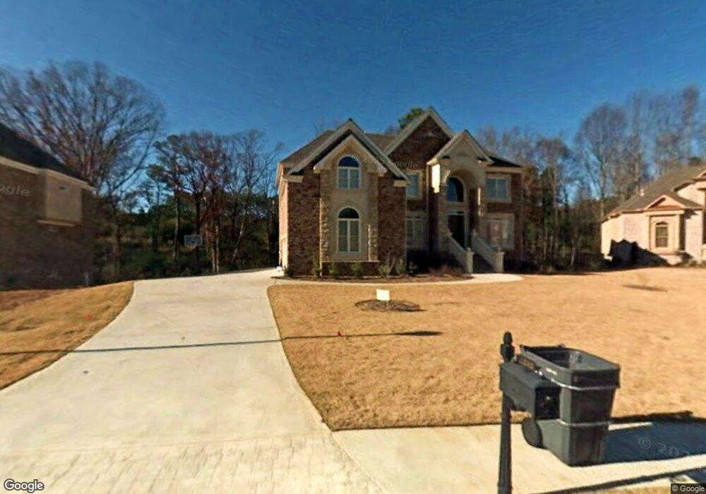
1243 Lionsgate Dr Conyers, GA 30094
Estimated Value: $472,000 - $632,000
5
Beds
5
Baths
3,466
Sq Ft
$158/Sq Ft
Est. Value
About This Home
This home is located at 1243 Lionsgate Dr, Conyers, GA 30094 and is currently estimated at $548,560, approximately $158 per square foot. 1243 Lionsgate Dr is a home located in Rockdale County with nearby schools including Shoal Creek Elementary School, Edwards Middle School, and Rockdale County High School.
Ownership History
Date
Name
Owned For
Owner Type
Purchase Details
Closed on
Aug 3, 2007
Sold by
R & R Custom Homes Inc
Bought by
Pennant Dave A and Barnett Curline
Current Estimated Value
Home Financials for this Owner
Home Financials are based on the most recent Mortgage that was taken out on this home.
Original Mortgage
$457,805
Outstanding Balance
$289,415
Interest Rate
6.63%
Mortgage Type
New Conventional
Estimated Equity
$259,146
Create a Home Valuation Report for This Property
The Home Valuation Report is an in-depth analysis detailing your home's value as well as a comparison with similar homes in the area
Home Values in the Area
Average Home Value in this Area
Purchase History
| Date | Buyer | Sale Price | Title Company |
|---|---|---|---|
| Pennant Dave A | $481,900 | -- |
Source: Public Records
Mortgage History
| Date | Status | Borrower | Loan Amount |
|---|---|---|---|
| Open | Pennant Dave A | $457,805 |
Source: Public Records
Tax History Compared to Growth
Tax History
| Year | Tax Paid | Tax Assessment Tax Assessment Total Assessment is a certain percentage of the fair market value that is determined by local assessors to be the total taxable value of land and additions on the property. | Land | Improvement |
|---|---|---|---|---|
| 2024 | $5,980 | $234,080 | $50,680 | $183,400 |
| 2023 | $4,785 | $195,280 | $50,680 | $144,600 |
| 2022 | $4,585 | $187,480 | $50,680 | $136,800 |
| 2021 | $4,527 | $173,040 | $36,240 | $136,800 |
| 2020 | $4,785 | $173,040 | $36,240 | $136,800 |
| 2019 | $4,561 | $161,880 | $25,080 | $136,800 |
| 2018 | $4,590 | $161,880 | $25,080 | $136,800 |
| 2017 | $4,192 | $147,240 | $25,080 | $122,160 |
| 2016 | $3,790 | $144,400 | $25,080 | $119,320 |
| 2015 | $3,281 | $126,600 | $19,200 | $107,400 |
| 2014 | $2,928 | $126,600 | $19,200 | $107,400 |
| 2013 | -- | $150,880 | $31,600 | $119,280 |
Source: Public Records
Map
Nearby Homes
- 2095 Flat Shoals Rd SW
- 1700 Carissa Dr
- 2318 Hedgeview Rd
- 0 Granade Rd SW Unit 10430605
- 0 Granade Rd SW Unit 10430608
- 0 Granade Rd SW Unit 23687414
- 0 Granade Rd SW Unit 10430607
- 0 Granade Rd SW Unit 10430610
- 0 Granade Rd SW Unit 10430604
- 1400 Ebenezer Rd SW
- 1377 Hill Dr SW
- 1841 Flat Shoals Rd SW
- 1509 Shoal Creek Dr SW
- 1804 Wiggins Cir SW
- 1799 Wiggins Cir SW
- 2289 Amberbrook Dr SW
- 1779 Granade Rd SW
- 2194 Klondike Rd SW
- 0 Klondike Rd SW Unit 7601318
- 0 Klondike Rd SW Unit 10547455
- 1239 Lionsgate Dr
- 1247 Lionsgate Dr
- 1235 Lionsgate Dr
- 1248 Lionsgate Dr
- 1244 Lionsgate Dr
- 1244 Lionsgate Dr Unit 55
- 1240 Lionsgate Dr
- 1240 Lionsgate Dr Unit 56
- 1230 Lionsgate Dr Unit 57
- 1230 Lionsgate Dr
- 1981 Flat Shoals Rd SW
- 1231 Lionsgate Dr
- 2102 Flat Shoals Rd SW
- 1204 Lionsgate Dr
- 1208 Lionsgate Dr
- 1200 Lionsgate Dr
- 1220 Lionsgate Dr
- 2089 Flat Shoals Rd SW
- 1212 Lionsgate Dr
- 1227 Lionsgate Dr