Estimated Value: $440,083 - $613,000
3
Beds
2
Baths
1,579
Sq Ft
$316/Sq Ft
Est. Value
About This Home
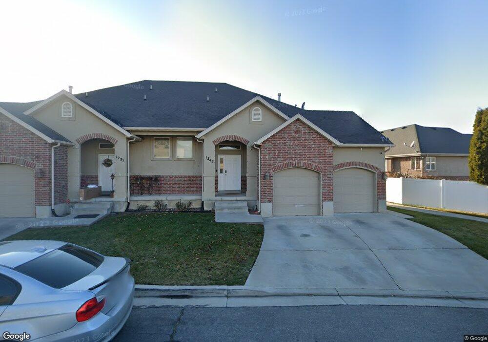
This home is located at 1243 N Circle Cove, Lehi, UT 84043 and is currently estimated at $498,521, approximately $315 per square foot. 1243 N Circle Cove is a home with nearby schools including Lehi Elementary School, Lehi Junior High School, and Lehi High School.
Ownership History
Date
Name
Owned For
Owner Type
Purchase Details
Closed on
Dec 21, 2005
Sold by
Pease Raymond and Pease Heather
Bought by
Pease Raymond
Current Estimated Value
Home Financials for this Owner
Home Financials are based on the most recent Mortgage that was taken out on this home.
Original Mortgage
$29,025
Interest Rate
6.27%
Mortgage Type
Stand Alone Second
Purchase Details
Closed on
Feb 12, 2003
Sold by
Courtyard Cove Iii Llc
Bought by
Pease Raymond and Pease Heather
Home Financials for this Owner
Home Financials are based on the most recent Mortgage that was taken out on this home.
Original Mortgage
$118,800
Interest Rate
6.38%
Create a Home Valuation Report for This Property
The Home Valuation Report is an in-depth analysis detailing your home's value as well as a comparison with similar homes in the area
Home Values in the Area
Average Home Value in this Area
Purchase History
| Date | Buyer | Sale Price | Title Company |
|---|---|---|---|
| Pease Raymond | -- | Integrated Title Insurance | |
| Pease Raymond | -- | Provo Land Title Company |
Source: Public Records
Mortgage History
| Date | Status | Borrower | Loan Amount |
|---|---|---|---|
| Closed | Pease Raymond | $29,025 | |
| Open | Pease Raymond | $125,775 | |
| Closed | Pease Raymond | $118,800 |
Source: Public Records
Tax History Compared to Growth
Tax History
| Year | Tax Paid | Tax Assessment Tax Assessment Total Assessment is a certain percentage of the fair market value that is determined by local assessors to be the total taxable value of land and additions on the property. | Land | Improvement |
|---|---|---|---|---|
| 2025 | $1,949 | $230,395 | $67,500 | $351,400 |
| 2024 | $1,949 | $228,140 | $0 | $0 |
| 2023 | $1,801 | $228,800 | $0 | $0 |
| 2022 | $1,516 | $186,725 | $0 | $0 |
| 2021 | $1,424 | $265,200 | $62,500 | $202,700 |
| 2020 | $1,399 | $257,500 | $62,500 | $195,000 |
| 2019 | $1,229 | $235,200 | $62,500 | $172,700 |
| 2018 | $1,300 | $235,200 | $62,500 | $172,700 |
| 2017 | $1,273 | $122,485 | $0 | $0 |
| 2016 | $1,222 | $109,010 | $0 | $0 |
| 2015 | $1,240 | $105,050 | $0 | $0 |
| 2014 | $1,045 | $88,000 | $0 | $0 |
Source: Public Records
Map
Nearby Homes
- 1301 N 900 W Unit 12
- 902 W 1500 N
- 1817 W Bad Rock Cir
- 1094 W 1425 N
- 1150 N 200 W Unit 6
- 996 N 200 W
- 1610 N 1125 W
- 443 W 820 N
- 1755 N 250 W
- 155 W State St Unit TRLR 3
- 1011 W Mountain Way Unit 316
- 68 W State St
- 1329 N 100 E Unit 21
- 578 N Woods Dr
- 1132 Titan Dr
- 1332 W 1500 N
- 1032 Titan Dr
- 1272 W 1800 N
- 1295 N 190 E
- 7 E State St
- 681 W 1290 N
- 681 W 1290 N Unit 56
- 665 W 1290 N
- 688 W 1290 N
- 1237 N Circle Cove
- 622 W Circle Cove
- 678 W 1290 N
- 710 W 1200 N
- 710 W 1200 N
- 1256 N Circle Cove
- 616 W Circle Cove
- 1262 N Circle Cove
- 664 W 1290 N
- 621 Circle Cove
- 621 W Circle Cove
- 1244 Trinnaman Ln
- 615 W Circle Cove
- 598 W Circle Cove
- 598 Circle Cove
- 615 Circle Cove