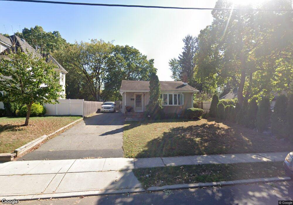
1243 S 9th St South Plainfield, NJ 07080
Estimated Value: $465,000 - $546,000
3
Beds
2
Baths
--
Sq Ft
6,273
Sq Ft Lot
About This Home
This home is located at 1243 S 9th St, South Plainfield, NJ 07080 and is currently estimated at $522,226. 1243 S 9th St is a home located in Middlesex County with nearby schools including South Plainfield High School and The Queen City Academy Charter School.
Ownership History
Date
Name
Owned For
Owner Type
Purchase Details
Closed on
Mar 1, 2010
Sold by
Alvarado Miguel and Alvarado Elvira
Bought by
Anderson Kendra Y
Current Estimated Value
Home Financials for this Owner
Home Financials are based on the most recent Mortgage that was taken out on this home.
Original Mortgage
$177,721
Outstanding Balance
$119,368
Interest Rate
5.25%
Mortgage Type
FHA
Estimated Equity
$402,858
Purchase Details
Closed on
Oct 18, 1996
Sold by
Dixon Amelung
Bought by
Alvarado Miguel and Alvarado Elvira
Home Financials for this Owner
Home Financials are based on the most recent Mortgage that was taken out on this home.
Original Mortgage
$122,000
Interest Rate
8.22%
Create a Home Valuation Report for This Property
The Home Valuation Report is an in-depth analysis detailing your home's value as well as a comparison with similar homes in the area
Home Values in the Area
Average Home Value in this Area
Purchase History
| Date | Buyer | Sale Price | Title Company |
|---|---|---|---|
| Anderson Kendra Y | $181,000 | First American Title Ins Co | |
| Alvarado Miguel | $128,000 | -- |
Source: Public Records
Mortgage History
| Date | Status | Borrower | Loan Amount |
|---|---|---|---|
| Open | Anderson Kendra Y | $177,721 | |
| Previous Owner | Alvarado Miguel | $122,000 |
Source: Public Records
Tax History Compared to Growth
Tax History
| Year | Tax Paid | Tax Assessment Tax Assessment Total Assessment is a certain percentage of the fair market value that is determined by local assessors to be the total taxable value of land and additions on the property. | Land | Improvement |
|---|---|---|---|---|
| 2025 | $8,169 | $117,000 | $27,200 | $89,800 |
| 2024 | $7,813 | $117,000 | $27,200 | $89,800 |
| 2023 | $7,813 | $117,000 | $27,200 | $89,800 |
| 2022 | $7,716 | $117,000 | $27,200 | $89,800 |
| 2021 | $6,874 | $117,000 | $27,200 | $89,800 |
| 2020 | $7,425 | $117,000 | $27,200 | $89,800 |
| 2019 | $7,124 | $117,000 | $27,200 | $89,800 |
| 2018 | $6,940 | $117,000 | $27,200 | $89,800 |
| 2017 | $6,852 | $117,000 | $27,200 | $89,800 |
| 2016 | $6,782 | $117,000 | $27,200 | $89,800 |
| 2015 | $6,665 | $117,000 | $27,200 | $89,800 |
| 2014 | $6,474 | $117,000 | $27,200 | $89,800 |
Source: Public Records
Map
Nearby Homes