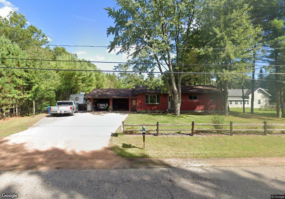
1243 Torun Rd Stevens Point, WI 54482
Estimated Value: $372,000 - $408,000
Studio
--
Bath
--
Sq Ft
1.23
Acres
About This Home
This home is located at 1243 Torun Rd, Stevens Point, WI 54482 and is currently estimated at $389,528. 1243 Torun Rd is a home located in Portage County with nearby schools including Washington Elementary School, P.J. Jacobs Junior High School, and Stevens Point Area Senior High School.
Ownership History
Date
Name
Owned For
Owner Type
Purchase Details
Closed on
Dec 14, 2017
Sold by
Wiza Donald J
Bought by
Glodowski William and Glodowski Patricia A
Current Estimated Value
Home Financials for this Owner
Home Financials are based on the most recent Mortgage that was taken out on this home.
Original Mortgage
$178,500
Outstanding Balance
$73,034
Interest Rate
3.94%
Mortgage Type
New Conventional
Estimated Equity
$316,494
Create a Home Valuation Report for This Property
The Home Valuation Report is an in-depth analysis detailing your home's value as well as a comparison with similar homes in the area
Home Values in the Area
Average Home Value in this Area
Purchase History
| Date | Buyer | Sale Price | Title Company |
|---|---|---|---|
| Glodowski William | -- | Anderson Obrien Law Firm |
Source: Public Records
Mortgage History
| Date | Status | Borrower | Loan Amount |
|---|---|---|---|
| Open | Glodowski William | $178,500 |
Source: Public Records
Tax History Compared to Growth
Tax History
| Year | Tax Paid | Tax Assessment Tax Assessment Total Assessment is a certain percentage of the fair market value that is determined by local assessors to be the total taxable value of land and additions on the property. | Land | Improvement |
|---|---|---|---|---|
| 2024 | $44 | $243,300 | $21,000 | $222,300 |
| 2023 | $4,139 | $243,300 | $21,000 | $222,300 |
| 2022 | $4,127 | $243,300 | $21,000 | $222,300 |
| 2021 | $3,979 | $243,300 | $21,000 | $222,300 |
| 2020 | $4,074 | $243,300 | $21,000 | $222,300 |
| 2019 | $3,812 | $243,300 | $21,000 | $222,300 |
| 2018 | $4,111 | $228,500 | $20,900 | $207,600 |
| 2017 | $3,753 | $228,500 | $20,900 | $207,600 |
| 2016 | $3,790 | $228,500 | $20,900 | $207,600 |
| 2015 | $3,783 | $228,500 | $20,900 | $207,600 |
| 2014 | $3,834 | $228,500 | $20,900 | $207,600 |
Source: Public Records
Map
Nearby Homes
- 4809 Partridge Way
- Lot 1 Somerset Dr
- 1403 N Sky Line Dr
- Lot 31 Red Tail Hawk Dr
- 1665 S Ponderosa Dr
- Lot 2 Highway 10 NW
- 4050 Kennedy Dr
- 152 Maple Bluff Rd
- Lot 6 Two Sisters Ct
- 5486 Forest Creek Rd
- 172 Evelyn Ct
- 203 Joe St
- 5572 Forest Creek Rd
- 204 Leonard St
- 5580 Forest Creek Rd
- 220 Leonard St
- Bentlee Plan at Stevens Point
- Fern Plan at Stevens Point
- Willow Plan at Stevens Point
- White Pine Plan at Stevens Point
- 5270 State Highway 66
- 5282 State Highway 66
- 5235 Airport Rd
- 5227 Airport Rd
- 5260 State Highway 66
- 5219 Airport Rd
- 1225 Torun Rd
- 1239 Torun Rd
- 1255 Torun Rd
- 1213 Torun Rd
- 5288 State Highway 66
- 5248 Airport Rd
- 5209 Airport Rd
- 5258 Airport Rd
- 1203 Torun Rd
- 5269 State Highway 66
- 5281 Wisconsin 66
- 5277 State Highway 66
- 5247 State Highway 66
- 5277 & 527 State Highway 66