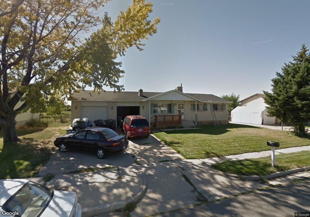
1243 W 1045 S Clearfield, UT 84015
Estimated Value: $439,000 - $488,389
5
Beds
2
Baths
3,250
Sq Ft
$145/Sq Ft
Est. Value
About This Home
This home is located at 1243 W 1045 S, Clearfield, UT 84015 and is currently estimated at $469,847, approximately $144 per square foot. 1243 W 1045 S is a home located in Davis County with nearby schools including Cook School, Syracuse Junior High School, and Syracuse High School.
Ownership History
Date
Name
Owned For
Owner Type
Purchase Details
Closed on
Oct 31, 2024
Sold by
Spencer Don and Spencer Mildred Laraine
Bought by
Morris Christopher
Current Estimated Value
Home Financials for this Owner
Home Financials are based on the most recent Mortgage that was taken out on this home.
Original Mortgage
$457,000
Outstanding Balance
$452,425
Interest Rate
6.09%
Mortgage Type
VA
Estimated Equity
$17,422
Purchase Details
Closed on
Oct 29, 2004
Sold by
Spencer Don
Bought by
Spencer Don and Spencer Mildred Laraine
Home Financials for this Owner
Home Financials are based on the most recent Mortgage that was taken out on this home.
Original Mortgage
$146,501
Interest Rate
5.74%
Mortgage Type
FHA
Purchase Details
Closed on
Feb 29, 1996
Sold by
Ornelas David and Ornelas Peggy Jo
Bought by
Bost Robert M and Bost Darline Kurill
Home Financials for this Owner
Home Financials are based on the most recent Mortgage that was taken out on this home.
Original Mortgage
$126,690
Interest Rate
7.87%
Mortgage Type
VA
Create a Home Valuation Report for This Property
The Home Valuation Report is an in-depth analysis detailing your home's value as well as a comparison with similar homes in the area
Home Values in the Area
Average Home Value in this Area
Purchase History
| Date | Buyer | Sale Price | Title Company |
|---|---|---|---|
| Morris Christopher | -- | None Listed On Document | |
| Spencer Don | -- | Heritage West Title Ins | |
| Spencer Don | -- | Title West Title Company | |
| Bost Robert M | -- | Us Title |
Source: Public Records
Mortgage History
| Date | Status | Borrower | Loan Amount |
|---|---|---|---|
| Open | Morris Christopher | $457,000 | |
| Previous Owner | Spencer Don | $146,501 | |
| Previous Owner | Bost Robert M | $126,690 |
Source: Public Records
Tax History Compared to Growth
Tax History
| Year | Tax Paid | Tax Assessment Tax Assessment Total Assessment is a certain percentage of the fair market value that is determined by local assessors to be the total taxable value of land and additions on the property. | Land | Improvement |
|---|---|---|---|---|
| 2025 | $3,013 | $270,050 | $77,676 | $192,374 |
| 2024 | $2,833 | $255,750 | $74,221 | $181,529 |
| 2023 | $2,638 | $437,000 | $118,224 | $318,776 |
| 2022 | $2,786 | $249,700 | $67,181 | $182,519 |
| 2021 | $2,489 | $337,000 | $74,235 | $262,765 |
| 2020 | $2,187 | $294,000 | $62,963 | $231,037 |
| 2019 | $2,117 | $281,000 | $64,041 | $216,959 |
| 2018 | $1,949 | $252,000 | $56,843 | $195,157 |
| 2016 | $1,697 | $114,730 | $22,893 | $91,837 |
| 2015 | $1,619 | $104,335 | $22,893 | $81,442 |
| 2014 | $1,533 | $100,136 | $22,893 | $77,243 |
| 2013 | -- | $91,385 | $32,670 | $58,715 |
Source: Public Records
Map
Nearby Homes
- 1166 Dallas St
- 1121 W 1290 S
- 817 S 1350 W
- 1097 W 850 S
- 1384 S Melanie Ln
- 1385 S 1100 W
- 1251 S 1650 W
- 1481 S Melanie Ln
- 1327 S 1650 W
- 587 S 1400 W
- 922 S 1760 W
- 916 S 1760 W
- 1622 S 1000 W
- 1154 W 1700 S
- 1466 Earl Cir
- 1876 S 1230 W
- 4284 W 350 S Unit 615
- 4296 W 350 S Unit 614
- 1153 W 1875 S Unit 223
- 992 W 1910 S
- 1251 W 1045 S
- 1231 W 1045 S
- 1254 W 1100 S Unit 108
- 1242 W 1100 S
- 1262 W 1100 S Unit 107
- 1277 W 1045 S
- 1221 W 1045 S
- 1274 W 1100 S Unit 106
- 1274 W 1100 S
- 1260 W 1045 S
- 1228 W 1045 S
- 1222 W 1100 S Unit 108
- 1222 W 1100 S Unit 110
- 1222 W 1100 S Unit 112
- 1222 W 1100 S
- 1222 W 1100 S Unit 111
- 1299 W 1045 S
- 1211 W 1045 S
- 1216 W 1045 S
- 1280 W 1045 S