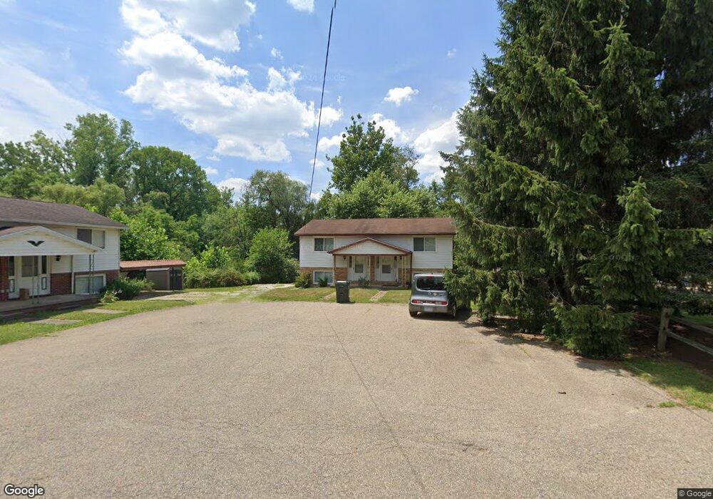
1243 Zwick Ave Louisville, OH 44641
Estimated Value: $167,555 - $222,000
4
Beds
2
Baths
950
Sq Ft
$212/Sq Ft
Est. Value
About This Home
This home is located at 1243 Zwick Ave, Louisville, OH 44641 and is currently estimated at $201,639, approximately $212 per square foot. 1243 Zwick Ave is a home located in Stark County with nearby schools including Louisville High School and St. Thomas Aquinas High School & Middle School.
Ownership History
Date
Name
Owned For
Owner Type
Purchase Details
Closed on
Dec 3, 2007
Sold by
Ferguson Gary W and Ferguson Vickie L
Bought by
Nees Steven B
Current Estimated Value
Home Financials for this Owner
Home Financials are based on the most recent Mortgage that was taken out on this home.
Original Mortgage
$116,176
Outstanding Balance
$74,178
Interest Rate
6.47%
Mortgage Type
Purchase Money Mortgage
Estimated Equity
$127,461
Purchase Details
Closed on
Mar 13, 2001
Sold by
Starr Norman B and Miller James R
Bought by
Ferguson Gary W and Ferguson Vickie L
Home Financials for this Owner
Home Financials are based on the most recent Mortgage that was taken out on this home.
Original Mortgage
$60,000
Interest Rate
7.13%
Mortgage Type
Purchase Money Mortgage
Create a Home Valuation Report for This Property
The Home Valuation Report is an in-depth analysis detailing your home's value as well as a comparison with similar homes in the area
Home Values in the Area
Average Home Value in this Area
Purchase History
| Date | Buyer | Sale Price | Title Company |
|---|---|---|---|
| Nees Steven B | $118,000 | Grimsley Title Agency | |
| Ferguson Gary W | $75,000 | Grimsley Title Agency |
Source: Public Records
Mortgage History
| Date | Status | Borrower | Loan Amount |
|---|---|---|---|
| Open | Nees Steven B | $116,176 | |
| Previous Owner | Ferguson Gary W | $60,000 |
Source: Public Records
Tax History Compared to Growth
Tax History
| Year | Tax Paid | Tax Assessment Tax Assessment Total Assessment is a certain percentage of the fair market value that is determined by local assessors to be the total taxable value of land and additions on the property. | Land | Improvement |
|---|---|---|---|---|
| 2025 | -- | $40,880 | $14,350 | $26,530 |
| 2024 | -- | $40,880 | $14,350 | $26,530 |
| 2023 | $1,643 | $37,320 | $11,870 | $25,450 |
| 2022 | $1,648 | $37,320 | $11,870 | $25,450 |
| 2021 | $1,653 | $37,320 | $11,870 | $25,450 |
| 2020 | $1,374 | $33,570 | $10,680 | $22,890 |
| 2019 | $1,381 | $31,010 | $8,120 | $22,890 |
| 2018 | $1,271 | $31,010 | $8,120 | $22,890 |
| 2017 | $1,150 | $27,060 | $6,790 | $20,270 |
| 2016 | $1,174 | $27,060 | $6,790 | $20,270 |
| 2015 | $1,177 | $27,060 | $6,790 | $20,270 |
| 2014 | $1,124 | $24,010 | $6,020 | $17,990 |
| 2013 | $565 | $24,010 | $6,020 | $17,990 |
Source: Public Records
Map
Nearby Homes
- 428 Honeycrisp Dr NE
- 3047 Mcintosh Dr NE
- 432 Honeycrisp Dr NE
- 2962 Mcintosh Dr NE
- 2963 Mcintosh Dr NE
- 430 Honeycrisp Dr NE
- 2957 Mcintosh Dr NE
- 300 Kennedy St
- 614 Reno Dr
- 524 Glenbar St
- 0 Glenbar St
- 316 E Reno Dr
- 5474 Ravenna Ave
- 0 Brookridge Ave
- 910 Crosswyck Cir
- 1175 Sturbridge Dr
- 1149 Sturbridge Dr
- 3580 Brookridge Ave Lot 15
- 325 Lincoln Ave
- 1170 Winding Ridge Ave
- 1251 Zwick Ave
- 1239 Zwick Ave
- 1240 Faircliff St
- 1250 Faircliff St
- 1261 Zwick Ave
- 1244 Zwick Ave
- 1222 Faircliff St
- 1260 Faircliff St
- 1250 Zwick Ave
- 229 Clara Ct
- 225 Clara Ct
- 1260 Zwick Ave
- 1270 Faircliff St
- 1239 Faircliff St
- 1249 Faircliff St
- 1270 Zwick Ave
- 259 Devinney Ave
- 265 Devinney Ave
- 221 Clara Ct
- 245 Devinney Ave