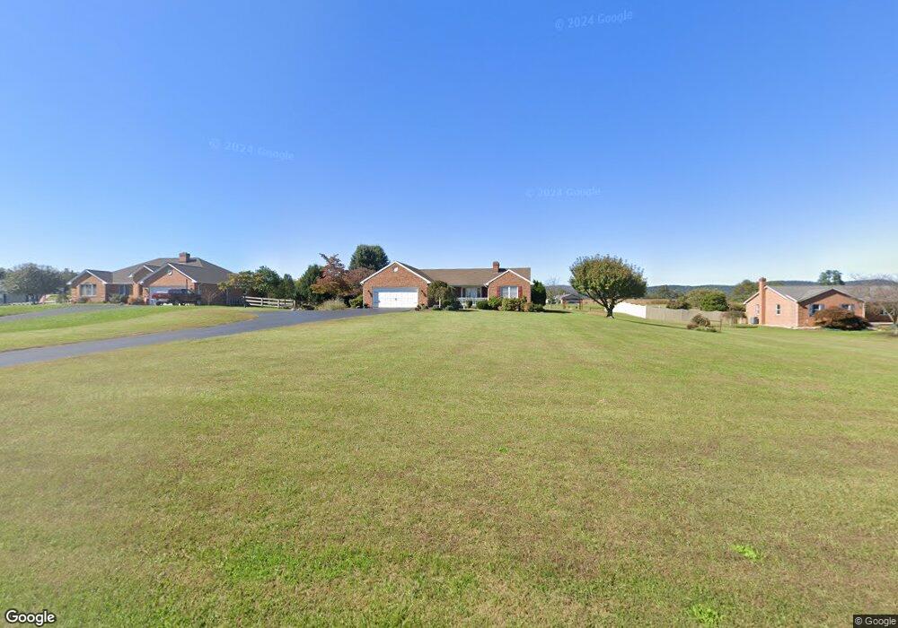
12434 Ashton Rd Clear Spring, MD 21722
Estimated Value: $314,000 - $451,000
Studio
2
Baths
1,612
Sq Ft
$224/Sq Ft
Est. Value
About This Home
This home is located at 12434 Ashton Rd, Clear Spring, MD 21722 and is currently estimated at $360,630, approximately $223 per square foot. 12434 Ashton Rd is a home located in Washington County with nearby schools including Clear Spring Elementary School, Clear Spring Middle School, and Clear Spring High School.
Ownership History
Date
Name
Owned For
Owner Type
Purchase Details
Closed on
May 7, 1992
Sold by
Kretzer Millard E and Kretzer Beverly J
Bought by
Lowery Charles F and Lowery Kimberly A
Current Estimated Value
Home Financials for this Owner
Home Financials are based on the most recent Mortgage that was taken out on this home.
Original Mortgage
$21,000
Interest Rate
8.84%
Purchase Details
Closed on
Apr 24, 1991
Sold by
Millard Kretzer
Bought by
Kretzer Millard E and Kretzer Beverly J
Home Financials for this Owner
Home Financials are based on the most recent Mortgage that was taken out on this home.
Original Mortgage
$275,000
Interest Rate
9.47%
Create a Home Valuation Report for This Property
The Home Valuation Report is an in-depth analysis detailing your home's value as well as a comparison with similar homes in the area
Purchase History
| Date | Buyer | Sale Price | Title Company |
|---|---|---|---|
| Lowery Charles F | $28,000 | -- | |
| Kretzer Millard E | $371,000 | -- |
Source: Public Records
Mortgage History
| Date | Status | Borrower | Loan Amount |
|---|---|---|---|
| Closed | Lowery Charles F | $21,000 | |
| Previous Owner | Kretzer Millard E | $275,000 |
Source: Public Records
Tax History
| Year | Tax Paid | Tax Assessment Tax Assessment Total Assessment is a certain percentage of the fair market value that is determined by local assessors to be the total taxable value of land and additions on the property. | Land | Improvement |
|---|---|---|---|---|
| 2025 | $2,253 | $261,233 | $0 | $0 |
| 2024 | $2,253 | $230,967 | $0 | $0 |
| 2023 | $2,138 | $200,700 | $69,000 | $131,700 |
| 2022 | $2,138 | $200,700 | $69,000 | $131,700 |
| 2021 | $2,421 | $200,700 | $69,000 | $131,700 |
| 2020 | $2,421 | $223,700 | $69,000 | $154,700 |
| 2019 | $2,431 | $223,700 | $69,000 | $154,700 |
| 2018 | $2,431 | $223,700 | $69,000 | $154,700 |
| 2017 | $2,431 | $223,700 | $0 | $0 |
| 2016 | -- | $223,700 | $0 | $0 |
| 2015 | -- | $223,700 | $0 | $0 |
| 2014 | $2,557 | $223,700 | $0 | $0 |
Source: Public Records
Map
Nearby Homes
- 13407 Rhodes Ct
- 11717 Ashton Rd
- 11705 Ashton Rd
- 13100 Saint Paul Rd
- 11868 National Pike
- Block 87 Lot 4 Pikers Peak Dr
- Block 139 Lot 56 Boo Blvd
- Block 11 Lot 14 Hot Springs Ave
- Block 7 Lot 30 & 31 Campfire Blvd
- Block 8 Lot 16 & 17 Campfire Blvd
- Block 1 Lot 27 Boo Blvd
- Block 1 Lot 35 Boo Blvd
- 0 Block 10 Lot 2 Deadwood Dr Unit WVBE2040636
- Block 1 Lot 36 Boo Blvd
- Block 5 lots 6 and 7 Poison Oak
- Block 90 Lot 8 Ranger Rd
- Block 1 Lot 42 Boo Blvd
- Block 12 Lot 41 Ranger Rd
- 25-20 Rocky Rd
- Block 14 Lot 10 Old Faceful Rd
- 12446 Ashton Rd
- 12432 Ashton Rd
- 13434 Rhodes Ct
- 12424 Ashton Rd
- 12452 Ashton Rd
- 13430 Rhodes Ct
- 12408 Ashton Rd
- 12460 Ashton Rd
- 13419 Rhodes Ct
- 12448 Ashton Rd
- 13422 Rhodes Ct
- 12406 Ashton Rd
- 13426 Rhodes Ct
- 13418 Rhodes Ct
- 13415 Rhodes Ct
- 12402 Ashton Rd
- 13411 Rhodes Ct
- 13410 Rhodes Ct
- 13414 Rhodes Ct
- 12516 Ashton Rd
Your Personal Tour Guide
Ask me questions while you tour the home.