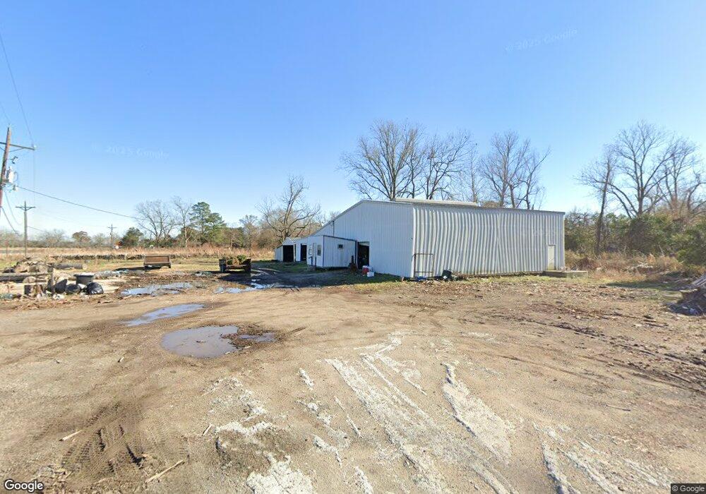
12437 Highway 190 W Port Allen, LA 70767
West Baton Rouge Parish NeighborhoodEstimated Value: $306,478
--
Bed
--
Bath
7,500
Sq Ft
$41/Sq Ft
Est. Value
About This Home
This home is located at 12437 Highway 190 W, Port Allen, LA 70767 and is currently estimated at $306,478, approximately $40 per square foot. 12437 Highway 190 W is a home located in West Baton Rouge Parish with nearby schools including Caneview K-8 School, Chamberlin Elementary School, and Devall Middle School.
Ownership History
Date
Name
Owned For
Owner Type
Purchase Details
Closed on
Mar 19, 2024
Sold by
Ssai Llc
Bought by
Bittu Singh Llc
Current Estimated Value
Home Financials for this Owner
Home Financials are based on the most recent Mortgage that was taken out on this home.
Original Mortgage
$401,250
Outstanding Balance
$394,576
Interest Rate
6.63%
Mortgage Type
New Conventional
Estimated Equity
-$88,098
Purchase Details
Closed on
Aug 14, 2018
Sold by
Blaylock Winston
Bought by
Lemoyne Travis J and Reine-Lemoyne Robyn
Home Financials for this Owner
Home Financials are based on the most recent Mortgage that was taken out on this home.
Original Mortgage
$75,000
Interest Rate
4.5%
Mortgage Type
Purchase Money Mortgage
Create a Home Valuation Report for This Property
The Home Valuation Report is an in-depth analysis detailing your home's value as well as a comparison with similar homes in the area
Home Values in the Area
Average Home Value in this Area
Purchase History
| Date | Buyer | Sale Price | Title Company |
|---|---|---|---|
| Bittu Singh Llc | $525,000 | First American Title | |
| Bittu Singh Llc | $525,000 | First American Title | |
| Lemoyne Travis J | $75,000 | -- |
Source: Public Records
Mortgage History
| Date | Status | Borrower | Loan Amount |
|---|---|---|---|
| Open | Bittu Singh Llc | $401,250 | |
| Closed | Bittu Singh Llc | $401,250 | |
| Previous Owner | Lemoyne Travis J | $75,000 |
Source: Public Records
Tax History Compared to Growth
Tax History
| Year | Tax Paid | Tax Assessment Tax Assessment Total Assessment is a certain percentage of the fair market value that is determined by local assessors to be the total taxable value of land and additions on the property. | Land | Improvement |
|---|---|---|---|---|
| 2024 | $4,034 | $41,650 | $15,970 | $25,680 |
| 2023 | $2,600 | $25,040 | $13,890 | $11,150 |
| 2022 | $2,626 | $25,040 | $13,890 | $11,150 |
| 2021 | $2,686 | $25,040 | $13,890 | $11,150 |
| 2020 | $1,896 | $17,500 | $7,460 | $10,040 |
| 2019 | $1,790 | $15,870 | $5,460 | $10,410 |
| 2018 | $2,057 | $15,870 | $5,460 | $10,410 |
| 2017 | $1,900 | $15,870 | $5,460 | $10,410 |
| 2015 | $1,414 | $16,460 | $5,200 | $11,260 |
| 2014 | $1,391 | $16,460 | $5,200 | $11,260 |
| 2013 | $1,391 | $16,460 | $5,200 | $11,260 |
Source: Public Records
Map
Nearby Homes
- 1053 Poydras Bayou Rd
- 841 Poydras Bayou Rd
- 11837 E Subdivision Rd
- TBD E Subdivision Rd
- TBD E Subdivision Rd
- 5632 Horner Rd
- 5252 Elm Grove Rd
- 12408 Lorio Dairy Rd
- 10082 Swanson Ln
- TBD Highway 190
- 6255 Rougon Rd
- 6229 Rougon Rd
- 3638 Oakland Rd Unit 6
- 9765 Skynet Ln
- 9766 Skynet Ln
- 1093 Poydras Bayou Dr
- 1096 Wilkinson Ln
- 8856 Singleton Rd
- 8958 Singleton Rd
- 9527 Burnside Rd
- 12437 Hwy 190 W
- C-2 La Hwy 190
- 12437 La Hwy 190
- 12478 Maple St
- 12458 Maple St
- TBD - 1 La Hwy 190
- 12426 Maple St
- 12478 Hwy 190 W
- 12476 Maple St
- 12456 Maple St
- 12496 Maple St
- 12486 Maple St
- 12518 Maple St
- C-3 La Hwy 190
- 12412 Maple St
- 12528 Maple St
- 12335 Highway 190 W
- 12335 U S Highway 190
- 12368 Maple St
- 12437 La Hwy 190 W