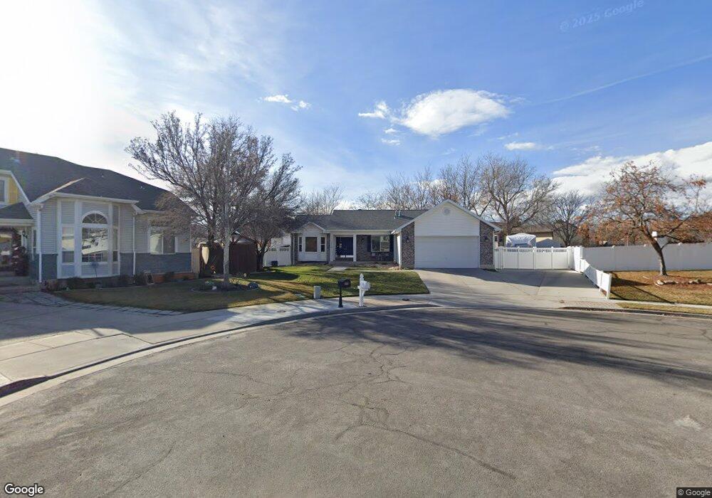
12438 Maple Cir Riverton, UT 84065
Estimated Value: $635,000 - $666,000
4
Beds
3
Baths
1,502
Sq Ft
$431/Sq Ft
Est. Value
About This Home
This home is located at 12438 Maple Cir, Riverton, UT 84065 and is currently estimated at $646,772, approximately $430 per square foot. 12438 Maple Cir is a home located in Salt Lake County with nearby schools including Rosamond Elementary School, Oquirrh Hills Middle School, and Riverton High School.
Ownership History
Date
Name
Owned For
Owner Type
Purchase Details
Closed on
Sep 27, 2016
Sold by
Beglarian Zachary C and Romero Angela M
Bought by
Begalrian Zachary C and Begalrian Anglea M
Current Estimated Value
Home Financials for this Owner
Home Financials are based on the most recent Mortgage that was taken out on this home.
Original Mortgage
$272,700
Outstanding Balance
$217,152
Interest Rate
3.25%
Mortgage Type
FHA
Estimated Equity
$429,620
Purchase Details
Closed on
Sep 26, 1996
Sold by
Kolar James Stanley
Bought by
Betts Edmun and Betts Gaye L
Home Financials for this Owner
Home Financials are based on the most recent Mortgage that was taken out on this home.
Original Mortgage
$125,040
Interest Rate
7.87%
Purchase Details
Closed on
May 19, 1994
Sold by
Watt Residential Partners
Bought by
Kolar James Stanley
Home Financials for this Owner
Home Financials are based on the most recent Mortgage that was taken out on this home.
Original Mortgage
$128,150
Interest Rate
8.52%
Create a Home Valuation Report for This Property
The Home Valuation Report is an in-depth analysis detailing your home's value as well as a comparison with similar homes in the area
Home Values in the Area
Average Home Value in this Area
Purchase History
| Date | Buyer | Sale Price | Title Company |
|---|---|---|---|
| Begalrian Zachary C | -- | Meridian Title | |
| Betts Edmun | -- | -- | |
| Kolar James Stanley | -- | First American Title |
Source: Public Records
Mortgage History
| Date | Status | Borrower | Loan Amount |
|---|---|---|---|
| Open | Begalrian Zachary C | $272,700 | |
| Closed | Betts Edmun | $125,040 | |
| Previous Owner | Kolar James Stanley | $128,150 |
Source: Public Records
Tax History
| Year | Tax Paid | Tax Assessment Tax Assessment Total Assessment is a certain percentage of the fair market value that is determined by local assessors to be the total taxable value of land and additions on the property. | Land | Improvement |
|---|---|---|---|---|
| 2025 | $3,462 | $609,800 | $232,900 | $376,900 |
| 2024 | $3,462 | $599,200 | $228,600 | $370,600 |
| 2023 | $3,363 | $548,700 | $211,700 | $337,000 |
| 2022 | $3,514 | $562,500 | $207,500 | $355,000 |
| 2021 | $3,033 | $432,300 | $155,700 | $276,600 |
| 2020 | $2,957 | $392,900 | $139,500 | $253,400 |
| 2019 | $2,982 | $389,500 | $126,800 | $262,700 |
Source: Public Records
Map
Nearby Homes
- 2162 W Kimber Ln
- 2356 W Montcalm Dr
- 2127 Silver Tree Cir
- 1924 W Trail Heights Dr
- 12702 S City Heights Dr Unit 158
- 1733 W Shade Ln
- 12341 S Redwood Rd
- 12325 S Redwood Rd
- 12317 S Redwood Rd
- 12501 Falls Creek Rd
- 12738 S Park Run Ct
- 12813 Keri Lynn Ct
- 12224 S Madison View Dr
- 2328 W 12835 S
- 1056 W Kate Springs Ln S Unit 10
- 1661 W Madison View Dr
- 1644 W Madison Ridge Ln
- 12894 S Berlynn Dr Unit 17
- 1719 W 12050 S
- 12332 S 2700 W
- 12438 S 2075 W
- 12441 Maple Cir
- 12441 S 2075 W
- 12435 S 2145 W
- 12432 Maple Cir
- 12432 S 2075 W
- 2106 W 12510 S
- 2120 W 12510 S
- 12427 S 2145 W
- 2086 W 12510 S
- 12437 S 2075 W
- 12437 Maple Cir
- 12437 S 2145 W
- 2142 W 12510 S
- 12422 S 2075 W
- 12422 Maple Cir
- 12429 S 2075 W
- 12429 S 2075 W
- 12429 Maple Cir
- 12417 S 2145 W
Your Personal Tour Guide
Ask me questions while you tour the home.