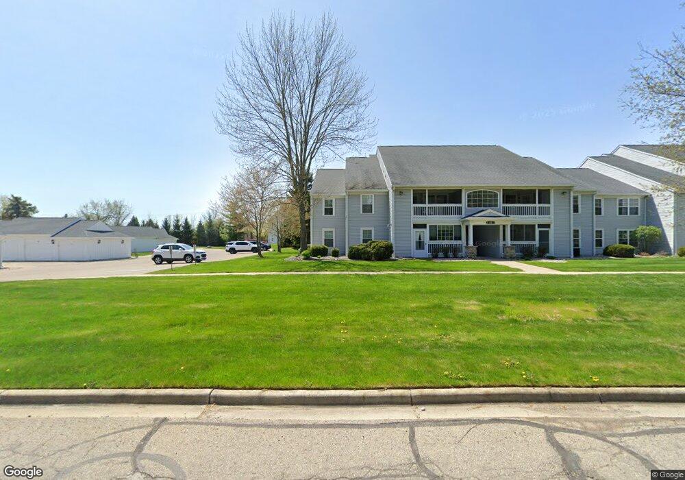
12438 Saint Andrews Way Unit 12438 Fenton, MI 48430
Estimated Value: $181,108 - $238,000
2
Beds
2
Baths
1,177
Sq Ft
$168/Sq Ft
Est. Value
About This Home
This home is located at 12438 Saint Andrews Way Unit 12438, Fenton, MI 48430 and is currently estimated at $197,527, approximately $167 per square foot. 12438 Saint Andrews Way Unit 12438 is a home located in Genesee County with nearby schools including West Shore Elementary School, Torrey Hill Intermediate School, and Lake Fenton Middle School.
Ownership History
Date
Name
Owned For
Owner Type
Purchase Details
Closed on
Jul 21, 2022
Sold by
Jolenne Stewart
Bought by
Moore Kaylee
Current Estimated Value
Purchase Details
Closed on
Jan 18, 2016
Sold by
Stewart John W and Stewart Jolenne
Bought by
Stewart John W and Stewart Jolenne
Purchase Details
Closed on
Nov 16, 2015
Sold by
West Glenda D
Bought by
Stewart John W and Stewart Jolenne
Purchase Details
Closed on
May 9, 2012
Sold by
West Michael G and West Glenda D
Bought by
West Glenda D
Purchase Details
Closed on
Sep 16, 2010
Sold by
Bollinger Danielle and Bollinger Patton Danielle
Bought by
West Michael G and West Glenda D
Purchase Details
Closed on
May 14, 2001
Sold by
Dailey Michael J and Dailey Jamie
Bought by
Bollinger Danielle
Create a Home Valuation Report for This Property
The Home Valuation Report is an in-depth analysis detailing your home's value as well as a comparison with similar homes in the area
Home Values in the Area
Average Home Value in this Area
Purchase History
| Date | Buyer | Sale Price | Title Company |
|---|---|---|---|
| Moore Kaylee | $150,000 | New Title Company Name | |
| Stewart John W | -- | Attorney | |
| Stewart John W | $83,000 | Cislo Title Co | |
| West Glenda D | -- | None Available | |
| West Michael G | $30,000 | Liberty Title | |
| Bollinger Danielle | $105,900 | Guaranty Title |
Source: Public Records
Tax History Compared to Growth
Tax History
| Year | Tax Paid | Tax Assessment Tax Assessment Total Assessment is a certain percentage of the fair market value that is determined by local assessors to be the total taxable value of land and additions on the property. | Land | Improvement |
|---|---|---|---|---|
| 2025 | $2,364 | $85,900 | $0 | $0 |
| 2024 | $864 | $79,400 | $0 | $0 |
| 2023 | $824 | $71,600 | $0 | $0 |
| 2022 | $1,335 | $69,300 | $0 | $0 |
| 2021 | $2,350 | $54,200 | $0 | $0 |
| 2020 | $434 | $50,500 | $0 | $0 |
| 2019 | $427 | $46,600 | $0 | $0 |
| 2018 | $2,268 | $42,600 | $0 | $0 |
| 2017 | $2,222 | $39,900 | $0 | $0 |
| 2016 | $1,950 | $34,900 | $0 | $0 |
| 2015 | $1,495 | $32,400 | $0 | $0 |
| 2014 | $326 | $28,900 | $0 | $0 |
| 2012 | -- | $31,300 | $31,300 | $0 |
Source: Public Records
Map
Nearby Homes
- 12364 Saint Andrews Way Unit 66
- 13167 Harbor Landings Dr
- 13163 Harbor Landings Dr Unit 112
- 12333 Saint Andrews Way Unit 86
- 3129 Harbor Pointe Cir
- 3127 Harbor Pointe Cir
- 3130 Harbor Pointe Cir Unit 64
- 13111 Harbor Landings Dr Unit 46
- 2410 Torrey Grove Ct Unit 12
- 2414 Cranewood Dr
- 3302 Rolston Rd
- 24 S Hill Dr
- 2509 Golden Shores Dr
- VL Crane Crane Rd
- 2497 Golden Shores Dr
- 12147 Torrey Rd
- 2369 Golden Shores Dr
- 2361 Golden Shore Dr
- 12356 Jennings Rd
- 2234 Toledo St
- 12438 Saint Andrews Way Unit 64
- 12434 Saint Andrews Way
- 12434 Saint Andrews Way Unit 4
- 12428 Saint Andrews Way Unit 60
- 12428 St Andrews Way
- 12424 Saint Andrews Way Unit 58
- 12436 Saint Andrews Way
- 12426 Saint Andrews Way Unit 59
- 12426 Saint Andrews Way Unit 4, 59
- 12426 Saint Andrews Way
- 12432 Saint Andrews Way Unit 61
- 12422 Saint Andrews Way Unit 57
- 12402 Saint Andrews Way
- 12406 Saint Andrews Way
- 12454 Saint Andrews Way Unit 54
- 12458 Saint Andrews Way
- 12458 Saint Andrews Way Unit 3
- 12448 Saint Andrews Way Unit 52
- 12404 Saint Andrews Way Unit 26
- 12408 Saint Andrews Way Unit Bldg-Unit