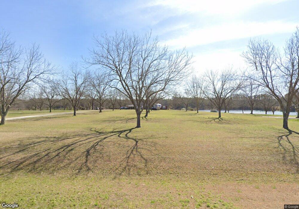
1244 Ga Highway 169 Claxton, GA 30417
Estimated Value: $364,000 - $529,163
3
Beds
2
Baths
2,098
Sq Ft
$203/Sq Ft
Est. Value
About This Home
This home is located at 1244 Ga Highway 169, Claxton, GA 30417 and is currently estimated at $425,054, approximately $202 per square foot. 1244 Ga Highway 169 is a home located in Evans County with nearby schools including Claxton Elementary School, Second Chance, and Claxton Middle School.
Ownership History
Date
Name
Owned For
Owner Type
Purchase Details
Closed on
Jun 27, 2017
Sold by
Farrow Lou Ann Daniel
Bought by
Farrow Christopher Michael
Current Estimated Value
Purchase Details
Closed on
Jun 5, 2015
Sold by
Daniel Marvin C
Bought by
Farrow Lou Ann Daniel
Purchase Details
Closed on
Jan 9, 2015
Sold by
Daniel Ouida Hodges
Bought by
Daniel Marvin C and Daniel Farrow Lou Ann
Purchase Details
Closed on
Jul 22, 2014
Sold by
Bradley Marvin Edward
Bought by
Oliver Kristina Ann
Purchase Details
Closed on
May 4, 1988
Sold by
Daniel W T
Bought by
Daniel M C
Create a Home Valuation Report for This Property
The Home Valuation Report is an in-depth analysis detailing your home's value as well as a comparison with similar homes in the area
Home Values in the Area
Average Home Value in this Area
Purchase History
| Date | Buyer | Sale Price | Title Company |
|---|---|---|---|
| Farrow Christopher Michael | -- | -- | |
| Farrow Lou Ann Daniel | -- | -- | |
| Daniel Marvin C | -- | -- | |
| Daniel Marvin C | -- | -- | |
| Oliver Kristina Ann | $35,000 | -- | |
| Daniel M C | -- | -- |
Source: Public Records
Tax History Compared to Growth
Tax History
| Year | Tax Paid | Tax Assessment Tax Assessment Total Assessment is a certain percentage of the fair market value that is determined by local assessors to be the total taxable value of land and additions on the property. | Land | Improvement |
|---|---|---|---|---|
| 2024 | $2,245 | $140,764 | $66,000 | $74,764 |
| 2023 | $1,902 | $103,960 | $54,640 | $49,320 |
| 2022 | $2,670 | $103,960 | $54,640 | $49,320 |
| 2021 | $2,670 | $103,960 | $54,640 | $49,320 |
| 2020 | $2,670 | $103,960 | $54,640 | $49,320 |
| 2019 | $2,670 | $103,960 | $54,640 | $49,320 |
| 2018 | $2,670 | $103,960 | $54,640 | $49,320 |
| 2017 | $2,745 | $106,880 | $57,520 | $49,360 |
| 2016 | $2,696 | $105,000 | $56,440 | $48,560 |
| 2015 | -- | $82,240 | $30,640 | $51,600 |
| 2014 | -- | $82,240 | $30,640 | $51,600 |
| 2013 | -- | $83,040 | $30,840 | $52,200 |
Source: Public Records
Map
Nearby Homes
- LOT 7 Camp Ground Rd
- 87.21 AC Bay Branch Church Rd
- 0 Bay Branch Church Rd Unit 25551331
- 4164 Perry Rd
- 4909 Perry Rd
- 6893 Hilton Hall Rd
- 319 A Rupert Wood Ln
- 3772 US Highway 301
- 47 Manassas Station Rd
- 62 Manassas Station Rd
- 29 Grove Ln
- 19 Collins St
- 0 Turnpike Rd Unit SA339603
- 12 Wisteria Ln
- 12 Wysteria Ln
- 19 Wysteria Ln
- 10 Honeysuckle Dr
- 7 Honeysuckle Way
- 147 Creek Ridge Rd
- 179 Creek Ridge Rd
- 376 Bay Branch Church Rd
- 284 Bay Branch Church Rd
- 0 Georgia 169
- 853 Campground Rd
- 0 Campground Rd Unit 10377666
- 0 Campground Rd Unit 7351460
- 1955 Levi H Kennedy Rd
- 118 Daniel Pond House Rd
- 154 Daniel Pond House Rd
- 572 Bay Branch Church Rd
- 460 Daniel Pond House Rd
- LOT 8 Camp Ground Rd
- Lot 5 Camp Ground Rd
- 574 Daniel Pond House Rd
- 1002 Campground Rd
- 332 Louis Kennedy Rd
- 734 Bay Branch Church Rd
- 2067 Levi H Kennedy Rd
- 1079 Campground Rd
- 554 Daniel Pond House Rd
