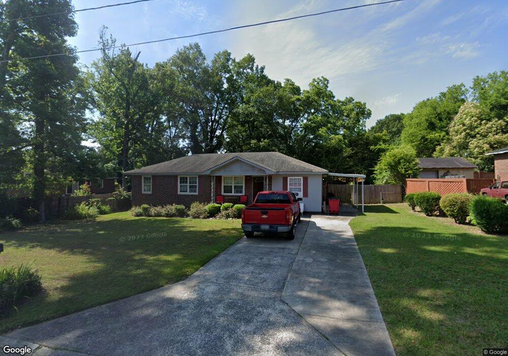
1244 Shermount Dr Macon, GA 31204
Estimated Value: $89,000 - $117,000
3
Beds
1
Bath
1,261
Sq Ft
$81/Sq Ft
Est. Value
About This Home
This home is located at 1244 Shermount Dr, Macon, GA 31204 and is currently estimated at $102,397, approximately $81 per square foot. 1244 Shermount Dr is a home located in Bibb County with nearby schools including John Robert Lewis Elementary School, Weaver Middle School, and Westside High School.
Ownership History
Date
Name
Owned For
Owner Type
Purchase Details
Closed on
Mar 6, 2009
Sold by
Andrews Wilburn and Andrews Margaret
Bought by
Hodges Bonita A
Current Estimated Value
Home Financials for this Owner
Home Financials are based on the most recent Mortgage that was taken out on this home.
Original Mortgage
$47,200
Outstanding Balance
$29,771
Interest Rate
5.14%
Mortgage Type
Purchase Money Mortgage
Estimated Equity
$72,626
Create a Home Valuation Report for This Property
The Home Valuation Report is an in-depth analysis detailing your home's value as well as a comparison with similar homes in the area
Home Values in the Area
Average Home Value in this Area
Purchase History
| Date | Buyer | Sale Price | Title Company |
|---|---|---|---|
| Hodges Bonita A | $59,000 | None Available |
Source: Public Records
Mortgage History
| Date | Status | Borrower | Loan Amount |
|---|---|---|---|
| Open | Hodges Bonita A | $47,200 |
Source: Public Records
Tax History Compared to Growth
Tax History
| Year | Tax Paid | Tax Assessment Tax Assessment Total Assessment is a certain percentage of the fair market value that is determined by local assessors to be the total taxable value of land and additions on the property. | Land | Improvement |
|---|---|---|---|---|
| 2025 | $845 | $34,369 | $2,734 | $31,635 |
| 2024 | $805 | $31,695 | $2,936 | $28,759 |
| 2023 | $782 | $30,784 | $2,025 | $28,759 |
| 2022 | $815 | $23,542 | $3,467 | $20,075 |
| 2021 | $895 | $23,542 | $3,467 | $20,075 |
| 2020 | $914 | $23,542 | $3,467 | $20,075 |
| 2019 | $922 | $23,542 | $3,467 | $20,075 |
| 2018 | $1,591 | $23,542 | $3,467 | $20,075 |
| 2017 | $882 | $23,542 | $3,467 | $20,075 |
| 2016 | $815 | $23,542 | $3,467 | $20,075 |
| 2015 | $1,116 | $22,797 | $3,467 | $19,330 |
| 2014 | $1,284 | $22,797 | $3,467 | $19,330 |
Source: Public Records
Map
Nearby Homes
- 1202 James St
- 1042 Washington St
- 3533 Greenbriar Rd
- 3846 Log Cabin Dr
- 3515 Greenbriar Rd
- 3908 Log Cabin Dr
- 3745 Partridge Dr
- 3941 Log Cabin Dr
- 3584 Log Cabin Dr
- 3220 Hollingsworth Rd
- 1305 Edna Place
- 1184 Edna Place
- 3565 Log Cabin Dr
- 4450 Bluebird Terrace
- 3515 Log Cabin Dr
- 3782 Robinson Rd
- 4281 Robinson Ct
- 3386 Seaton Dr
- 1252 Shermount Dr
- 1165 Hartridge Dr
- 1256 Sherbrooke Ct
- 1175 Hartridge Dr
- 1256 Shermount Dr
- 1245 Shermount Dr
- 1145 Hartridge Dr
- 1253 Shermount Dr
- 1248 Sherbrooke Ct
- 1261 Shermount Dr
- 1135 Hartridge Dr
- 1152 Hartridge Dr
- 1160 Hartridge Dr
- 1144 Hartridge Dr
- 1176 Hartridge Dr
- 1136 Hartridge Dr
- 1240 Sherbrooke Ct
- 1182 Pike St
- 1127 Hartridge Dr
- 1281 Pike 1165 Deanna Dr