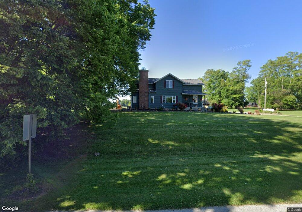
1244 State Route 12 Fremont, OH 43420
Estimated Value: $266,000 - $347,000
3
Beds
2
Baths
2,214
Sq Ft
$144/Sq Ft
Est. Value
About This Home
This home is located at 1244 State Route 12, Fremont, OH 43420 and is currently estimated at $318,736, approximately $143 per square foot. 1244 State Route 12 is a home located in Sandusky County with nearby schools including Fremont Ross High School.
Ownership History
Date
Name
Owned For
Owner Type
Purchase Details
Closed on
Jan 6, 1997
Sold by
Havens Joan C
Bought by
Rodd Steven A and Rodd Carrie F
Current Estimated Value
Home Financials for this Owner
Home Financials are based on the most recent Mortgage that was taken out on this home.
Original Mortgage
$100,000
Outstanding Balance
$10,711
Interest Rate
7.6%
Mortgage Type
New Conventional
Estimated Equity
$308,025
Purchase Details
Closed on
Sep 1, 1988
Bought by
Rodd Steven A and Rodd Carrie F
Create a Home Valuation Report for This Property
The Home Valuation Report is an in-depth analysis detailing your home's value as well as a comparison with similar homes in the area
Home Values in the Area
Average Home Value in this Area
Purchase History
| Date | Buyer | Sale Price | Title Company |
|---|---|---|---|
| Rodd Steven A | $118,000 | -- | |
| Rodd Steven A | $62,000 | -- |
Source: Public Records
Mortgage History
| Date | Status | Borrower | Loan Amount |
|---|---|---|---|
| Open | Rodd Steven A | $100,000 |
Source: Public Records
Tax History Compared to Growth
Tax History
| Year | Tax Paid | Tax Assessment Tax Assessment Total Assessment is a certain percentage of the fair market value that is determined by local assessors to be the total taxable value of land and additions on the property. | Land | Improvement |
|---|---|---|---|---|
| 2024 | $3,529 | $88,730 | $29,330 | $59,400 |
| 2023 | $3,529 | $71,790 | $23,840 | $47,950 |
| 2022 | $3,049 | $71,790 | $23,840 | $47,950 |
| 2021 | $3,140 | $71,790 | $23,840 | $47,950 |
| 2020 | $3,144 | $70,460 | $21,670 | $48,790 |
| 2019 | $2,963 | $66,470 | $21,670 | $44,800 |
| 2018 | $2,803 | $66,470 | $21,670 | $44,800 |
| 2017 | $2,721 | $63,530 | $21,670 | $41,860 |
| 2016 | $2,387 | $63,530 | $21,670 | $41,860 |
| 2015 | $2,349 | $63,530 | $21,670 | $41,860 |
| 2014 | $2,005 | $51,950 | $18,940 | $33,010 |
| 2013 | $1,963 | $51,950 | $18,940 | $33,010 |
Source: Public Records
Map
Nearby Homes
- 855 Rambo Ln
- 2231 County Road 23
- 704 County Road 126
- 2484 Buckland Ave
- 43 Sun Valley Dr Unit 43
- 17 Adams Dr
- 2595 County Road 13
- 350 Conner Dr
- 1970 Morrison Rd
- 41 Brookview Dr
- 1818 Finley Dr
- 822 Upton Rd
- 10 Meadowbrook Dr
- 10 Meadowbrook Ln
- 64 River Run Dr Unit J
- 64 River Run Dr
- 1719 Buckland Ave
- 135 Briarwood Cir
- 1832 Myrtle St
- 0 State Route 590 Unit 6136844
- 1220 State Route 12
- 1381 County Road 31
- 1396 County Road 31
- 1393 County Road 31
- 1803 State Route 12
- 1850 State Route 12
- 1414 County Road 31
- 1401 County Road 31
- 1407 County Road 31
- 1426 County Road 31
- 1411 County Road 31
- 1440 County Road 31
- 1433 County Road 31
- 1766 S State Route 53
- 1466 County Road 31
- 1455 County Road 31
- 1764 S State Route 53
- 1471 County Road 31
- 1472 County Road 31
- 1951 State Route 12