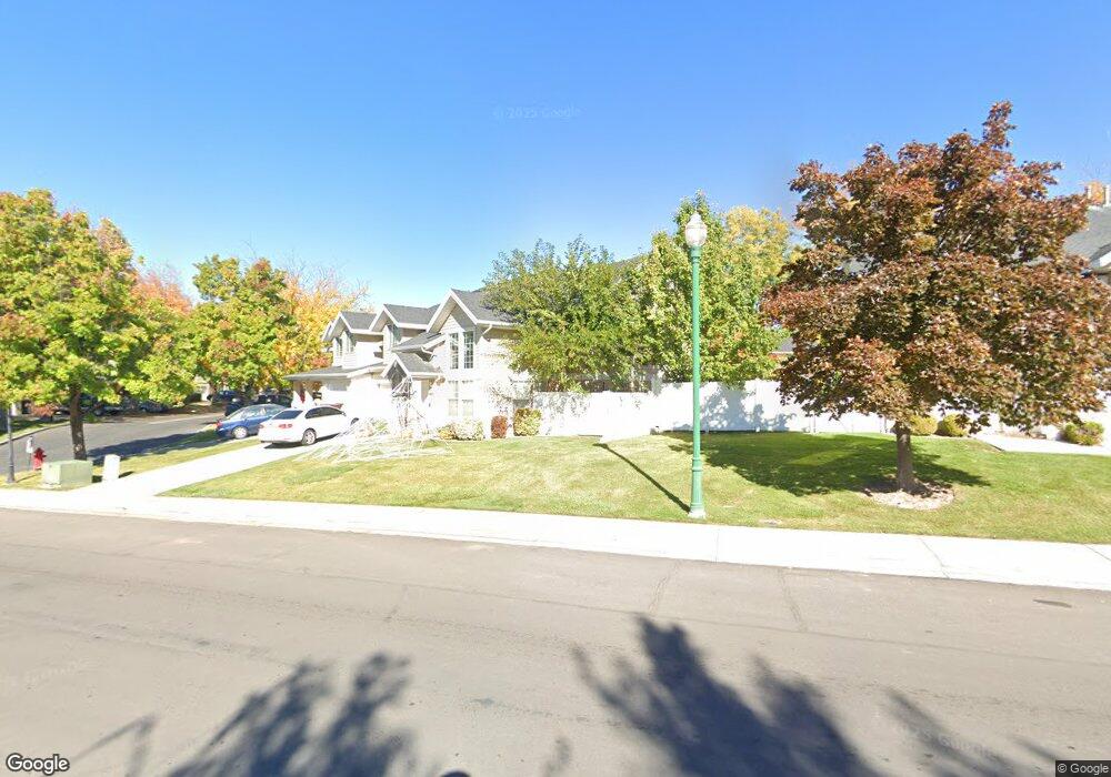
1244 W 1295 S Orem, UT 84058
Lakeview NeighborhoodEstimated Value: $408,000 - $432,000
3
Beds
3
Baths
1,771
Sq Ft
$236/Sq Ft
Est. Value
About This Home
This home is located at 1244 W 1295 S, Orem, UT 84058 and is currently estimated at $418,316, approximately $236 per square foot. 1244 W 1295 S is a home located in Utah County with nearby schools including Vineyard Elementary School, Lakeridge Jr High School, and Mountain View High School.
Ownership History
Date
Name
Owned For
Owner Type
Purchase Details
Closed on
Jun 20, 2018
Sold by
Manson Donald R and Manson Carolyn
Bought by
Manson Donald R and Manson Carolyn
Current Estimated Value
Home Financials for this Owner
Home Financials are based on the most recent Mortgage that was taken out on this home.
Original Mortgage
$50,000
Outstanding Balance
$43,242
Interest Rate
4.5%
Mortgage Type
Credit Line Revolving
Estimated Equity
$375,074
Purchase Details
Closed on
Apr 26, 2018
Sold by
Meleod John Malcolm and Meleod Joan B
Bought by
Monson Donlad R and Monson Carolyn
Home Financials for this Owner
Home Financials are based on the most recent Mortgage that was taken out on this home.
Original Mortgage
$50,000
Outstanding Balance
$43,242
Interest Rate
4.5%
Mortgage Type
Credit Line Revolving
Estimated Equity
$375,074
Purchase Details
Closed on
May 24, 2005
Sold by
Mcleod John M and Mcleod Joan B
Bought by
Mcleod John Malcolm and Mcleod Joan B
Purchase Details
Closed on
Apr 30, 2003
Sold by
Sweet Water Investments Llc
Bought by
Mcleod John M and Mcleod Joan B
Home Financials for this Owner
Home Financials are based on the most recent Mortgage that was taken out on this home.
Original Mortgage
$121,600
Interest Rate
5.72%
Mortgage Type
Purchase Money Mortgage
Purchase Details
Closed on
Dec 7, 2000
Sold by
Sweet Water Investments Lp
Bought by
Sweet Water Investments Llc
Purchase Details
Closed on
May 3, 2000
Sold by
Taylor Monica
Bought by
Sweet Water Investments Lp
Purchase Details
Closed on
Dec 27, 1999
Sold by
Kent Adam A and Kent Carrie L
Bought by
Taylor Jerry and Taylor Monica
Home Financials for this Owner
Home Financials are based on the most recent Mortgage that was taken out on this home.
Original Mortgage
$107,200
Interest Rate
7.35%
Purchase Details
Closed on
Apr 1, 1997
Sold by
Country Woods L C
Bought by
Kent Adam A and Kent Carrie L
Home Financials for this Owner
Home Financials are based on the most recent Mortgage that was taken out on this home.
Original Mortgage
$123,400
Interest Rate
7.66%
Mortgage Type
FHA
Create a Home Valuation Report for This Property
The Home Valuation Report is an in-depth analysis detailing your home's value as well as a comparison with similar homes in the area
Home Values in the Area
Average Home Value in this Area
Purchase History
| Date | Buyer | Sale Price | Title Company |
|---|---|---|---|
| Manson Donald R | -- | Meridian Title Co | |
| Manson Donald R | -- | Meridian Title Co | |
| Monson Donlad R | -- | Key Land Title | |
| Mcleod John Malcolm | -- | -- | |
| Mcleod John M | -- | Sundance Title Insurance Ag | |
| Sweet Water Investments Llc | -- | -- | |
| Sweet Water Investments Lp | -- | -- | |
| Taylor Monica | -- | -- | |
| Taylor Jerry | -- | Old Republic Title Company | |
| Kent Adam A | -- | First American Title |
Source: Public Records
Mortgage History
| Date | Status | Borrower | Loan Amount |
|---|---|---|---|
| Open | Manson Donald R | $50,000 | |
| Previous Owner | Mcleod John M | $121,600 | |
| Previous Owner | Taylor Jerry | $107,200 | |
| Previous Owner | Kent Adam A | $123,400 |
Source: Public Records
Tax History
| Year | Tax Paid | Tax Assessment Tax Assessment Total Assessment is a certain percentage of the fair market value that is determined by local assessors to be the total taxable value of land and additions on the property. | Land | Improvement |
|---|---|---|---|---|
| 2025 | $1,760 | $217,745 | -- | -- |
| 2024 | $1,669 | $215,270 | $0 | $0 |
| 2023 | $1,546 | $219,340 | $0 | $0 |
| 2022 | $1,546 | $196,900 | $0 | $0 |
| 2021 | $1,456 | $280,800 | $33,700 | $247,100 |
| 2020 | $1,223 | $250,700 | $30,100 | $220,600 |
| 2019 | $1,223 | $241,000 | $31,400 | $209,600 |
| 2018 | $1,162 | $218,800 | $27,500 | $191,300 |
| 2017 | $1,020 | $102,850 | $0 | $0 |
| 2016 | $1,005 | $93,500 | $0 | $0 |
| 2015 | $1,060 | $93,225 | $0 | $0 |
| 2014 | $1,017 | $89,100 | $0 | $0 |
Source: Public Records
Map
Nearby Homes
- 1412 S Geneva Rd
- 1363 S 1150 W
- 1037 W 1360 S
- 1395 S 1020 W
- 937 S 1635 W
- 1700 S Sandhill Rd Unit F401
- 1618 W 860 S
- 1463 W 730 S
- 1431 W 650 S
- 1924 S 1120 W
- 1942 S 1140 W Unit 725
- 1041 W 600 S
- 1928 S 1030 W
- 1813 W 795 S Unit 231
- 881 S 635 W
- 713 S 1803 W
- 442 W 1430 S Unit 421
- 1963 W Golden Pond Way
- 570 S 800 West St Unit 15
- 467 W 1640 S
- 1244 W 1295 S Unit 30
- 1246 W 1295 S
- 1246 W 1295 S Unit 29
- 1240 W 1295 S
- 1240 W 1295 S Unit 31
- 1250 W 1295 S Unit 28
- 1238 W 1295 S
- 1238 W 1295 S Unit 32
- 1252 W 1295 S
- 1252 W 1295 S Unit 27
- 1274 S 1220 W
- 1266 S 1220 W
- 1258 S 1220 W
- 1272 S 1220 W
- 1264 S 1220 W
- 1256 S 1220 W
- 1234 W 1295 S
- 1234 W 1295 S Unit 33
- 1245 W 1295 S
- 1245 W 1295 S Unit 15
Your Personal Tour Guide
Ask me questions while you tour the home.