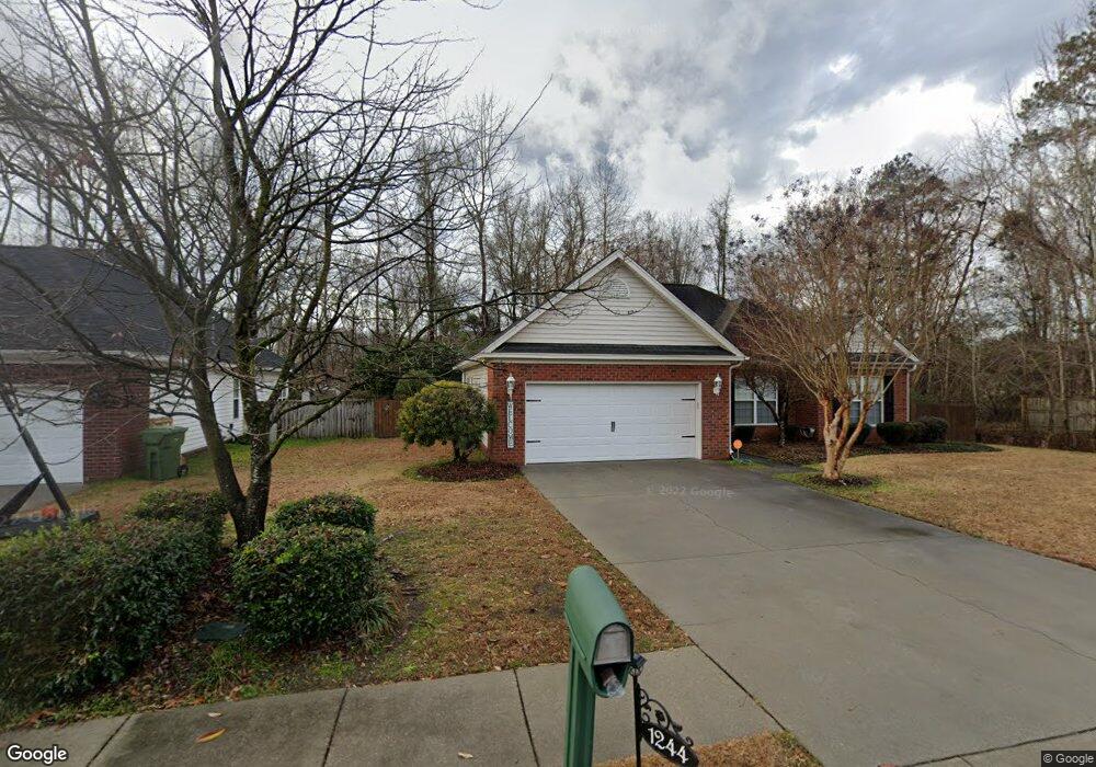
1244 Waxwing Dr Florence, SC 29505
Estimated Value: $252,000 - $281,000
3
Beds
2
Baths
1,650
Sq Ft
$160/Sq Ft
Est. Value
About This Home
This home is located at 1244 Waxwing Dr, Florence, SC 29505 and is currently estimated at $264,205, approximately $160 per square foot. 1244 Waxwing Dr is a home located in Florence County with nearby schools including McLaurin Elementary School, Southside Middle School, and South Florence High School.
Ownership History
Date
Name
Owned For
Owner Type
Purchase Details
Closed on
Oct 23, 2015
Sold by
Regan Colleen Kelley
Bought by
Swinton Beverly Gail
Current Estimated Value
Home Financials for this Owner
Home Financials are based on the most recent Mortgage that was taken out on this home.
Original Mortgage
$163,975
Outstanding Balance
$129,533
Interest Rate
4.4%
Mortgage Type
FHA
Estimated Equity
$134,672
Purchase Details
Closed on
Mar 31, 2004
Sold by
Dailey Development Inc
Bought by
Regan Colleen Kelley
Create a Home Valuation Report for This Property
The Home Valuation Report is an in-depth analysis detailing your home's value as well as a comparison with similar homes in the area
Purchase History
| Date | Buyer | Sale Price | Title Company |
|---|---|---|---|
| Swinton Beverly Gail | $167,000 | -- | |
| Regan Colleen Kelley | $147,900 | -- |
Source: Public Records
Mortgage History
| Date | Status | Borrower | Loan Amount |
|---|---|---|---|
| Open | Swinton Beverly Gail | $163,975 |
Source: Public Records
Tax History
| Year | Tax Paid | Tax Assessment Tax Assessment Total Assessment is a certain percentage of the fair market value that is determined by local assessors to be the total taxable value of land and additions on the property. | Land | Improvement |
|---|---|---|---|---|
| 2025 | $713 | $9,023 | $1,280 | $7,743 |
| 2024 | $573 | $9,023 | $1,280 | $7,743 |
| 2023 | $490 | $6,603 | $1,280 | $5,323 |
| 2022 | $569 | $6,603 | $1,280 | $5,323 |
| 2021 | $602 | $6,600 | $0 | $0 |
| 2020 | $777 | $6,600 | $0 | $0 |
| 2019 | $724 | $6,603 | $1,280 | $5,323 |
| 2018 | $684 | $6,600 | $0 | $0 |
| 2017 | $648 | $6,600 | $0 | $0 |
| 2016 | $601 | $6,600 | $0 | $0 |
| 2015 | $605 | $6,360 | $0 | $0 |
| 2014 | $523 | $6,361 | $1,280 | $5,081 |
Source: Public Records
Map
Nearby Homes
- 2141 Elderberry Dr
- 2113 Sanderling Dr
- 1193 Waxwing Dr
- 2943 Wild Turkey Dr
- 2001 Elaine Cir
- 1905 Marsh Ave
- 1701 Tuxedo Junction Rd
- 1110 3rd Loop Rd
- 1717 Full Moon Rd
- 1914 Brigadoone Ln
- 1830 Marsh Ave
- 1804 Woods Dr
- 1807 Nottingham Dr
- 1814 Citadel St
- 1216 Barn Owl Rd
- 1768 Marsh Ave
- 1808 Taylor Ct
- 1860 Brigadoone Ln
- 1779 S Saint Anthony Ave
- 2222 Ashford Dr
- 1240 Waxwing Dr
- 1236 Waxwing Dr
- 2149 Loquat Dr
- 2214 Amberleigh Ct
- 1232 Waxwing Dr
- 2145 Loquat Dr
- 2210 Amberleigh Ct
- 2148 Loquat Dr
- 1228 Waxwing Dr
- 2141 Loquat Dr
- 2144 Loquat Dr
- 2149 Sumac Dr
- 2140 Loquat Dr
- 1224 Waxwing Dr
- 2137 Loquat Dr
- 2145 Sumac Dr
- 2136 Loquat Dr
- 2133 Loquat Dr
- 2141 Sumac Dr
- 1220 Waxwing Dr
Your Personal Tour Guide
Ask me questions while you tour the home.