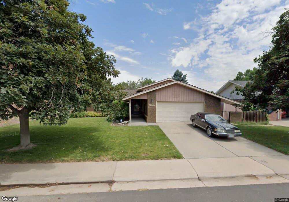
12447 E Cedar Cir Aurora, CO 80012
Aurora Hills NeighborhoodEstimated Value: $472,000 - $577,000
4
Beds
3
Baths
2,255
Sq Ft
$239/Sq Ft
Est. Value
About This Home
This home is located at 12447 E Cedar Cir, Aurora, CO 80012 and is currently estimated at $538,577, approximately $238 per square foot. 12447 E Cedar Cir is a home located in Arapahoe County with nearby schools including Aurora Hills Middle School, Aurora Central High School, and Lotus School for Excellence.
Ownership History
Date
Name
Owned For
Owner Type
Purchase Details
Closed on
Oct 11, 2006
Sold by
Polen Dorothy M
Bought by
Siverts Robert John
Current Estimated Value
Home Financials for this Owner
Home Financials are based on the most recent Mortgage that was taken out on this home.
Original Mortgage
$53,000
Interest Rate
6.11%
Mortgage Type
Stand Alone Second
Purchase Details
Closed on
Jan 29, 2001
Sold by
Norton Michael
Bought by
Polen Dorothy M
Purchase Details
Closed on
Oct 16, 1995
Sold by
Alcock Ronald G and Alcock Donna M
Bought by
Norton Michael E and Polen Dorothy M
Home Financials for this Owner
Home Financials are based on the most recent Mortgage that was taken out on this home.
Original Mortgage
$153,600
Interest Rate
7.62%
Purchase Details
Closed on
Jul 4, 1776
Bought by
Conversion Arapco
Create a Home Valuation Report for This Property
The Home Valuation Report is an in-depth analysis detailing your home's value as well as a comparison with similar homes in the area
Home Values in the Area
Average Home Value in this Area
Purchase History
| Date | Buyer | Sale Price | Title Company |
|---|---|---|---|
| Siverts Robert John | $265,000 | Land Title Guarantee Company | |
| Polen Dorothy M | -- | -- | |
| Norton Michael E | $192,000 | Land Title | |
| Conversion Arapco | -- | -- |
Source: Public Records
Mortgage History
| Date | Status | Borrower | Loan Amount |
|---|---|---|---|
| Closed | Siverts Robert John | $53,000 | |
| Open | Siverts Robert John | $212,000 | |
| Previous Owner | Norton Michael E | $153,600 |
Source: Public Records
Tax History Compared to Growth
Tax History
| Year | Tax Paid | Tax Assessment Tax Assessment Total Assessment is a certain percentage of the fair market value that is determined by local assessors to be the total taxable value of land and additions on the property. | Land | Improvement |
|---|---|---|---|---|
| 2025 | $3,194 | $35,319 | -- | -- |
| 2024 | $3,097 | $40,026 | -- | -- |
| 2023 | $3,097 | $40,026 | $0 | $0 |
| 2022 | $2,739 | $34,229 | $0 | $0 |
| 2021 | $2,827 | $34,229 | $0 | $0 |
| 2020 | $2,484 | $31,009 | $0 | $0 |
| 2019 | $2,471 | $31,009 | $0 | $0 |
| 2018 | $2,285 | $28,807 | $0 | $0 |
| 2017 | $2,650 | $28,807 | $0 | $0 |
| 2016 | $2,123 | $22,598 | $0 | $0 |
| 2015 | $2,049 | $22,598 | $0 | $0 |
| 2014 | -- | $18,046 | $0 | $0 |
| 2013 | -- | $19,320 | $0 | $0 |
Source: Public Records
Map
Nearby Homes
- 12802 E Nevada Cir
- 373 S Troy St
- 365 S Ursula Way
- 12024 E Maple Ave
- 12466 E Alaska Place
- 12204 E Dakota Ave
- 13637 E Nevada Ave
- 12080 E Maple Ave
- 12457 E Virginia Place
- 11902 E Maple Ave
- 414 S Worchester Way
- 13069 E Alaska Place
- 12182 E 2nd Dr
- 351 S Peoria Cir
- 252 Quari St
- 11759 E Alaska Ave
- 365 Titan St
- 126 S Nome St
- 12054 E 3rd Ave
- 11608 E Cedar Ave
- 12437 E Cedar Cir
- 12457 E Cedar Cir
- 12446 E Cedar Cir
- 12427 E Cedar Cir
- 12467 E Cedar Cir
- 12456 E Cedar Cir
- 12417 E Cedar Cir
- 12477 E Cedar Cir
- 12426 E Cedar Cir
- 12486 E Cedar Cir
- 12476 E Cedar Cir
- 12478 E Cedar Ave
- 12496 E Cedar Cir
- 12395 E Cedar Cir
- 12487 E Cedar Ave
- 12304 E Cedar Cir
- 12398 E Cedar Cir
- 12459 E Cedar Cir
- 209 S Revere St
- 12314 E Cedar Cir