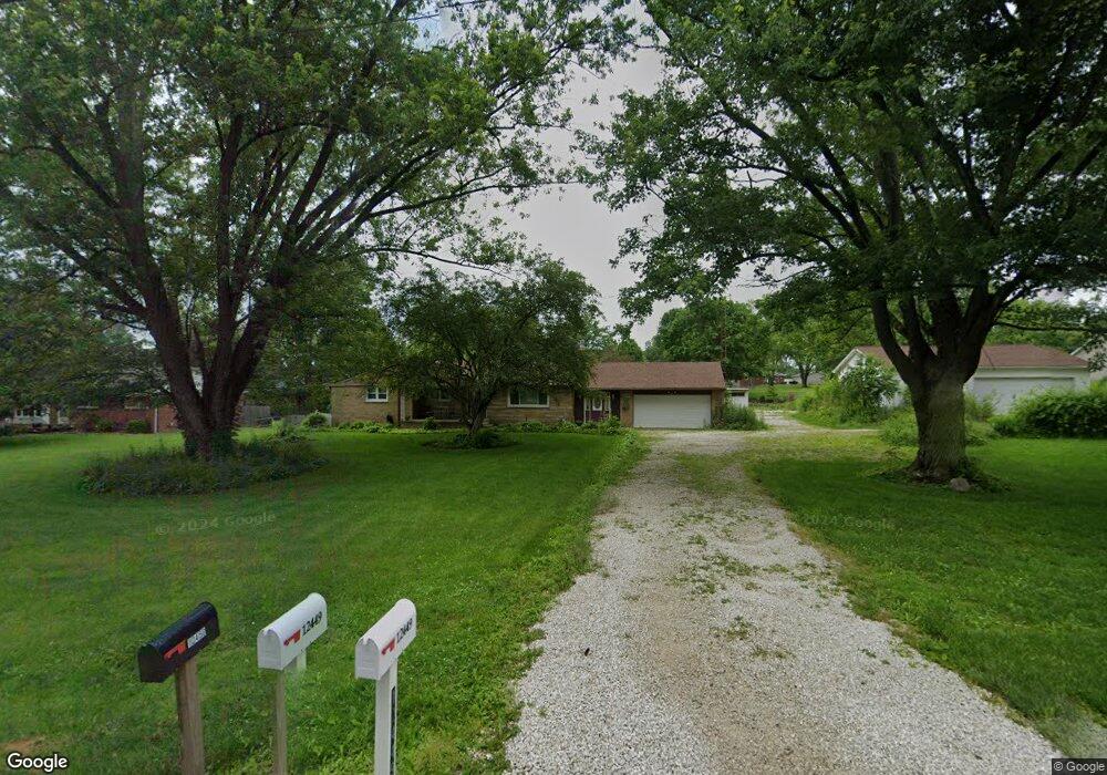
12449 Wooster St NW Massillon, OH 44647
Amherst Heights-Clearview NeighborhoodEstimated Value: $253,000 - $372,000
3
Beds
3
Baths
1,477
Sq Ft
$210/Sq Ft
Est. Value
About This Home
This home is located at 12449 Wooster St NW, Massillon, OH 44647 and is currently estimated at $310,322, approximately $210 per square foot. 12449 Wooster St NW is a home located in Stark County with nearby schools including Tuslaw Elementary School, Tuslaw Middle School, and Tuslaw High School.
Ownership History
Date
Name
Owned For
Owner Type
Purchase Details
Closed on
May 31, 2022
Sold by
Saunders Eric A and Saunders Joy M
Bought by
Bergener Douglas and Bergener Kelley
Current Estimated Value
Home Financials for this Owner
Home Financials are based on the most recent Mortgage that was taken out on this home.
Original Mortgage
$326,340
Outstanding Balance
$309,772
Interest Rate
5%
Mortgage Type
VA
Estimated Equity
$550
Purchase Details
Closed on
Oct 18, 2013
Sold by
Saunders Eric A and Saunders Joy M
Bought by
Blair Theresa A and Blair James M
Purchase Details
Closed on
Sep 13, 2001
Sold by
Garner Norma M
Bought by
Blair Donald W and Blair Charlene
Create a Home Valuation Report for This Property
The Home Valuation Report is an in-depth analysis detailing your home's value as well as a comparison with similar homes in the area
Home Values in the Area
Average Home Value in this Area
Purchase History
| Date | Buyer | Sale Price | Title Company |
|---|---|---|---|
| Bergener Douglas | -- | None Listed On Document | |
| Blair Theresa A | $90,000 | Netwide Title Agency Inc | |
| Saunders Eric A | $90,000 | None Available | |
| Blair Donald W | $62,500 | -- | |
| Blair Donald W | $62,000 | -- |
Source: Public Records
Mortgage History
| Date | Status | Borrower | Loan Amount |
|---|---|---|---|
| Open | Bergener Douglas | $326,340 |
Source: Public Records
Tax History Compared to Growth
Tax History
| Year | Tax Paid | Tax Assessment Tax Assessment Total Assessment is a certain percentage of the fair market value that is determined by local assessors to be the total taxable value of land and additions on the property. | Land | Improvement |
|---|---|---|---|---|
| 2025 | -- | $95,590 | $22,890 | $72,700 |
| 2024 | -- | $95,590 | $22,890 | $72,700 |
| 2023 | $3,028 | $77,140 | $18,340 | $58,800 |
| 2022 | $2,169 | $55,270 | $15,580 | $39,690 |
| 2021 | $2,200 | $55,270 | $15,580 | $39,690 |
| 2020 | $1,915 | $45,400 | $12,780 | $32,620 |
| 2019 | $1,849 | $45,410 | $12,780 | $32,630 |
| 2018 | $1,820 | $45,410 | $12,780 | $32,630 |
| 2017 | $1,782 | $41,840 | $12,950 | $28,890 |
| 2016 | $1,802 | $41,840 | $12,950 | $28,890 |
| 2015 | $1,608 | $36,870 | $7,980 | $28,890 |
| 2014 | $1,539 | $33,760 | $7,320 | $26,440 |
| 2013 | $574 | $33,760 | $7,320 | $26,440 |
Source: Public Records
Map
Nearby Homes
- 2636 Kenyon Ave NW
- 3610 Kenyon Creek Ave NW
- 4420 Lockhart Cir NW
- 3564 Kenyon Creek Ave NW
- 1783 Heron Creek St NW
- 4745 Sippo Reserves Dr NW
- Eden Cay w/ Basement Plan at Sippo Reserves
- Aruba Bay Plan at Sippo Reserves
- Grand Cayman w/ Basement Plan at Sippo Reserves
- Grand Bahama w/ Basement Plan at Sippo Reserves
- 1350 Alpha St NW
- 1252 Gabrielle Cir NW
- 0 Ben Fulton Ave NW
- 982 Lanedale St NW
- 3069 Castle West Cir NW
- 0 Manchester Ave NW
- 1220 Ben Fulton Ave NW
- 3130 Lincoln Way W
- 822 32nd St NW
- 1174 Manchester Ave SW
- 12449 Wooster St NW
- 12475 Wooster St NW
- 0 Wooster St NW Unit 3786974
- 0 Wooster St NW Unit 3790497
- 0 Wooster St NW Unit 3790749
- 0 Wooster St NW Unit 4069951
- 2310 Parkbrook St NW
- 12450 Wooster St NW
- 12409 Wooster St NW
- 12410 Wooster St NW
- 2326 Parkbrook St NW
- 2281 Parkbrook St NW
- 12403 Wooster St NW
- 12406 Wooster St NW
- 2311 Parkbrook St NW
- 12535 Wooster St NW
- 12424 Garnell St NW
- 2350 Parkbrook St NW
- 2333 Parkbrook St NW
- 12373 Wooster St NW