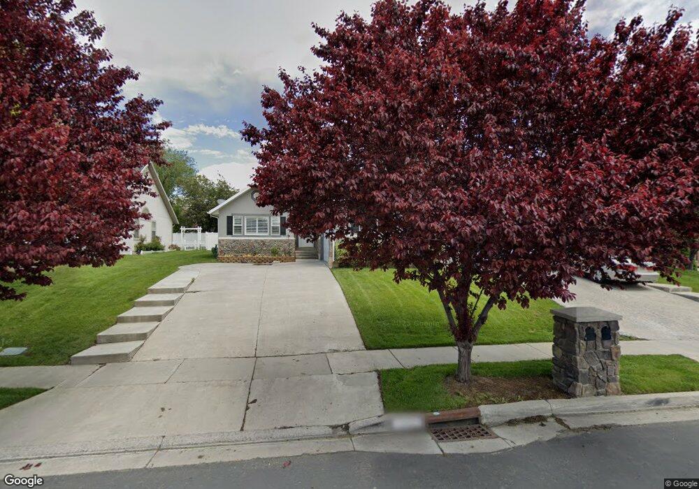
1245 E 1350 N Unit TWIN American Fork, UT 84003
Estimated Value: $596,000 - $656,000
3
Beds
3
Baths
1,600
Sq Ft
$385/Sq Ft
Est. Value
About This Home
This home is located at 1245 E 1350 N Unit TWIN, American Fork, UT 84003 and is currently estimated at $616,045, approximately $385 per square foot. 1245 E 1350 N Unit TWIN is a home located in Utah County with nearby schools including Deerfield Elementary School, Mountain Ridge Junior High School, and American Fork High School.
Ownership History
Date
Name
Owned For
Owner Type
Purchase Details
Closed on
Aug 14, 2025
Sold by
John Thomas Douglas and John Christine F
Bought by
Thomas D John And Christine F John Revocable and John
Current Estimated Value
Purchase Details
Closed on
May 7, 2021
Sold by
Griffiths Jacob and Griffiths Family Trust
Bought by
John Thomas Douglas and John Christine F
Purchase Details
Closed on
Mar 19, 2008
Sold by
Griffiths Robert and Griffiths Ladeane
Bought by
Griffiths Robert and Griffiths Ladeane
Home Financials for this Owner
Home Financials are based on the most recent Mortgage that was taken out on this home.
Original Mortgage
$120,000
Interest Rate
5.65%
Mortgage Type
New Conventional
Purchase Details
Closed on
Dec 8, 2004
Sold by
Lassen April
Bought by
Wilbur Justin D and Wilbur Melody L
Purchase Details
Closed on
Mar 2, 2001
Sold by
American Springs Development Company Llc
Bought by
Lassen April
Create a Home Valuation Report for This Property
The Home Valuation Report is an in-depth analysis detailing your home's value as well as a comparison with similar homes in the area
Home Values in the Area
Average Home Value in this Area
Purchase History
| Date | Buyer | Sale Price | Title Company |
|---|---|---|---|
| Thomas D John And Christine F John Revocable | -- | None Listed On Document | |
| John Thomas Douglas | -- | Investors Title Ins Agcy Inc | |
| Griffiths Robert | -- | Us Title Utah | |
| Griffiths Robert | -- | Metro National Title | |
| Wilbur Justin D | -- | Action Title Company | |
| Lassen April | -- | Signature Title |
Source: Public Records
Mortgage History
| Date | Status | Borrower | Loan Amount |
|---|---|---|---|
| Previous Owner | Griffiths Robert | $120,000 |
Source: Public Records
Tax History Compared to Growth
Tax History
| Year | Tax Paid | Tax Assessment Tax Assessment Total Assessment is a certain percentage of the fair market value that is determined by local assessors to be the total taxable value of land and additions on the property. | Land | Improvement |
|---|---|---|---|---|
| 2025 | $2,521 | $296,010 | $115,400 | $422,800 |
| 2024 | $2,521 | $280,060 | $0 | $0 |
| 2023 | $2,383 | $280,665 | $0 | $0 |
| 2022 | $2,345 | $272,635 | $0 | $0 |
| 2021 | $2,047 | $371,700 | $105,000 | $266,700 |
| 2020 | $1,786 | $350,700 | $105,000 | $245,700 |
| 2019 | $1,786 | $325,300 | $105,000 | $220,300 |
| 2018 | $1,868 | $325,300 | $105,000 | $220,300 |
| 2017 | $1,816 | $170,665 | $0 | $0 |
| 2016 | $0 | $145,915 | $0 | $0 |
| 2015 | -- | $140,800 | $0 | $0 |
| 2014 | -- | $128,150 | $0 | $0 |
Source: Public Records
Map
Nearby Homes
- 4441 W Bridgestone Dr
- 1243 N 1270 E
- 1172 Murdock Dr
- 248 N Deerfield Ln
- 9587 N 4500 W
- 1162 E 1180 N
- 9681 N Peach Ct
- 4631 W Harvey Blvd
- 1228 E 1030 N
- 1058 N 930 E Unit 64
- 1089 N 950 E
- 9506 N 4000 W
- 1059 N 930 E
- The McKenzie Plan at Autumn Crest
- The Christine Plan at Autumn Crest
- The Avery Plan at Autumn Crest
- The Madison Plan at Autumn Crest
- The Roosevelt Plan at Autumn Crest
- The Annie Plan at Autumn Crest
- The Michelle Plan at Autumn Crest
- 1245 E 1350 N
- 1247 E 1350 N Unit 46
- 1247 E 1350 N
- 1233 E 1350 N
- 1233 E 1350 N Unit 44
- 1231 E 1350 N
- 1231 E 1350 N Unit 43
- 1259 E 1350 N
- 1246 Murdock Dr
- 1244 Murdock Dr
- 1272 Murdock Dr
- 1229 E 1350 N
- 1229 E 1350 N Unit 42
- 1226 Murdock Dr
- 1244 E 1350 N
- 1261 E 1350 N
- 1262 E 1350 N
- 1262 E 1350 N Unit 81
- 1230 E 1350 N
- 1227 E 1350 N