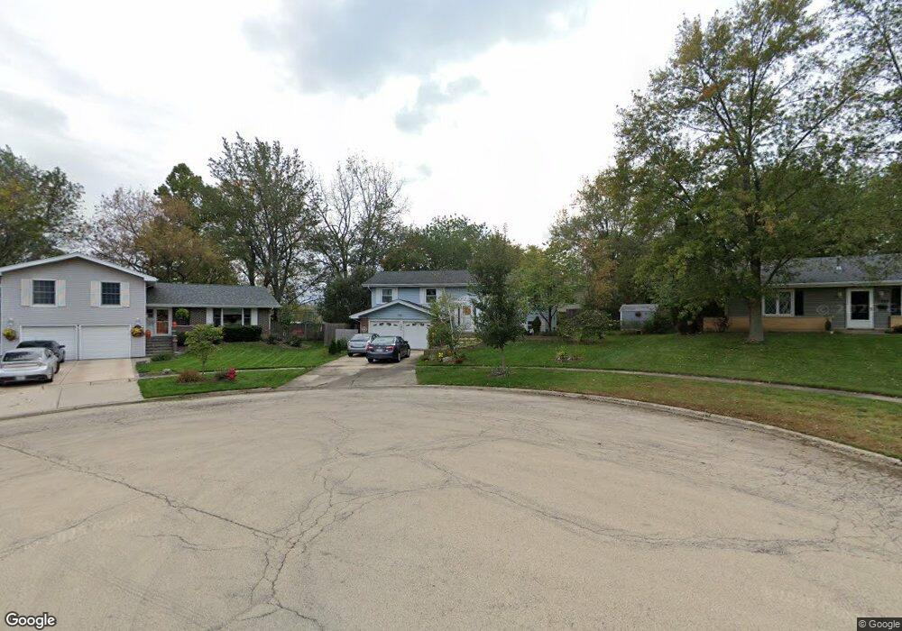
1245 Hassell Cir Hoffman Estates, IL 60169
High Point Park NeighborhoodEstimated Value: $367,000 - $418,369
3
Beds
2
Baths
1,260
Sq Ft
$308/Sq Ft
Est. Value
About This Home
This home is located at 1245 Hassell Cir, Hoffman Estates, IL 60169 and is currently estimated at $388,592, approximately $308 per square foot. 1245 Hassell Cir is a home located in Cook County with nearby schools including MacArthur International Spanish Academy, Dwight D Eisenhower Junior High School, and Hoffman Estates High School.
Ownership History
Date
Name
Owned For
Owner Type
Purchase Details
Closed on
Jul 25, 1995
Sold by
Marth Adolph J and Marth Patricia K
Bought by
Rolewicz Robert A and Rolewicz Christine E
Current Estimated Value
Home Financials for this Owner
Home Financials are based on the most recent Mortgage that was taken out on this home.
Original Mortgage
$80,000
Interest Rate
7.56%
Create a Home Valuation Report for This Property
The Home Valuation Report is an in-depth analysis detailing your home's value as well as a comparison with similar homes in the area
Home Values in the Area
Average Home Value in this Area
Purchase History
| Date | Buyer | Sale Price | Title Company |
|---|---|---|---|
| Rolewicz Robert A | $170,000 | -- |
Source: Public Records
Mortgage History
| Date | Status | Borrower | Loan Amount |
|---|---|---|---|
| Closed | Rolewicz Robert A | $80,000 |
Source: Public Records
Tax History Compared to Growth
Tax History
| Year | Tax Paid | Tax Assessment Tax Assessment Total Assessment is a certain percentage of the fair market value that is determined by local assessors to be the total taxable value of land and additions on the property. | Land | Improvement |
|---|---|---|---|---|
| 2024 | $9,416 | $34,000 | $8,337 | $25,663 |
| 2023 | $9,082 | $34,000 | $8,337 | $25,663 |
| 2022 | $9,082 | $34,000 | $8,337 | $25,663 |
| 2021 | $7,085 | $24,477 | $5,558 | $18,919 |
| 2020 | $6,994 | $24,477 | $5,558 | $18,919 |
| 2019 | $6,958 | $27,197 | $5,558 | $21,639 |
| 2018 | $5,281 | $19,630 | $4,724 | $14,906 |
| 2017 | $5,206 | $19,630 | $4,724 | $14,906 |
| 2016 | $5,104 | $19,630 | $4,724 | $14,906 |
| 2015 | $5,421 | $19,501 | $4,168 | $15,333 |
| 2014 | $5,342 | $19,501 | $4,168 | $15,333 |
| 2013 | $5,187 | $19,501 | $4,168 | $15,333 |
Source: Public Records
Map
Nearby Homes
- 1180 Cobble Hill Ct
- 1360 Mayfield Ln
- 1420 Hassell Rd
- 1410 Nottingham Ln
- 1445 Nottingham Ln
- 2004 E Parkview Cir
- 1940 Kenilworth Cir Unit H
- 920 Eden Dr
- 2079 E Parkview Cir
- 1360 Devonshire Ln
- 1975 Kenilworth Cir Unit B
- 1977 Kenilworth Cir Unit D
- 1860 Ashley Rd
- 1704 Fayette Walk Unit B
- 1712 Fayette Walk Unit D
- 1800 Huntington Blvd Unit AE615
- 1800 Huntington Blvd Unit AE212
- 1840 Huntington Blvd Unit 412
- 1840 Huntington Blvd Unit 415
- 1800 Fayette Walk Unit E
- 1239 Hassell Cir
- 1249 Hassell Cir
- 1289 Hassell Ct
- 1285 Hassell Ct
- 1285 Hassell Ct
- 1235 Hassell Cir
- 1255 Hassell Cir
- 1295 Hassell Ct
- 1279 Hassell Ct
- 1229 Hassell Cir
- 1225 Hassell Cir
- 1265 Hassell Cir
- 1275 Hassell Ct
- 1219 Hassell Cir
- 1190 Lancaster Ct
- 1301 Hassell Ct
- 1180 Lancaster Ct
- 1170 Lancaster Ct
- 1305 Hassell Ct
- 1215 Hassell Cir