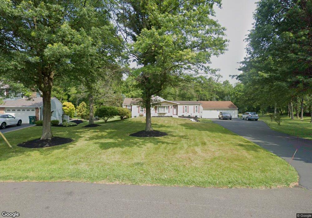
1245 Hawthorne Rd Bensalem, PA 19020
Estimated Value: $427,000 - $585,000
3
Beds
2
Baths
2,510
Sq Ft
$202/Sq Ft
Est. Value
About This Home
This home is located at 1245 Hawthorne Rd, Bensalem, PA 19020 and is currently estimated at $505,835, approximately $201 per square foot. 1245 Hawthorne Rd is a home located in Bucks County with nearby schools including School Lane Charter School, St. Ephrem School, and Holy Ghost Preparatory School.
Ownership History
Date
Name
Owned For
Owner Type
Purchase Details
Closed on
Jul 27, 1995
Sold by
Pritchard Kathleen Margaret
Bought by
Simmer James W and Simmer Diana T
Current Estimated Value
Home Financials for this Owner
Home Financials are based on the most recent Mortgage that was taken out on this home.
Original Mortgage
$106,000
Interest Rate
7.48%
Purchase Details
Closed on
Jul 29, 1994
Sold by
Pritchard George Ray and Pritchard Kathleen Margaret
Bought by
Pritchard Kathleen Margaret
Create a Home Valuation Report for This Property
The Home Valuation Report is an in-depth analysis detailing your home's value as well as a comparison with similar homes in the area
Home Values in the Area
Average Home Value in this Area
Purchase History
| Date | Buyer | Sale Price | Title Company |
|---|---|---|---|
| Simmer James W | $132,500 | -- | |
| Pritchard Kathleen Margaret | -- | -- |
Source: Public Records
Mortgage History
| Date | Status | Borrower | Loan Amount |
|---|---|---|---|
| Closed | Simmer James W | $106,000 |
Source: Public Records
Tax History Compared to Growth
Tax History
| Year | Tax Paid | Tax Assessment Tax Assessment Total Assessment is a certain percentage of the fair market value that is determined by local assessors to be the total taxable value of land and additions on the property. | Land | Improvement |
|---|---|---|---|---|
| 2025 | $6,165 | $28,240 | $4,160 | $24,080 |
| 2024 | $6,165 | $28,240 | $4,160 | $24,080 |
| 2023 | $5,991 | $28,240 | $4,160 | $24,080 |
| 2022 | $5,956 | $28,240 | $4,160 | $24,080 |
| 2021 | $5,956 | $28,240 | $4,160 | $24,080 |
| 2020 | $5,896 | $28,240 | $4,160 | $24,080 |
| 2019 | $5,764 | $28,240 | $4,160 | $24,080 |
| 2018 | $5,631 | $28,240 | $4,160 | $24,080 |
| 2017 | $5,596 | $28,240 | $4,160 | $24,080 |
| 2016 | $5,596 | $28,240 | $4,160 | $24,080 |
| 2015 | -- | $28,240 | $4,160 | $24,080 |
| 2014 | -- | $28,240 | $4,160 | $24,080 |
Source: Public Records
Map
Nearby Homes
- 1100 Wayland Ave
- 4783 Meeting Rd
- 953 Farley Rd
- 938 Ashton Rd
- 446 N Mount Vernon Cir Unit 446
- 435 N Mount Vernon Cir Unit 435
- 1440 Atterbury Way
- 419 Rutgers Ct
- 393 Rutgers Ct Unit 393
- 5110 Bay Rd
- 389 Rutgers Ct Unit 389
- 580 S Mount Vernon Cir
- 5107 Leeward Rd
- 5217 Bay Rd
- 5102 Lighthouse Ln
- 801 Cliff Rd
- 1881 Byberry Rd
- 4744 Dunston Rd
- L:15 Dunston Rd
- 1446 Gibson Rd Unit D50
- 1265 Hawthorne Rd
- 1220 Hawthorne Rd
- 1233 Hawthorne Rd
- 1200 Harwood Rd
- 1221 Hawthorne Rd
- 1212 Hawthorne Rd
- 1215 Harwood Rd
- 4900 Wayland Ave
- 1190 Harwood Rd
- 1205 Hawthorne Rd
- 1206 Hawthorne Rd
- 1211 Harwood Rd
- 4908 Wayland Ave
- 1188 Harwood Rd
- 1156 Hawthorne Rd
- 1169 Hawthorne Rd
- 1169 Harwood Rd
- 1169 Harwood Rd
- 1186 Harwood Rd
- 1182 Wayland Ave