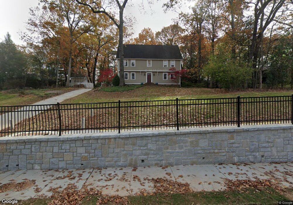
1245 Spalding Dr Unit 3 Atlanta, GA 30350
Estimated Value: $777,816 - $926,000
4
Beds
4
Baths
3,831
Sq Ft
$227/Sq Ft
Est. Value
About This Home
This home is located at 1245 Spalding Dr Unit 3, Atlanta, GA 30350 and is currently estimated at $868,204, approximately $226 per square foot. 1245 Spalding Dr Unit 3 is a home located in Fulton County with nearby schools including Woodland Elementary School, Sandy Springs Middle School, and North Springs High School.
Ownership History
Date
Name
Owned For
Owner Type
Purchase Details
Closed on
Feb 9, 2000
Sold by
Brinsmade Douglas B
Bought by
Brinsmade Douglas B and Brinsmade Jennifer Y
Current Estimated Value
Home Financials for this Owner
Home Financials are based on the most recent Mortgage that was taken out on this home.
Original Mortgage
$292,500
Outstanding Balance
$92,947
Interest Rate
7.63%
Mortgage Type
New Conventional
Estimated Equity
$775,257
Purchase Details
Closed on
Jul 30, 1998
Sold by
Reyes Jenith
Bought by
Reyes Jenith and Reyes Milena A
Home Financials for this Owner
Home Financials are based on the most recent Mortgage that was taken out on this home.
Original Mortgage
$350,000
Interest Rate
6.97%
Mortgage Type
New Conventional
Create a Home Valuation Report for This Property
The Home Valuation Report is an in-depth analysis detailing your home's value as well as a comparison with similar homes in the area
Home Values in the Area
Average Home Value in this Area
Purchase History
| Date | Buyer | Sale Price | Title Company |
|---|---|---|---|
| Brinsmade Douglas B | -- | -- | |
| Brinsmade Douglas B | $325,000 | -- | |
| Reyes Jenith | -- | -- | |
| Reyes Jenith | $507,800 | -- |
Source: Public Records
Mortgage History
| Date | Status | Borrower | Loan Amount |
|---|---|---|---|
| Open | Brinsmade Douglas B | $292,500 | |
| Previous Owner | Reyes Jenith | $350,000 |
Source: Public Records
Tax History Compared to Growth
Tax History
| Year | Tax Paid | Tax Assessment Tax Assessment Total Assessment is a certain percentage of the fair market value that is determined by local assessors to be the total taxable value of land and additions on the property. | Land | Improvement |
|---|---|---|---|---|
| 2025 | $4,671 | $164,000 | $34,440 | $129,560 |
| 2023 | $4,976 | $176,280 | $38,560 | $137,720 |
| 2022 | $4,549 | $176,280 | $38,560 | $137,720 |
| 2021 | $4,521 | $171,120 | $37,400 | $133,720 |
| 2020 | $4,552 | $168,920 | $34,400 | $134,520 |
| 2019 | $4,481 | $165,920 | $33,800 | $132,120 |
| 2018 | $4,928 | $162,040 | $33,000 | $129,040 |
| 2017 | $4,005 | $130,480 | $43,680 | $86,800 |
| 2016 | $4,004 | $130,480 | $43,680 | $86,800 |
| 2015 | $4,018 | $130,480 | $43,680 | $86,800 |
| 2014 | $4,155 | $130,480 | $43,680 | $86,800 |
Source: Public Records
Map
Nearby Homes
- 5662 Queensborough Dr
- 812 Stratford Ct
- 1136 Coronation Dr
- 1120 Whitehall Pointe
- 1015 Wingate Way
- 4006 Wingate Way
- 2015 Wingate Way
- 5697 Whitehall Walk
- 3020 Wingate Way
- 7632 Auden Trail
- 7967 Magnolia Square
- 1503 Wingate Way
- 942 Telfair Close
- 1804 Wingate Way Unit 1804
- 500 Calaveras Dr
- 1495 Spalding Dr
- 996 Pitts Rd Unit D
- 1293 Witham Dr
- 1255 Spalding Dr
- 1235 Spalding Dr Unit 3
- 5638 Queensborough Dr
- 5646 Queensborough Dr Unit 4
- 5630 Queensborough Dr
- 1280 Spalding Dr
- 1265 Spalding Dr
- 1225 Spalding Dr Unit 378
- 1225 Spalding Dr
- 5654 Queensborough Dr Unit 4
- 5622 Queensborough Dr
- 1270 Spalding Dr
- 7795 Stratford Ln
- 7805 Stratford Ln
- 7785 Stratford Ln
- 1309 Spalding Dr
- 7922 Stratford Ln
- 5614 Queensborough Dr
- 1215 Spalding Dr
- 1250 Spalding Dr