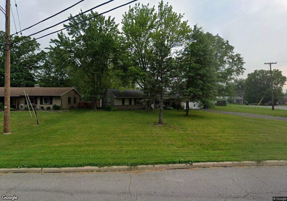
1245 Spruce Tree Ln Amherst, OH 44001
Estimated Value: $187,000 - $220,000
3
Beds
2
Baths
1,346
Sq Ft
$151/Sq Ft
Est. Value
About This Home
This home is located at 1245 Spruce Tree Ln, Amherst, OH 44001 and is currently estimated at $202,594, approximately $150 per square foot. 1245 Spruce Tree Ln is a home located in Lorain County with nearby schools including Powers Elementary School, Walter G. Nord Middle School, and Amherst Junior High School.
Ownership History
Date
Name
Owned For
Owner Type
Purchase Details
Closed on
Dec 6, 2021
Sold by
Naso Thomas R
Bought by
Naso Family Trust
Current Estimated Value
Purchase Details
Closed on
Aug 15, 2002
Sold by
Raeburn Edwin D and Raeburn Vicky L
Bought by
Naso Thomas R
Home Financials for this Owner
Home Financials are based on the most recent Mortgage that was taken out on this home.
Original Mortgage
$112,955
Interest Rate
6.64%
Purchase Details
Closed on
Oct 10, 1995
Sold by
Kelley Christopher L
Bought by
Raeburn Edwin D and Raeburn Vicky L
Home Financials for this Owner
Home Financials are based on the most recent Mortgage that was taken out on this home.
Original Mortgage
$99,847
Interest Rate
7.91%
Mortgage Type
FHA
Create a Home Valuation Report for This Property
The Home Valuation Report is an in-depth analysis detailing your home's value as well as a comparison with similar homes in the area
Home Values in the Area
Average Home Value in this Area
Purchase History
| Date | Buyer | Sale Price | Title Company |
|---|---|---|---|
| Naso Family Trust | -- | None Listed On Document | |
| Naso Thomas R | $118,900 | Real Living Title Agency Ltd | |
| Raeburn Edwin D | $99,900 | -- |
Source: Public Records
Mortgage History
| Date | Status | Borrower | Loan Amount |
|---|---|---|---|
| Previous Owner | Naso Thomas R | $112,955 | |
| Previous Owner | Raeburn Edwin D | $99,847 |
Source: Public Records
Tax History Compared to Growth
Tax History
| Year | Tax Paid | Tax Assessment Tax Assessment Total Assessment is a certain percentage of the fair market value that is determined by local assessors to be the total taxable value of land and additions on the property. | Land | Improvement |
|---|---|---|---|---|
| 2024 | $1,902 | $45,976 | $11,725 | $34,251 |
| 2023 | $1,745 | $35,546 | $11,015 | $24,532 |
| 2022 | $1,675 | $35,546 | $11,015 | $24,532 |
| 2021 | $1,680 | $35,546 | $11,015 | $24,532 |
| 2020 | $1,549 | $29,090 | $9,010 | $20,080 |
| 2019 | $1,519 | $29,090 | $9,010 | $20,080 |
| 2018 | $1,565 | $29,090 | $9,010 | $20,080 |
| 2017 | $1,603 | $28,670 | $8,380 | $20,290 |
| 2016 | $1,616 | $28,670 | $8,380 | $20,290 |
| 2015 | $1,608 | $28,670 | $8,380 | $20,290 |
| 2014 | $1,687 | $29,930 | $8,750 | $21,180 |
| 2013 | $1,693 | $29,930 | $8,750 | $21,180 |
Source: Public Records
Map
Nearby Homes
- 1273 Spruce Tree Ln
- Pine w/ Full Basement Plan at Quarry Creek
- Poplar Plan at Quarry Creek
- 60 Flamingo Ave
- 127 Tropicana Ave
- 117 Caesars Cir
- 41 Flamingo Ave
- 351 Rockridge Dr
- 8 Riviera Ave
- 922 Sharondale Dr
- 6394 Balsam Dr
- 135 Ridgeland Dr
- 707 Greenlawn Dr
- 1819 Gloucester Dr
- 45305 N Ridge Rd
- 105 N Woodhill Dr
- 5614 S Nantucket Dr
- 726 Sunrise Dr
- 0 Cooper Foster Park Rd Unit 5129838
- 825 Cleveland Ave
- 1239 Spruce Tree Ln
- 057 Spruce Tree Ln
- 056 Spruce Tree Ln
- 1250 Spruce Tree Ln
- 1235 Spruce Tree Ln
- 1242 Spruce Tree Ln
- 1260 Spruce Tree Ln
- 1238 Spruce Tree Ln
- 1259 Chapel Ct
- 1231 Spruce Tree Ln
- 495 High Meadow Rd
- 1265 Spruce Tree Ln
- 1270 Spruce Tree Ln
- 486 Lullaby Cir
- 489 Rock Creek Run
- 490 Rock Creek Run
- 490 Rock Creek Run
- 1227 Spruce Tree Ln
- 489 High Meadow Rd
- 482 Lullaby Cir