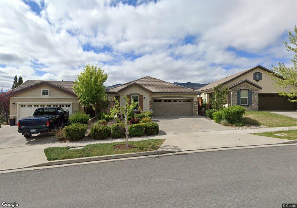
1245 Walking Stick Way Reno, NV 89523
Somersett NeighborhoodEstimated Value: $511,000 - $554,000
1
Bed
2
Baths
1,264
Sq Ft
$425/Sq Ft
Est. Value
About This Home
This home is located at 1245 Walking Stick Way, Reno, NV 89523 and is currently estimated at $536,823, approximately $424 per square foot. 1245 Walking Stick Way is a home located in Washoe County with nearby schools including B D Billinghurst Middle School and Robert McQueen High School.
Ownership History
Date
Name
Owned For
Owner Type
Purchase Details
Closed on
Sep 15, 2025
Sold by
Hickerson Ronald M and Hickerson Linda
Bought by
Hickersons Trust and Hickerson
Current Estimated Value
Purchase Details
Closed on
Nov 20, 2018
Sold by
Marcelino Joseph and Marcelino Albertina
Bought by
Hickerson Ronald M and Hickerson Linda
Home Financials for this Owner
Home Financials are based on the most recent Mortgage that was taken out on this home.
Original Mortgage
$300,000
Interest Rate
4.9%
Mortgage Type
New Conventional
Purchase Details
Closed on
Oct 8, 2007
Sold by
Pn Ii Inc
Bought by
Marcelino Joseph and Marcelino Albertina
Create a Home Valuation Report for This Property
The Home Valuation Report is an in-depth analysis detailing your home's value as well as a comparison with similar homes in the area
Home Values in the Area
Average Home Value in this Area
Purchase History
| Date | Buyer | Sale Price | Title Company |
|---|---|---|---|
| Hickersons Trust | -- | None Listed On Document | |
| Hickerson Ronald M | $350,000 | First Centennial Reno | |
| Marcelino Joseph | $260,000 | First American Title Reno |
Source: Public Records
Mortgage History
| Date | Status | Borrower | Loan Amount |
|---|---|---|---|
| Previous Owner | Hickerson Ronald M | $300,000 |
Source: Public Records
Tax History Compared to Growth
Tax History
| Year | Tax Paid | Tax Assessment Tax Assessment Total Assessment is a certain percentage of the fair market value that is determined by local assessors to be the total taxable value of land and additions on the property. | Land | Improvement |
|---|---|---|---|---|
| 2026 | $2,192 | $112,818 | $45,500 | $67,318 |
| 2025 | $2,845 | $111,080 | $42,805 | $68,275 |
| 2024 | $2,845 | $105,374 | $36,680 | $68,695 |
| 2023 | $2,762 | $107,948 | $43,190 | $64,758 |
| 2022 | $2,682 | $87,683 | $33,775 | $53,908 |
| 2021 | $2,604 | $79,737 | $26,215 | $53,522 |
| 2020 | $2,525 | $81,485 | $28,385 | $53,100 |
| 2019 | $2,452 | $80,848 | $30,310 | $50,538 |
| 2018 | $2,340 | $70,480 | $21,000 | $49,480 |
| 2017 | $2,246 | $69,219 | $19,775 | $49,444 |
| 2016 | $2,190 | $68,657 | $18,235 | $50,422 |
| 2015 | $2,185 | $65,982 | $15,995 | $49,987 |
| 2014 | $2,117 | $63,728 | $15,085 | $48,643 |
| 2013 | -- | $56,051 | $10,780 | $45,271 |
Source: Public Records
Map
Nearby Homes
- 1240 Cliff Park Way
- 1380 Wakefield Trail
- 1220 Cliff Park Way
- 9380 Copper Mountain Cir
- 1170 Cliff Park Way
- 9190 Quilberry Way
- 9225 Sassafras Trail
- 9161 Quilberry Way
- 9165 Kenton Trail
- 861 Larrimore Trail
- 1591 Elk Run Trail
- 0 Mountain Daisy Rd
- 0 Mountain Haven Ln
- 270 Mogul Mountain Dr
- 1590 Scott Valley Rd
- 1755 Back Nine Trail
- 35 Mogul Mountain Cir
- 1640 Scott Valley Rd
- 1671 Crescent Pointe Ct
- 80 Bobcat Dr
- 1245 Walking Stick Way Unit n/a
- 1255 Walking Stick Way
- 1235 Walking Stick Way
- 1265 Walking Stick Way
- 1295 Hidden River Ct
- 1275 Walking Stick Way
- 1305 Hidden River Way
- 1285 Hidden River Ct
- 1260 Sugar Creek Trail
- 1270 Sugar Creek Trail
- 1320 Walking Stick Way
- 1315 Hidden River Way
- 1285 Walking Stick Way
- 1275 Hidden River Ct
- 1330 Walking Stick Way
- 1250 Sugar Creek Trail
- 1325 Hidden River Way
- 1280 Sugar Creek Trail
- 1295 Walking Stick Way
- 1335 Hidden River Way