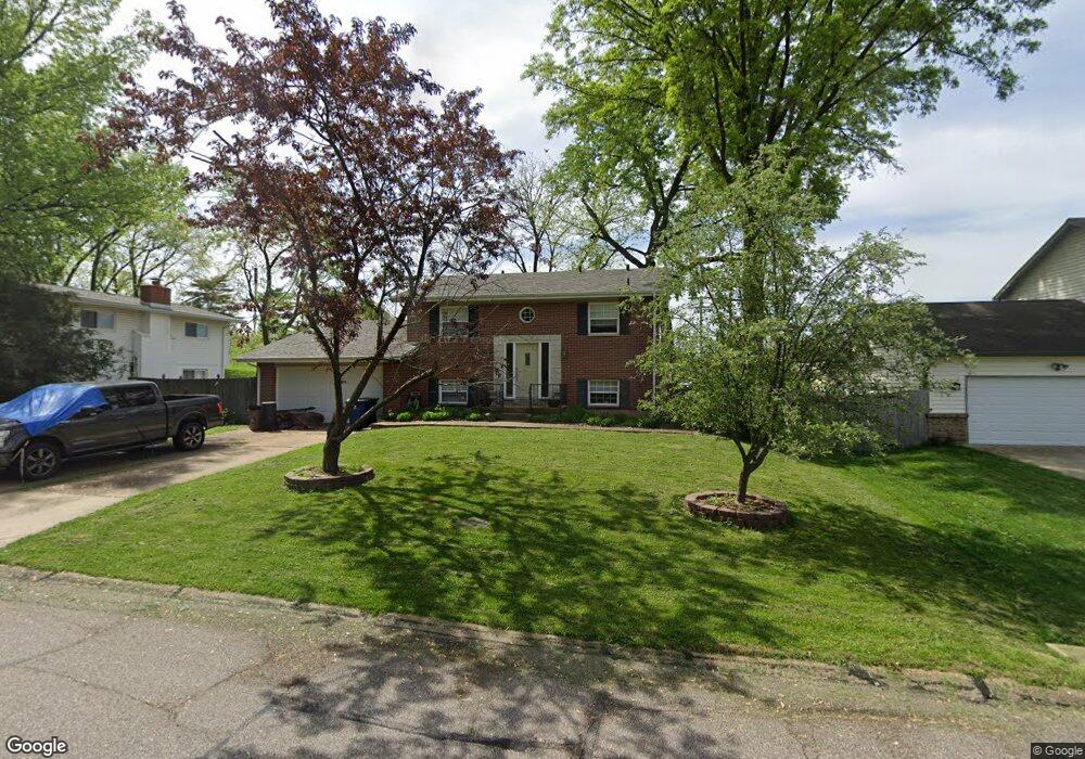
12452 Betsy Ross Ln Saint Louis, MO 63146
Estimated Value: $320,000 - $392,000
4
Beds
3
Baths
1,140
Sq Ft
$313/Sq Ft
Est. Value
About This Home
This home is located at 12452 Betsy Ross Ln, Saint Louis, MO 63146 and is currently estimated at $356,767, approximately $312 per square foot. 12452 Betsy Ross Ln is a home located in St. Louis County with nearby schools including Ross Elementary School, Parkway Northeast Middle School, and Parkway North High School.
Ownership History
Date
Name
Owned For
Owner Type
Purchase Details
Closed on
Dec 4, 2006
Sold by
Edwards Walter D
Bought by
Moseley Scott and Moseley Yana
Current Estimated Value
Home Financials for this Owner
Home Financials are based on the most recent Mortgage that was taken out on this home.
Original Mortgage
$190,400
Outstanding Balance
$114,466
Interest Rate
6.41%
Mortgage Type
Purchase Money Mortgage
Estimated Equity
$242,301
Purchase Details
Closed on
Jul 26, 2006
Sold by
Rafsky Carol G
Bought by
Edwards Walter D
Create a Home Valuation Report for This Property
The Home Valuation Report is an in-depth analysis detailing your home's value as well as a comparison with similar homes in the area
Home Values in the Area
Average Home Value in this Area
Purchase History
| Date | Buyer | Sale Price | Title Company |
|---|---|---|---|
| Moseley Scott | $238,000 | Ust | |
| Edwards Walter D | $179,900 | Ust |
Source: Public Records
Mortgage History
| Date | Status | Borrower | Loan Amount |
|---|---|---|---|
| Open | Moseley Scott | $190,400 |
Source: Public Records
Tax History Compared to Growth
Tax History
| Year | Tax Paid | Tax Assessment Tax Assessment Total Assessment is a certain percentage of the fair market value that is determined by local assessors to be the total taxable value of land and additions on the property. | Land | Improvement |
|---|---|---|---|---|
| 2025 | $2,958 | $53,270 | $17,400 | $35,870 |
| 2024 | $2,958 | $45,100 | $13,070 | $32,030 |
| 2023 | $2,920 | $45,100 | $13,070 | $32,030 |
| 2022 | $2,896 | $40,770 | $13,070 | $27,700 |
| 2021 | $2,875 | $40,770 | $13,070 | $27,700 |
| 2020 | $2,705 | $36,610 | $15,770 | $20,840 |
| 2019 | $2,662 | $36,610 | $15,770 | $20,840 |
| 2018 | $2,597 | $32,960 | $11,320 | $21,640 |
| 2017 | $2,578 | $32,960 | $11,320 | $21,640 |
| 2016 | $2,480 | $30,150 | $8,720 | $21,430 |
| 2015 | $2,586 | $30,150 | $8,720 | $21,430 |
| 2014 | $2,690 | $33,550 | $7,390 | $26,160 |
Source: Public Records
Map
Nearby Homes
- 1201 Ross Ave
- 12516 Starspur Ln
- 1018 Tempo Dr
- 1004 Tempo Dr
- 12430 Impact Dr
- 12314 Rossridge Ct
- 920 Tempo Dr
- 12304 Design Ln
- 12371 Sparrowhawk Ct
- 1529 Tryon Dr
- 12167 Plainsman Dr
- 12045 Bridal Shire Ct
- 12558 Pepperwood Dr
- 1425 Craig Rd
- 842 N New Ballas Ct Unit 302
- 950 E Rue de La Banque Unit 208
- 950 E Rue de La Banque Unit L1
- 950 E Rue de La Banque Unit 202
- 950 E Rue de La Banque Unit 317
- 950 E Rue de La Banque Unit 118
- 12460 Betsy Ross Ln
- 12444 Betsy Ross Ln
- 12455 Cape Cod Dr
- 12468 Betsy Ross Ln
- 12414 Betsy Ross Ln
- 12439 Betsy Ross Ln
- 12473 Betsy Ross Ln
- 12476 Betsy Ross Ln
- 12460 Cape Cod Dr
- 12432 Cape Cod Dr
- 12431 Betsy Ross Ln
- 12424 Cape Cod Dr
- 12465 Cape Cod Dr
- 12423 Betsy Ross Ln
- 12415 Betsy Ross Ln
- 1222 Ross Ave
- 12481 Betsy Ross Ln
- 12409 Betsy Ross Ln
- 12416 Cape Cod Dr
- 12457 Cape Cod Dr