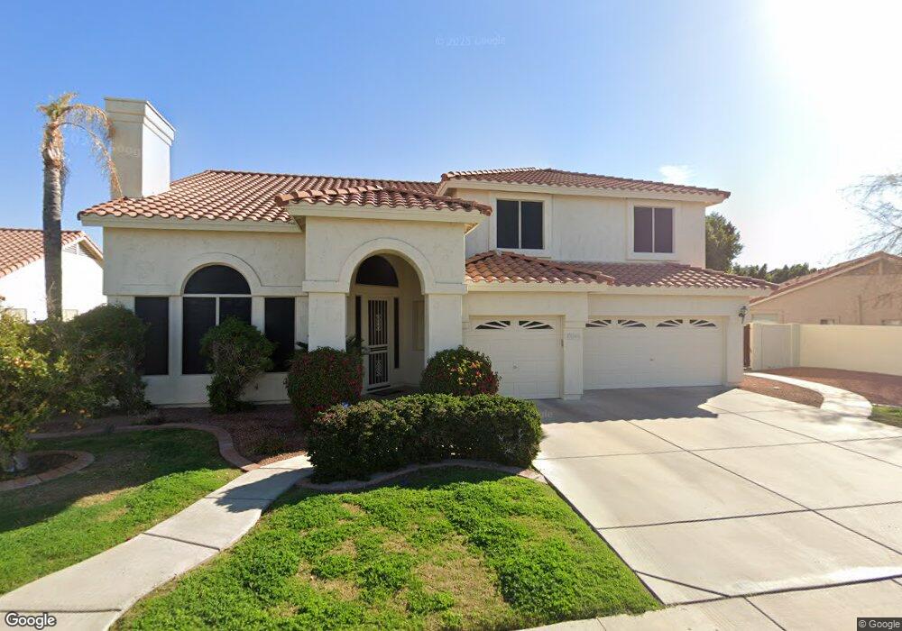
12459 N 57th Dr Glendale, AZ 85304
Estimated Value: $587,815 - $637,000
--
Bed
4
Baths
3,055
Sq Ft
$204/Sq Ft
Est. Value
About This Home
This home is located at 12459 N 57th Dr, Glendale, AZ 85304 and is currently estimated at $621,954, approximately $203 per square foot. 12459 N 57th Dr is a home located in Maricopa County with nearby schools including Marshall Ranch Elementary School, Ironwood High School, and Legacy Traditional School - Glendale.
Ownership History
Date
Name
Owned For
Owner Type
Purchase Details
Closed on
May 9, 1996
Sold by
Maracay Homes Corp
Bought by
Bassin Avtar S and Bassin Amarjit K
Current Estimated Value
Home Financials for this Owner
Home Financials are based on the most recent Mortgage that was taken out on this home.
Original Mortgage
$185,022
Interest Rate
8.01%
Mortgage Type
Purchase Money Mortgage
Purchase Details
Closed on
Dec 26, 1995
Sold by
Taro Properties Arizona I Llc
Bought by
Maracay Homes Corp
Home Financials for this Owner
Home Financials are based on the most recent Mortgage that was taken out on this home.
Original Mortgage
$1,472,250
Interest Rate
7.37%
Mortgage Type
New Conventional
Create a Home Valuation Report for This Property
The Home Valuation Report is an in-depth analysis detailing your home's value as well as a comparison with similar homes in the area
Home Values in the Area
Average Home Value in this Area
Purchase History
| Date | Buyer | Sale Price | Title Company |
|---|---|---|---|
| Bassin Avtar S | $231,278 | Security Title Agency | |
| Maracay Homes Corp | -- | Security Title Agency | |
| Maracay Homes Corp | $3,328,380 | Security Title Agency |
Source: Public Records
Mortgage History
| Date | Status | Borrower | Loan Amount |
|---|---|---|---|
| Previous Owner | Bassin Avtar S | $185,022 | |
| Previous Owner | Maracay Homes Corp | $1,472,250 |
Source: Public Records
Tax History Compared to Growth
Tax History
| Year | Tax Paid | Tax Assessment Tax Assessment Total Assessment is a certain percentage of the fair market value that is determined by local assessors to be the total taxable value of land and additions on the property. | Land | Improvement |
|---|---|---|---|---|
| 2025 | $2,420 | $31,758 | -- | -- |
| 2024 | $2,470 | $30,245 | -- | -- |
| 2023 | $2,470 | $46,030 | $9,200 | $36,830 |
| 2022 | $2,447 | $34,360 | $6,870 | $27,490 |
| 2021 | $2,627 | $32,920 | $6,580 | $26,340 |
| 2020 | $2,667 | $31,450 | $6,290 | $25,160 |
| 2019 | $2,592 | $32,450 | $6,490 | $25,960 |
| 2018 | $2,532 | $31,000 | $6,200 | $24,800 |
| 2017 | $2,549 | $26,850 | $5,370 | $21,480 |
| 2016 | $2,533 | $26,170 | $5,230 | $20,940 |
| 2015 | $2,375 | $26,710 | $5,340 | $21,370 |
Source: Public Records
Map
Nearby Homes
- 12327 N 57th Dr
- 12748 N 57th Dr
- 12334 N 58th Dr
- 12316 N 58th Dr
- 5534 W Riviera Dr
- 12407 N 54th Ave
- 5341 W Bloomfield Rd
- 5319 W Columbine Dr
- 5422 W Pershing Ave
- 11840 N 59th Ln
- 5757 W Eugie Ave Unit 1040
- 5757 W Eugie Ave Unit 2081
- 5757 W Eugie Ave Unit 2100
- 5318 W Shaw Butte Dr
- 6128 W Columbine Dr
- 5221 W Columbine Dr
- 5320 W Desert Hills Dr Unit 3
- 5228 W Aster Dr
- 5432 W Sunnyside Dr
- 12031 N 53rd Ave
- 12453 N 57th Dr
- 12465 N 57th Dr
- 5749 W Columbine Dr
- 12447 N 57th Dr
- 5744 W Columbine Dr
- 5748 W Bloomfield Rd
- 5750 W Columbine Dr
- 5759 W Columbine Dr
- 5754 W Bloomfield Rd
- 5773 W Larkspur Dr
- 12441 N 57th Dr
- 5756 W Columbine Dr
- 5765 W Columbine Dr
- 12435 N 57th Dr
- 5760 W Bloomfield Rd
- 5767 W Larkspur Dr
- 5751 W Bloomfield Rd
- 5762 W Columbine Dr
- 5771 W Columbine Dr
- 12429 N 57th Dr