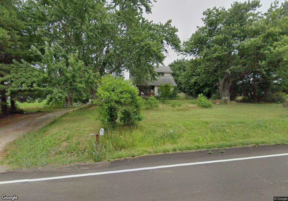
12467 Beech St NE Alliance, OH 44601
Estimated Value: $201,792 - $233,000
3
Beds
2
Baths
1,680
Sq Ft
$128/Sq Ft
Est. Value
About This Home
This home is located at 12467 Beech St NE, Alliance, OH 44601 and is currently estimated at $214,948, approximately $127 per square foot. 12467 Beech St NE is a home located in Stark County with nearby schools including Marlington High School and Regina Coeli/St Joseph School.
Ownership History
Date
Name
Owned For
Owner Type
Purchase Details
Closed on
Feb 15, 2005
Sold by
Mccoy Larry and Mccoy Angela M
Bought by
Whitmore Sharon L
Current Estimated Value
Purchase Details
Closed on
Sep 28, 1998
Sold by
Smith William E
Bought by
Mccoy Larry and Mccoy Angela M
Home Financials for this Owner
Home Financials are based on the most recent Mortgage that was taken out on this home.
Original Mortgage
$76,950
Interest Rate
6.99%
Mortgage Type
Balloon
Create a Home Valuation Report for This Property
The Home Valuation Report is an in-depth analysis detailing your home's value as well as a comparison with similar homes in the area
Purchase History
| Date | Buyer | Sale Price | Title Company |
|---|---|---|---|
| Whitmore Sharon L | $107,000 | Union Title Co | |
| Mccoy Larry | $81,000 | -- |
Source: Public Records
Mortgage History
| Date | Status | Borrower | Loan Amount |
|---|---|---|---|
| Previous Owner | Mccoy Larry | $76,950 |
Source: Public Records
Tax History
| Year | Tax Paid | Tax Assessment Tax Assessment Total Assessment is a certain percentage of the fair market value that is determined by local assessors to be the total taxable value of land and additions on the property. | Land | Improvement |
|---|---|---|---|---|
| 2025 | -- | $48,370 | $11,200 | $37,170 |
| 2024 | -- | $48,370 | $11,200 | $37,170 |
| 2023 | $1,117 | $35,850 | $9,770 | $26,080 |
| 2022 | $1,121 | $35,850 | $9,770 | $26,080 |
| 2021 | $1,124 | $35,850 | $9,770 | $26,080 |
| 2020 | $1,092 | $31,160 | $8,440 | $22,720 |
| 2019 | $1,082 | $31,160 | $8,440 | $22,720 |
Source: Public Records
Map
Nearby Homes
- 2535 Queensbury Rd
- 0 Valewood Cir Unit 5006281
- 8539 Schubert Ave NE
- 0 Winchester St
- 0 Winchester St Unit 5162877
- 2420 Beechwood Ave
- 6480 Frederick Ave NE
- 0 Frederick Ave NE
- 3018 Blenheim Ave
- 2635 Blenheim Ave
- 2630 Blenheim Ave
- 0 Federal Ave
- 2120 Blenheim Ave
- 2580 Edgewood Ave
- 1235 Spring Ridge Cir Unit 17A
- 1601 Raywood Rd
- 1718 Fernwood Blvd
- 29 Colony Dr
- 31 Colony Dr
- 856 Birchwood Dr
- 12501 Beech St NE
- 12464 Beech St NE
- 12362 Beech St NE
- 12565 Beech St NE
- 12354 Beech St NE
- 12552 Beech St NE
- 12334 Beech St NE
- 12359 Beech St NE
- 12643 Beech St NE
- 12258 Beech St NE
- 12660 Beech St NE
- 12384 Beech St NE
- 12720 Beech St NE
- 12743 Beech St NE
- 12775 Beech St NE
- 12783 Beech St NE
- 12836 Orchard Spring St NE
- 12156 Beech St NE
- 12808 Beech St NE
- 12811 Beech St NE
Your Personal Tour Guide
Ask me questions while you tour the home.