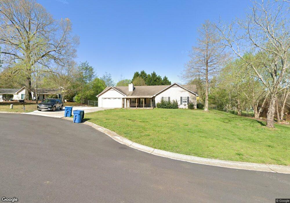
1247 Cabots Dr Unit 2 Auburn, GA 30011
Estimated Value: $304,477 - $328,000
3
Beds
2
Baths
1,391
Sq Ft
$229/Sq Ft
Est. Value
About This Home
This home is located at 1247 Cabots Dr Unit 2, Auburn, GA 30011 and is currently estimated at $317,869, approximately $228 per square foot. 1247 Cabots Dr Unit 2 is a home located in Barrow County with nearby schools including Auburn Elementary School, Westside Middle School, and Apalachee High School.
Ownership History
Date
Name
Owned For
Owner Type
Purchase Details
Closed on
Sep 10, 1999
Sold by
Fields Robin M
Bought by
Sensat Timothy J and Sensat Kelly A
Current Estimated Value
Home Financials for this Owner
Home Financials are based on the most recent Mortgage that was taken out on this home.
Original Mortgage
$94,900
Outstanding Balance
$26,684
Interest Rate
7.85%
Mortgage Type
New Conventional
Estimated Equity
$291,185
Purchase Details
Closed on
Aug 28, 1992
Bought by
Mckee Robin M
Create a Home Valuation Report for This Property
The Home Valuation Report is an in-depth analysis detailing your home's value as well as a comparison with similar homes in the area
Home Values in the Area
Average Home Value in this Area
Purchase History
| Date | Buyer | Sale Price | Title Company |
|---|---|---|---|
| Sensat Timothy J | $94,900 | -- | |
| Mckee Robin M | $65,000 | -- |
Source: Public Records
Mortgage History
| Date | Status | Borrower | Loan Amount |
|---|---|---|---|
| Open | Sensat Timothy J | $94,900 |
Source: Public Records
Tax History
| Year | Tax Paid | Tax Assessment Tax Assessment Total Assessment is a certain percentage of the fair market value that is determined by local assessors to be the total taxable value of land and additions on the property. | Land | Improvement |
|---|---|---|---|---|
| 2025 | $2,330 | $91,459 | $20,000 | $71,459 |
| 2024 | $2,317 | $89,403 | $20,000 | $69,403 |
| 2023 | $1,033 | $68,965 | $20,000 | $48,965 |
| 2022 | $1,252 | $49,428 | $12,800 | $36,628 |
| 2021 | $1,324 | $49,428 | $12,800 | $36,628 |
| 2020 | $1,323 | $49,428 | $12,800 | $36,628 |
| 2019 | $1,340 | $49,428 | $12,800 | $36,628 |
| 2018 | $1,193 | $43,532 | $9,800 | $33,732 |
| 2017 | $197 | $35,804 | $9,800 | $26,004 |
| 2016 | $907 | $32,766 | $9,800 | $22,966 |
| 2015 | $927 | $33,359 | $9,800 | $23,559 |
| 2014 | $780 | $30,128 | $6,272 | $23,856 |
| 2013 | -- | $29,040 | $6,272 | $22,768 |
Source: Public Records
Map
Nearby Homes
- 1236 Cabots Dr
- 1223 Cabots Dr
- 264 Kilcrease Rd
- 410 Kilcrease Rd
- 4079 Brookmont Way
- 5779 Wheeler Ridge Rd
- 4048 Brookmont Way
- 1308 Smokerise Ln
- 1311 Ridgeview Rd Unit 4
- 301 Jonaquil Ave
- 305 Scott Alex Cir
- 305 Bradford Ct
- 0 Apalachee Ridge Rd
- 0 Brown Bridge Rd Unit CL352178
- 0 Brown Bridge Rd Unit 10719495
- 1127 Bradford Park Dr
- 1133 Bradford Park Dr
- 1237 Carl Bethlehem Rd
- 0 Hwy 316 Unit 10599538
- 0 Hwy 316 Unit 7645364
- 1245 Cabots Dr Unit 26
- 1245 Cabots Dr
- 1249 Cabots Dr
- 1232 Cabots Ridge Unit 2
- 1234 Cabots Ridge
- 1243 Cabots Dr
- 1248 Cabots Dr Unit 2
- 1250 Cabots Dr
- 1230 Cabots Ridge
- 1246 Cabots Dr
- 1232 Willow Dr Unit 2
- 1244 Cabots Dr
- 1235 Cabots Ridge Unit 2
- 1230 Willow Dr
- 1234 Willow Dr
- 1234 Willow Dr Unit 2
- 1241 Cabots Dr Unit 2
- 1228 Cabots Ridge Unit 2
- 1228 Cabots Ridge
- 1228 Willow Dr Unit 2
Your Personal Tour Guide
Ask me questions while you tour the home.