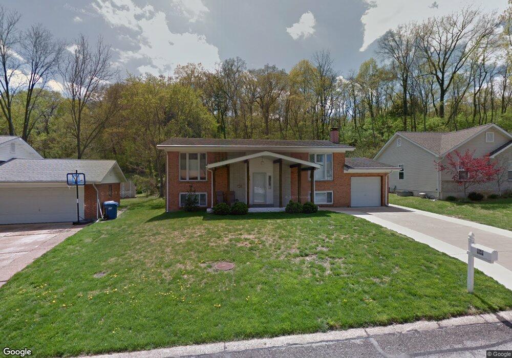
1247 Hawksbury Dr Arnold, MO 63010
Estimated Value: $203,063 - $241,000
Studio
--
Bath
960
Sq Ft
$236/Sq Ft
Est. Value
About This Home
This home is located at 1247 Hawksbury Dr, Arnold, MO 63010 and is currently estimated at $226,266, approximately $235 per square foot. 1247 Hawksbury Dr is a home located in Jefferson County with nearby schools including Rockport Heights Elementary School, Fox Middle School, and Fox Senior High School.
Ownership History
Date
Name
Owned For
Owner Type
Purchase Details
Closed on
Apr 30, 2015
Sold by
Hahn John L and Hahn Kimberly L
Bought by
White Keith L and White Dianna L
Current Estimated Value
Home Financials for this Owner
Home Financials are based on the most recent Mortgage that was taken out on this home.
Original Mortgage
$128,627
Outstanding Balance
$98,586
Interest Rate
3.62%
Mortgage Type
FHA
Estimated Equity
$127,680
Purchase Details
Closed on
Jun 7, 2011
Sold by
Hahn John L and Hahn Kimberly L
Bought by
Hahn John L and Hahn Kimberly L
Purchase Details
Closed on
Mar 6, 2008
Sold by
Johnson Clifton L and Johnson Margaret C
Bought by
Hahn John L and Hahn Kimberly L
Home Financials for this Owner
Home Financials are based on the most recent Mortgage that was taken out on this home.
Original Mortgage
$113,600
Interest Rate
5.72%
Mortgage Type
Purchase Money Mortgage
Create a Home Valuation Report for This Property
The Home Valuation Report is an in-depth analysis detailing your home's value as well as a comparison with similar homes in the area
Home Values in the Area
Average Home Value in this Area
Purchase History
| Date | Buyer | Sale Price | Title Company |
|---|---|---|---|
| White Keith L | -- | None Available | |
| Hahn John L | -- | None Available | |
| Hahn John L | -- | American Land Title |
Source: Public Records
Mortgage History
| Date | Status | Borrower | Loan Amount |
|---|---|---|---|
| Open | White Keith L | $128,627 | |
| Previous Owner | Hahn John L | $113,600 |
Source: Public Records
Tax History
| Year | Tax Paid | Tax Assessment Tax Assessment Total Assessment is a certain percentage of the fair market value that is determined by local assessors to be the total taxable value of land and additions on the property. | Land | Improvement |
|---|---|---|---|---|
| 2025 | $1,518 | $23,500 | $2,700 | $20,800 |
| 2024 | $1,518 | $21,700 | $2,700 | $19,000 |
| 2023 | $1,518 | $21,700 | $2,700 | $19,000 |
| 2022 | $1,547 | $21,700 | $2,700 | $19,000 |
| 2021 | $1,548 | $21,700 | $2,700 | $19,000 |
| 2020 | $1,421 | $18,900 | $2,300 | $16,600 |
| 2019 | $1,425 | $18,900 | $2,300 | $16,600 |
| 2018 | $1,416 | $18,900 | $2,300 | $16,600 |
| 2017 | $1,437 | $18,900 | $2,300 | $16,600 |
| 2016 | $1,220 | $17,200 | $2,500 | $14,700 |
| 2015 | $1,223 | $17,200 | $2,500 | $14,700 |
| 2013 | -- | $16,800 | $2,500 | $14,300 |
Source: Public Records
Map
Nearby Homes
- 3335 Boca Raton Dr
- 3018 Nelson Dr
- Lot 2 Baeumners Second Subdivision
- 170 Bogey Blvd
- 3941 Orchard Dr
- 1951 Fox Pointe Dr
- 1427 Appleton Ct
- 7600 Fine Rd
- 2929 Tenbrook Rd
- 0 Unknown Unit 22001740
- 0 Unknown Unit 22071117
- 0 Unknown Unit 22001730
- 0 Unknown Unit 21017758
- 4344 Iron Mountain Bluff
- 3550 Saint Martin Dr
- 1611 Hobelman Dr
- 324 Bramtonn Place
- 2721 Rose Dr
- 1258 Arnold Tenbrook Rd
- 1981 Saint Johns Crossing
- 1251 Hawksbury Dr
- 1243 Hawksbury Dr
- 1250 Hawksbury Dr
- 1240 Hawksbury Dr
- 1239 Hawksbury Dr
- 3318 Biscayne Blvd
- 3272 Biscayne Blvd
- 3309 Biscayne Blvd
- 3313 Biscayne Blvd
- 3305 Biscayne Blvd
- 3322 Biscayne Blvd
- 3268 Biscayne Blvd
- 2 Hawksbury Ct
- 3275 Biscayne Blvd
- 3321 Biscayne Blvd
- 1232 Hawksbury Dr
- 3326 Biscayne Blvd
- 3325 Biscayne Blvd
- 3264 Biscayne Blvd
- 3284 Telegraph Rd
Your Personal Tour Guide
Ask me questions while you tour the home.