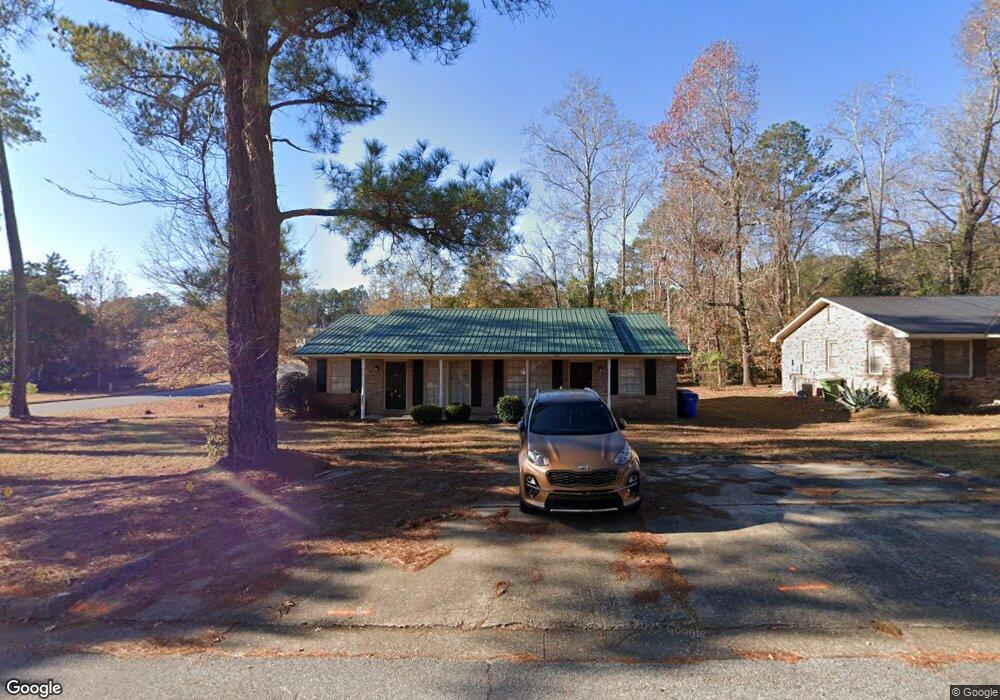
1247 Kings Mountain Ct Columbus, GA 31907
South Columbus NeighborhoodEstimated Value: $128,000 - $181,000
4
Beds
3
Baths
1,750
Sq Ft
$88/Sq Ft
Est. Value
About This Home
This home is located at 1247 Kings Mountain Ct, Columbus, GA 31907 and is currently estimated at $154,368, approximately $88 per square foot. 1247 Kings Mountain Ct is a home located in Muscogee County with nearby schools including East Columbus Magnet Academy, Spencer High School, and Pinehurst Christian School.
Ownership History
Date
Name
Owned For
Owner Type
Purchase Details
Closed on
Oct 31, 2013
Sold by
Mclaurin John W
Bought by
Cannon Stephen B
Current Estimated Value
Home Financials for this Owner
Home Financials are based on the most recent Mortgage that was taken out on this home.
Original Mortgage
$61,200
Interest Rate
4.23%
Mortgage Type
New Conventional
Purchase Details
Closed on
Apr 16, 2012
Sold by
Mclaurin John W
Bought by
Mclaurin John W
Create a Home Valuation Report for This Property
The Home Valuation Report is an in-depth analysis detailing your home's value as well as a comparison with similar homes in the area
Home Values in the Area
Average Home Value in this Area
Purchase History
| Date | Buyer | Sale Price | Title Company |
|---|---|---|---|
| Cannon Stephen B | $68,000 | -- | |
| Mclaurin John W | -- | -- |
Source: Public Records
Mortgage History
| Date | Status | Borrower | Loan Amount |
|---|---|---|---|
| Closed | Cannon Stephen B | $61,200 |
Source: Public Records
Tax History
| Year | Tax Paid | Tax Assessment Tax Assessment Total Assessment is a certain percentage of the fair market value that is determined by local assessors to be the total taxable value of land and additions on the property. | Land | Improvement |
|---|---|---|---|---|
| 2025 | $2,330 | $59,516 | $15,140 | $44,376 |
| 2024 | $1,960 | $50,080 | $15,140 | $34,940 |
| 2023 | $1,559 | $50,080 | $15,140 | $34,940 |
| 2022 | $1,616 | $39,588 | $15,140 | $24,448 |
| 2021 | $1,404 | $34,380 | $15,140 | $19,240 |
| 2020 | $1,404 | $34,380 | $15,140 | $19,240 |
| 2019 | $1,385 | $39,776 | $15,140 | $24,636 |
| 2018 | $1,630 | $39,776 | $15,140 | $24,636 |
| 2017 | $1,635 | $39,776 | $15,140 | $24,636 |
| 2016 | $1,122 | $27,200 | $6,168 | $21,032 |
| 2015 | $1,123 | $27,200 | $6,168 | $21,032 |
| 2014 | $1,125 | $27,200 | $6,168 | $21,032 |
| 2013 | -- | $29,188 | $6,168 | $23,020 |
Source: Public Records
Map
Nearby Homes
- 5452 Gettysburg Way
- 5310 Stoney Point Rd
- 5616 Monmouth Dr
- 1238 Brandywine Dr
- 1513 Alamo Dr
- 5644 Quebec Dr
- 1340 Bunker Ridge Ln
- 5336 Gettysburg Way
- 5728 Lexington Dr
- 1104 Antietam Ct
- 1106 Antietam Ct
- 1108 Antietam Ct
- 5185 Freedom Ridge Ct
- 1120 Antietam Ct
- 1123 Antietam Ct
- 4525 Village Ct
- 5325 Roundabout Dr
- 1406 Antietam Dr
- 849 Bunker Hill Rd
- 4939 Aaron Dr
- 1241 Kings Mount Unit A
- 1241 Kings Mountain Ct
- 1335 Kings Mountain Rd
- 1235 Kings Mountain Ct
- 1235 Kings Mountain Ct Unit A
- 5507 Gettysburg Way
- 1326 Kings Mountain Rd
- 1318 Kings Mountain Rd
- 1246 Kings Mountain Ct
- 1334 Kings Mountain Rd
- 1238 Kings Mountain Ct
- 5501 Gettysburg Way
- 1310 Kings Mountain Rd
- 1229 Kings Mountain Ct
- 5473 Gettysburg Way
- 1342 Kings Mountain Rd
- 1307 Kings Mountain Rd
- 1230 Kings Mountain Ct
- 1307 Kings Mountain Rd
- 5465 Gettysburg Way
Your Personal Tour Guide
Ask me questions while you tour the home.