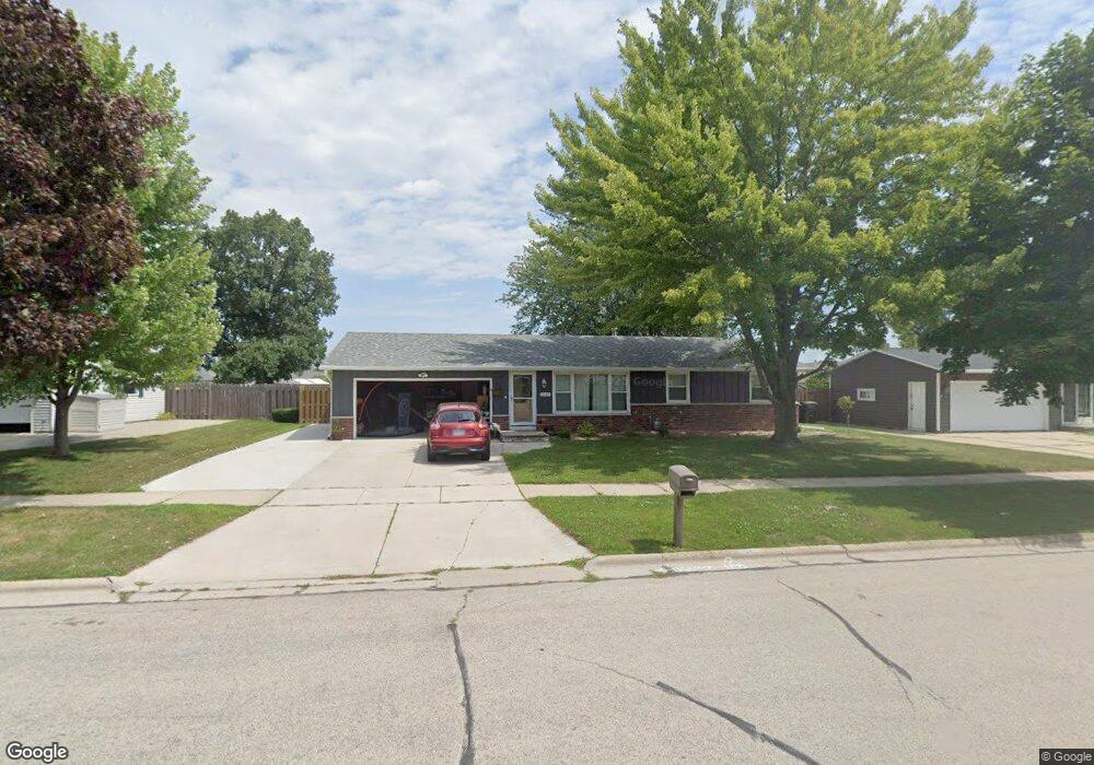
1247 Robin St de Pere, WI 54115
Estimated Value: $282,000 - $321,000
4
Beds
2
Baths
1,192
Sq Ft
$256/Sq Ft
Est. Value
About This Home
This home is located at 1247 Robin St, de Pere, WI 54115 and is currently estimated at $304,609, approximately $255 per square foot. 1247 Robin St is a home located in Brown County with nearby schools including Heritage Elementary School, Foxview Intermediate School, and De Pere Middle School.
Ownership History
Date
Name
Owned For
Owner Type
Purchase Details
Closed on
Dec 9, 2005
Sold by
Cherney Barry T
Bought by
Cherney Barry T and Cherney Sherry L
Current Estimated Value
Purchase Details
Closed on
Jul 29, 2005
Sold by
Brennan Mary E
Bought by
Cherney Barry T
Home Financials for this Owner
Home Financials are based on the most recent Mortgage that was taken out on this home.
Original Mortgage
$147,606
Outstanding Balance
$75,824
Interest Rate
5.71%
Mortgage Type
VA
Estimated Equity
$228,785
Create a Home Valuation Report for This Property
The Home Valuation Report is an in-depth analysis detailing your home's value as well as a comparison with similar homes in the area
Home Values in the Area
Average Home Value in this Area
Purchase History
| Date | Buyer | Sale Price | Title Company |
|---|---|---|---|
| Cherney Barry T | -- | Bay Title & Abstract | |
| Cherney Barry T | $144,500 | Bay Title & Abstract Inc |
Source: Public Records
Mortgage History
| Date | Status | Borrower | Loan Amount |
|---|---|---|---|
| Open | Cherney Barry T | $147,606 |
Source: Public Records
Tax History
| Year | Tax Paid | Tax Assessment Tax Assessment Total Assessment is a certain percentage of the fair market value that is determined by local assessors to be the total taxable value of land and additions on the property. | Land | Improvement |
|---|---|---|---|---|
| 2024 | $3,569 | $254,700 | $29,300 | $225,400 |
| 2023 | $3,300 | $245,200 | $29,300 | $215,900 |
| 2022 | $3,009 | $212,200 | $29,300 | $182,900 |
| 2021 | $2,852 | $190,600 | $24,400 | $166,200 |
| 2020 | $2,559 | $156,100 | $24,400 | $131,700 |
| 2019 | $2,569 | $145,100 | $24,400 | $120,700 |
| 2018 | $2,606 | $134,200 | $24,400 | $109,800 |
| 2017 | $2,616 | $119,200 | $24,400 | $94,800 |
| 2016 | $2,416 | $119,200 | $24,400 | $94,800 |
| 2015 | $2,508 | $116,000 | $24,500 | $91,500 |
| 2014 | $2,429 | $116,000 | $24,500 | $91,500 |
| 2013 | $2,429 | $116,000 | $24,500 | $91,500 |
Source: Public Records
Map
Nearby Homes
- 0 S Broadway St
- 1871 Ledgeview Rd
- 1658 Remington Ridge Way Unit 1658
- 826 Virginia Dr
- 1653 Remington Ridge Way Unit 1653
- 801 S Erie St
- 1853 Swan Rd
- 1724 Remington Ridge Way Unit 1724
- 1941 Horseshoe Ln
- 2087 Swanstone Cir
- 1861 Chicago St
- 318 S Webster Ave
- 1764 Other
- 1764 O'Hearn Ln
- 2080 Greenleaf Rd
- 821 Killarny Trail Unit 1
- 1217 Charles St
- 1109 S 6th St
- 119 S Ontario St
- 2167 Trailside Ln Unit 14
- 1257 Robin St
- 1245 Robin St
- 1415 O Keefe Rd Unit 1417
- 1414 Mission Heights Rd Unit 1416
- 1248 Robin St
- 1258 Robin St
- 1237 Robin St
- 1421 O Keefe Rd Unit 1423
- 1242 Robin St
- 1420 Mission Heights Rd
- 1238 Robin St
- 1414 O Keefe Rd Unit 1416
- 1404 O Keefe Rd Unit 1406
- 1418 O Keefe Rd
- 1245 O Keefe Ct
- 1427 O Keefe Rd Unit 1429
- 1255 O Keefe Ct Unit 1325
- 1237 O Keefe Ct
- 1234 Robin St
- 1394 O Keefe Rd Unit 1396