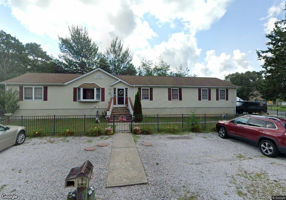
1247 Taylor Ln Forked River, NJ 08731
Estimated Value: $459,000 - $553,000
3
Beds
3
Baths
3,696
Sq Ft
$142/Sq Ft
Est. Value
About This Home
This home is located at 1247 Taylor Ln, Forked River, NJ 08731 and is currently estimated at $524,963, approximately $142 per square foot. 1247 Taylor Ln is a home located in Ocean County with nearby schools including Lacey Township High School.
Ownership History
Date
Name
Owned For
Owner Type
Purchase Details
Closed on
Aug 23, 2005
Sold by
Carson Albert Edward and Carson Denise
Bought by
Tufano Michael and Tufano Joanne
Current Estimated Value
Home Financials for this Owner
Home Financials are based on the most recent Mortgage that was taken out on this home.
Original Mortgage
$115,000
Outstanding Balance
$79,107
Interest Rate
10.99%
Mortgage Type
Fannie Mae Freddie Mac
Estimated Equity
$445,856
Purchase Details
Closed on
Oct 14, 1994
Sold by
Hydera Dorothy
Bought by
Carson Albert and Wade Denise
Home Financials for this Owner
Home Financials are based on the most recent Mortgage that was taken out on this home.
Original Mortgage
$14,000
Interest Rate
8.65%
Create a Home Valuation Report for This Property
The Home Valuation Report is an in-depth analysis detailing your home's value as well as a comparison with similar homes in the area
Home Values in the Area
Average Home Value in this Area
Purchase History
| Date | Buyer | Sale Price | Title Company |
|---|---|---|---|
| Tufano Michael | $330,000 | Chicago Title Insurance Co | |
| Carson Albert | $28,000 | -- |
Source: Public Records
Mortgage History
| Date | Status | Borrower | Loan Amount |
|---|---|---|---|
| Open | Tufano Michael | $115,000 | |
| Previous Owner | Carson Albert | $14,000 |
Source: Public Records
Tax History
| Year | Tax Paid | Tax Assessment Tax Assessment Total Assessment is a certain percentage of the fair market value that is determined by local assessors to be the total taxable value of land and additions on the property. | Land | Improvement |
|---|---|---|---|---|
| 2025 | $7,265 | $286,700 | $89,500 | $197,200 |
| 2024 | $6,792 | $286,700 | $89,500 | $197,200 |
| 2023 | $6,488 | $286,700 | $89,500 | $197,200 |
| 2022 | $6,488 | $286,700 | $89,500 | $197,200 |
| 2021 | $6,379 | $286,700 | $89,500 | $197,200 |
| 2020 | $6,176 | $286,700 | $89,500 | $197,200 |
| 2019 | $6,067 | $286,700 | $89,500 | $197,200 |
| 2018 | $5,995 | $286,700 | $89,500 | $197,200 |
| 2017 | $5,857 | $286,700 | $89,500 | $197,200 |
| 2016 | $5,834 | $286,700 | $89,500 | $197,200 |
| 2015 | $5,573 | $286,700 | $89,500 | $197,200 |
| 2014 | $6,025 | $350,300 | $129,500 | $220,800 |
Source: Public Records
Map
Nearby Homes
- 1303 Cypress St
- 1216 Taylor Ln
- 22 Saltspray Dr
- 102 Maria Loretta Ln
- 1223 Sylvania Place
- 9 Hollywood Blvd S
- 0 Lakeside Dr S Unit 22601319
- 463 Ensign Rd
- 123 Oakwood Place
- 0 Nautical Dr
- 417 Riverview Rd
- 69 Saltspray Dr
- 75 Saltspray Dr
- 79 Saltspray Dr
- 1326 Leguene Ave
- 404 Beach Blvd
- 217 Nantucket Rd
- 10 Dolphin Ct
- 72 Saltspray Dr
- 1440 Leguene Ave
- 1246 Taylor Ln
- 1243 Taylor Ln
- 1242 Taylor Ln
- 12 Taylor Ln
- 12A Taylor Ln
- 201 Cedar Lake Point
- 1203 Tamarack Rd
- 1200 Cypress Place
- 1203 Kennebec Rd
- 1207 Tamarack Rd
- 202 Cedar Lake Point
- 1202 Kennebec Rd
- 1241 Taylor Ln
- 1238 Taylor Ln
- 10 Taylor Ln
- 1207 Kennebec Rd
- 203 Cedar Lake Point
- 1212 Tamarack Rd
- 213 Cedar Lake Point
- 1206 Kennebec Rd
Your Personal Tour Guide
Ask me questions while you tour the home.