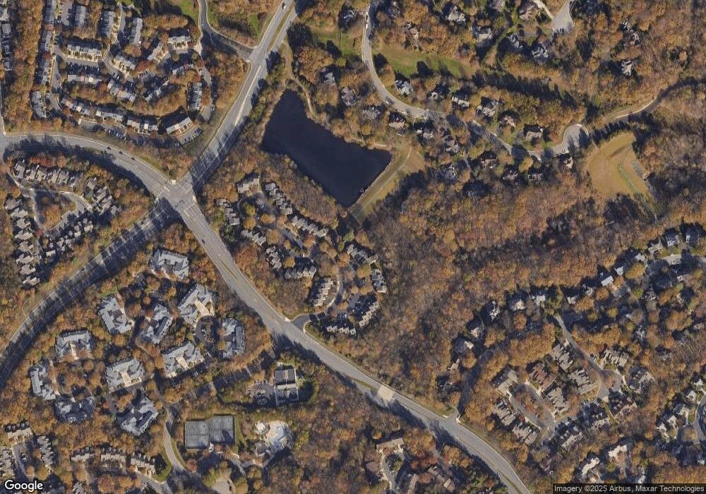
1247 Weatherstone Ct Reston, VA 20194
Tall Oaks/Uplands NeighborhoodEstimated Value: $746,230 - $774,000
3
Beds
4
Baths
1,660
Sq Ft
$458/Sq Ft
Est. Value
About This Home
This home is located at 1247 Weatherstone Ct, Reston, VA 20194 and is currently estimated at $760,115, approximately $457 per square foot. 1247 Weatherstone Ct is a home located in Fairfax County with nearby schools including Aldrin Elementary, Herndon Middle School, and Herndon High School.
Ownership History
Date
Name
Owned For
Owner Type
Purchase Details
Closed on
Jan 7, 2023
Sold by
Finn Peter J and Pien-Finn Lynn G
Bought by
Finn Peter J and Pien-Finn Lynn G
Current Estimated Value
Purchase Details
Closed on
Aug 14, 1995
Sold by
Van Metre Residential Cnst Lp
Bought by
Finn Peter J
Home Financials for this Owner
Home Financials are based on the most recent Mortgage that was taken out on this home.
Original Mortgage
$222,600
Interest Rate
7.48%
Create a Home Valuation Report for This Property
The Home Valuation Report is an in-depth analysis detailing your home's value as well as a comparison with similar homes in the area
Home Values in the Area
Average Home Value in this Area
Purchase History
| Date | Buyer | Sale Price | Title Company |
|---|---|---|---|
| Finn Peter J | -- | None Listed On Document | |
| Finn Peter J | $234,811 | -- |
Source: Public Records
Mortgage History
| Date | Status | Borrower | Loan Amount |
|---|---|---|---|
| Previous Owner | Finn Peter J | $222,600 |
Source: Public Records
Tax History Compared to Growth
Tax History
| Year | Tax Paid | Tax Assessment Tax Assessment Total Assessment is a certain percentage of the fair market value that is determined by local assessors to be the total taxable value of land and additions on the property. | Land | Improvement |
|---|---|---|---|---|
| 2025 | $8,197 | $726,400 | $235,000 | $491,400 |
| 2024 | $8,197 | $679,940 | $215,000 | $464,940 |
| 2023 | $7,653 | $651,020 | $205,000 | $446,020 |
| 2022 | $6,839 | $574,430 | $175,000 | $399,430 |
| 2021 | $6,362 | $521,290 | $150,000 | $371,290 |
| 2020 | $6,281 | $510,480 | $150,000 | $360,480 |
| 2019 | $6,246 | $507,600 | $150,000 | $357,600 |
| 2018 | $5,732 | $498,440 | $145,000 | $353,440 |
| 2017 | $6,021 | $498,440 | $145,000 | $353,440 |
| 2016 | $6,272 | $520,300 | $145,000 | $375,300 |
| 2015 | $6,008 | $516,580 | $145,000 | $371,580 |
| 2014 | $5,829 | $502,290 | $145,000 | $357,290 |
Source: Public Records
Map
Nearby Homes
- 1361 Garden Wall Cir Unit 701
- 11408 Gate Hill Place Unit 113
- 1334 Garden Wall Cir Unit C
- 1307 Windleaf Dr Unit 139
- 1350 Red Hawk Cir
- 1281 Wedgewood Manor Way
- 1303 Wedgewood Manor Way
- 1247 Lamplighter Way
- 1316 Park Garden Ln
- 11603 Auburn Grove Ct
- 11181 Longwood Grove Dr
- 11504 Turnbridge Ln
- 1403 Church Hill Place
- 1435 Church Hill Place Unit 1435
- 1534 Church Hill Place
- 1532 Church Hill Place
- 11752 Great Owl Cir
- 11665 Gilman Ln
- 11733 Summerchase Cir Unit 1733C
- 11709 Summerchase Cir Unit D
- 1249 Weatherstone Ct
- 1251 Weatherstone Ct
- 1253 Weatherstone Ct
- 1255 Weatherstone Ct
- 1235 Weatherstone Ct
- 1257 Weatherstone Ct
- 1256 Weatherstone Ct
- 1233 Weatherstone Ct
- 1259 Weatherstone Ct
- 1246 Weatherstone Ct
- 1258 Weatherstone Ct
- 1231 Weatherstone Ct
- 1261 Weatherstone Ct
- 1260 Weatherstone Ct
- 1263 Weatherstone Ct
- 1229 Weatherstone Ct
- 1262 Weatherstone Ct
- 1227 Weatherstone Ct
- 1240 Weatherstone Ct
- 1265 Weatherstone Ct
