Estimated Value: $168,481 - $267,000
--
Bed
--
Bath
--
Sq Ft
9,801
Sq Ft Lot
About This Home
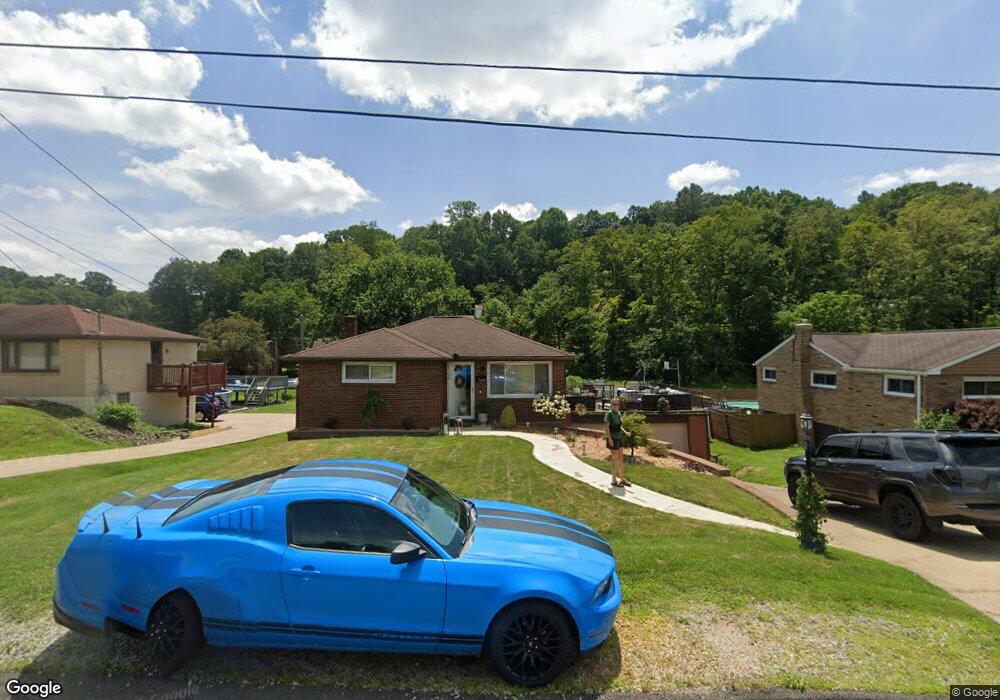
This home is located at 12470 Adams Dr, Irwin, PA 15642 and is currently estimated at $215,620. 12470 Adams Dr is a home located in Westmoreland County with nearby schools including Sunset Valley El School, Hillcrest Intermediate School, and Norwin Middle School.
Ownership History
Date
Name
Owned For
Owner Type
Purchase Details
Closed on
Sep 13, 2021
Sold by
Balog Rhonda K and Balog Edward J
Bought by
Balog Brittney
Current Estimated Value
Home Financials for this Owner
Home Financials are based on the most recent Mortgage that was taken out on this home.
Original Mortgage
$128,250
Outstanding Balance
$116,524
Interest Rate
2.7%
Mortgage Type
New Conventional
Estimated Equity
$99,096
Purchase Details
Closed on
Sep 19, 2003
Sold by
Campbell Deborah L and Campbell Charles A
Bought by
Brosenko Rhonda K
Home Financials for this Owner
Home Financials are based on the most recent Mortgage that was taken out on this home.
Original Mortgage
$93,263
Interest Rate
6.31%
Mortgage Type
FHA
Purchase Details
Closed on
Oct 12, 1998
Sold by
Hambright Deborah L and Hambright Roger T
Bought by
Hambright Deborah L
Create a Home Valuation Report for This Property
The Home Valuation Report is an in-depth analysis detailing your home's value as well as a comparison with similar homes in the area
Home Values in the Area
Average Home Value in this Area
Purchase History
| Date | Buyer | Sale Price | Title Company |
|---|---|---|---|
| Balog Brittney | $135,000 | None Available | |
| Brosenko Rhonda K | $94,000 | -- | |
| Hambright Deborah L | -- | -- |
Source: Public Records
Mortgage History
| Date | Status | Borrower | Loan Amount |
|---|---|---|---|
| Open | Balog Brittney | $128,250 | |
| Previous Owner | Brosenko Rhonda K | $93,263 |
Source: Public Records
Tax History Compared to Growth
Tax History
| Year | Tax Paid | Tax Assessment Tax Assessment Total Assessment is a certain percentage of the fair market value that is determined by local assessors to be the total taxable value of land and additions on the property. | Land | Improvement |
|---|---|---|---|---|
| 2025 | $2,386 | $18,120 | $4,160 | $13,960 |
| 2024 | $2,280 | $18,120 | $4,160 | $13,960 |
| 2023 | $2,153 | $18,120 | $4,160 | $13,960 |
| 2022 | $2,135 | $18,120 | $4,160 | $13,960 |
| 2021 | $2,135 | $18,120 | $4,160 | $13,960 |
| 2020 | $2,092 | $18,120 | $4,160 | $13,960 |
| 2019 | $2,039 | $18,120 | $4,160 | $13,960 |
| 2018 | $1,996 | $18,120 | $4,160 | $13,960 |
| 2017 | $1,952 | $18,120 | $4,160 | $13,960 |
| 2016 | $1,875 | $18,120 | $4,160 | $13,960 |
| 2015 | $1,875 | $18,120 | $4,160 | $13,960 |
| 2014 | $1,842 | $18,120 | $4,160 | $13,960 |
Source: Public Records
Map
Nearby Homes
- 12490 Adams Dr
- 12429 Adams Dr
- 12509 Herold Dr
- 12329 Herold Dr
- 1201 Robbins Station Rd
- 12360 Church Dr
- 12220 Herold Dr
- 12480 Saint Nikolai Dr
- 12440 Saint Nikolai Dr
- 12729 Deborah Dr
- 12106 Center St
- 1754 Haflinger Dr
- 0 Ridge Rd
- 2171 Robbins Station Rd
- 260 Jennie Dr
- Parcel 3R Frank Wood Ridge Rd
- 1621 Windsor Rd
- 3088 Derby Ct
- 13700 Harriet Dr
- 3079 Warwick Dr