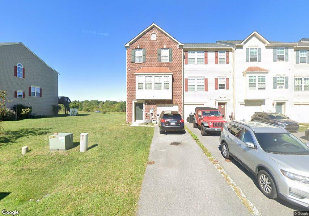
12479 Jackson Ave Waynesboro, PA 17268
Estimated Value: $208,506 - $275,000
3
Beds
3
Baths
1,786
Sq Ft
$142/Sq Ft
Est. Value
About This Home
This home is located at 12479 Jackson Ave, Waynesboro, PA 17268 and is currently estimated at $254,127, approximately $142 per square foot. 12479 Jackson Ave is a home located in Franklin County with nearby schools including Waynesboro Area Senior High School, Noah's Ark Christian Child Care Center, and St. Andrew Catholic School.
Ownership History
Date
Name
Owned For
Owner Type
Purchase Details
Closed on
Sep 29, 2010
Sold by
Nvr Inc
Bought by
Sawicki Troy
Current Estimated Value
Home Financials for this Owner
Home Financials are based on the most recent Mortgage that was taken out on this home.
Original Mortgage
$117,550
Outstanding Balance
$77,610
Interest Rate
4.36%
Mortgage Type
New Conventional
Estimated Equity
$176,517
Create a Home Valuation Report for This Property
The Home Valuation Report is an in-depth analysis detailing your home's value as well as a comparison with similar homes in the area
Home Values in the Area
Average Home Value in this Area
Purchase History
| Date | Buyer | Sale Price | Title Company |
|---|---|---|---|
| Sawicki Troy | $146,990 | None Available |
Source: Public Records
Mortgage History
| Date | Status | Borrower | Loan Amount |
|---|---|---|---|
| Open | Sawicki Troy | $117,550 |
Source: Public Records
Tax History
| Year | Tax Paid | Tax Assessment Tax Assessment Total Assessment is a certain percentage of the fair market value that is determined by local assessors to be the total taxable value of land and additions on the property. | Land | Improvement |
|---|---|---|---|---|
| 2025 | $3,492 | $22,730 | $1,760 | $20,970 |
| 2024 | $3,389 | $22,730 | $1,760 | $20,970 |
| 2023 | $3,289 | $22,730 | $1,760 | $20,970 |
| 2022 | $3,192 | $22,730 | $1,760 | $20,970 |
| 2021 | $3,101 | $22,730 | $1,760 | $20,970 |
| 2020 | $3,053 | $22,730 | $1,760 | $20,970 |
| 2019 | $2,985 | $22,730 | $1,760 | $20,970 |
| 2018 | $2,888 | $22,730 | $1,760 | $20,970 |
| 2017 | $2,826 | $22,730 | $1,760 | $20,970 |
| 2016 | $651 | $22,730 | $1,760 | $20,970 |
| 2015 | $607 | $22,730 | $1,760 | $20,970 |
| 2014 | $607 | $22,730 | $1,760 | $20,970 |
Source: Public Records
Map
Nearby Homes
- 11439 Viking Ave
- 10059 Pendleton Ave
- 12398 Shelby Ave
- 9383 Oyer Dr
- 9319 Meadowbrook Dr
- 10851 Sierra Dr
- 10842 Sierra Dr
- 13345 Old Mill Rd
- 13295 Iroquois Trail
- 10673 Susquehanna Ave Unit 64
- 11802 Mystic Rock Ln S
- 11798 Mystic Rock Ln S
- 11816 Mystic Rock Ln S
- 11820 Mystic Rock Ln S
- 11823 Mystic Rock Ln S
- 11819 Mystic Rock Ln S
- 11797 Mystic Rock Ln S
- 11845 Mystic Rock Ln S
- 13405 Meadowview Ave
- 13189 Seneca Dr
- 12477 Jackson Ave
- 12483 Jackson Ave
- 12475 Jackson Ave
- 12473 Jackson Ave
- 12422 Jackson Ave
- 12424 Jackson Ave
- 12430 Jackson Ave Unit 20
- 12485 Jackson Ave
- 12441 Jackson Ave
- 12439 Jackson Ave
- 12437 Jackson Ave
- 12435 Jackson Ave
- 12429 Jackson Ave Unit 14
- 12427 Jackson Ave Unit 15
- 12459 Jackson Ave Unit 5
- 12461 Jackson Ave Unit 4
- 12463 Jackson Ave Unit 3
- 12471 Jackson Ave
- 12487 Jackson Ave
- 12489 Jackson Ave