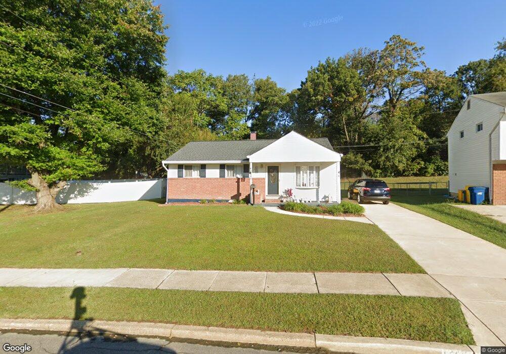
1248 Aster Dr Glen Burnie, MD 21061
Estimated Value: $362,000 - $422,000
--
Bed
1
Bath
972
Sq Ft
$397/Sq Ft
Est. Value
About This Home
This home is located at 1248 Aster Dr, Glen Burnie, MD 21061 and is currently estimated at $385,881, approximately $396 per square foot. 1248 Aster Dr is a home located in Anne Arundel County with nearby schools including George T. Cromwell Elementary School, Lindale Middle School, and North County High School.
Ownership History
Date
Name
Owned For
Owner Type
Purchase Details
Closed on
Sep 28, 1998
Sold by
Perdue Robert A
Bought by
Coulling Robert W and Coulling Mary M
Current Estimated Value
Purchase Details
Closed on
Oct 5, 1994
Sold by
Magrowsky Stephen
Bought by
Perdue Robert A
Home Financials for this Owner
Home Financials are based on the most recent Mortgage that was taken out on this home.
Original Mortgage
$111,900
Interest Rate
8.55%
Create a Home Valuation Report for This Property
The Home Valuation Report is an in-depth analysis detailing your home's value as well as a comparison with similar homes in the area
Home Values in the Area
Average Home Value in this Area
Purchase History
| Date | Buyer | Sale Price | Title Company |
|---|---|---|---|
| Coulling Robert W | $122,580 | -- | |
| Perdue Robert A | $112,000 | -- |
Source: Public Records
Mortgage History
| Date | Status | Borrower | Loan Amount |
|---|---|---|---|
| Previous Owner | Perdue Robert A | $111,900 | |
| Closed | Coulling Robert W | -- |
Source: Public Records
Tax History Compared to Growth
Tax History
| Year | Tax Paid | Tax Assessment Tax Assessment Total Assessment is a certain percentage of the fair market value that is determined by local assessors to be the total taxable value of land and additions on the property. | Land | Improvement |
|---|---|---|---|---|
| 2025 | $2,557 | $288,300 | $161,000 | $127,300 |
| 2024 | $2,557 | $273,700 | $0 | $0 |
| 2023 | $1,999 | $259,100 | $0 | $0 |
| 2022 | $2,299 | $244,500 | $128,500 | $116,000 |
| 2021 | $4,511 | $233,767 | $0 | $0 |
| 2020 | $2,171 | $223,033 | $0 | $0 |
| 2019 | $2,131 | $212,300 | $94,900 | $117,400 |
| 2018 | $2,153 | $212,300 | $94,900 | $117,400 |
| 2017 | $2,025 | $212,300 | $0 | $0 |
| 2016 | -- | $218,300 | $0 | $0 |
| 2015 | -- | $215,300 | $0 | $0 |
| 2014 | -- | $212,300 | $0 | $0 |
Source: Public Records
Map
Nearby Homes
- 1203 Branch Ln
- 1402 Rowe Dr
- 28 W Furnace Branch Rd
- 302 Wellham Ct
- 104 Wellham Ave NW
- 307 Shipley Ave
- 1509 Baby Baer Ct
- 7103 Avesbury Ln
- 413 Glenwood Ave
- 898 Brighton Place
- 406 Burwood Ave
- 114 Olen Dr
- 202 Juneberry Way Unit 2C
- 607 Wellham Ave
- 933 Andrews Rd
- 0 Ritchie Hwy
- 6401 Grafton Garth Ct
- 405 Melrose Ave
- 6800 White Water Way Unit 203
- 6803 White Water Way Unit 201