Estimated Value: $176,542 - $191,000
3
Beds
1
Bath
1,244
Sq Ft
$148/Sq Ft
Est. Value
About This Home
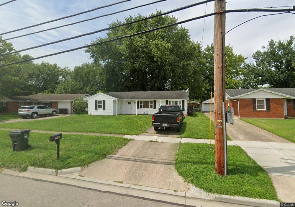
This home is located at 1248 Bellbrook Ave, Xenia, OH 45385 and is currently estimated at $184,386, approximately $148 per square foot. 1248 Bellbrook Ave is a home located in Greene County with nearby schools including Xenia High School, Summit Academy Community School for Alternative Learners - Xenia, and Legacy Christian Academy.
Ownership History
Date
Name
Owned For
Owner Type
Purchase Details
Closed on
Aug 5, 2025
Sold by
Fraley Kim S and Fraley Michael J
Bought by
Kimtym Llc
Current Estimated Value
Purchase Details
Closed on
May 29, 2025
Sold by
Slesinger-Fraley Kim and Mary Kay Slesinger Rich Revocable Trust
Bought by
Fraley Kim S
Purchase Details
Closed on
Dec 10, 2018
Sold by
Slesinger M Kay and Slesinger Kay
Bought by
Slesinger Rich Mary Kay and Mary Kay Slesinger Rich Revocable Trust
Purchase Details
Closed on
Oct 6, 2015
Sold by
Bank Of America
Bought by
Rich Mary Kay Slesinger
Purchase Details
Closed on
Sep 4, 2015
Sold by
Federal National Mortgage Association
Bought by
Bank Of America Na
Purchase Details
Closed on
Jul 23, 2015
Sold by
Brewer E Marlene and Brewer Ethel Marlene Kimbler
Bought by
Federal National Mortgage Association
Purchase Details
Closed on
Sep 4, 2009
Sold by
Estate Of Kenneth R Brewer
Bought by
Brewer E Marlene and Brewer Marlene Kimbler
Create a Home Valuation Report for This Property
The Home Valuation Report is an in-depth analysis detailing your home's value as well as a comparison with similar homes in the area
Home Values in the Area
Average Home Value in this Area
Purchase History
| Date | Buyer | Sale Price | Title Company |
|---|---|---|---|
| Kimtym Llc | -- | None Listed On Document | |
| Fraley Kim S | -- | None Listed On Document | |
| Slesinger Rich Mary Kay | -- | None Available | |
| Rich Mary Kay Slesinger | $34,500 | None Available | |
| Bank Of America Na | -- | Attorney | |
| Federal National Mortgage Association | $46,000 | Attorney | |
| Brewer E Marlene | -- | None Available |
Source: Public Records
Tax History Compared to Growth
Tax History
| Year | Tax Paid | Tax Assessment Tax Assessment Total Assessment is a certain percentage of the fair market value that is determined by local assessors to be the total taxable value of land and additions on the property. | Land | Improvement |
|---|---|---|---|---|
| 2024 | $1,892 | $44,210 | $12,160 | $32,050 |
| 2023 | $1,892 | $44,210 | $12,160 | $32,050 |
| 2022 | $1,558 | $31,050 | $7,150 | $23,900 |
| 2021 | $1,579 | $31,050 | $7,150 | $23,900 |
| 2020 | $1,513 | $31,050 | $7,150 | $23,900 |
| 2019 | $1,520 | $29,380 | $6,940 | $22,440 |
| 2018 | $1,526 | $29,380 | $6,940 | $22,440 |
| 2017 | $1,428 | $29,380 | $6,940 | $22,440 |
| 2016 | $1,428 | $26,980 | $6,940 | $20,040 |
| 2015 | -- | $26,980 | $6,940 | $20,040 |
| 2014 | $1,371 | $26,980 | $6,940 | $20,040 |
Source: Public Records
Map
Nearby Homes
- 1272 Bellbrook Ave
- 1208 Bellbrook Ave
- 1618 Navajo Dr
- 1708 Ottawa Dr
- 1881 Commonwealth Dr
- 1653 Seneca Dr
- 1454 Kylemore Dr
- 1342 Kylemore Dr
- 1568 Cheyenne Dr
- 1766 Gayhart Dr
- 1829 Gayhart Dr
- 646 Glady Ave
- 1908 Whitt St
- 1223 June Dr
- 1283 June Dr
- 1255 Colorado Dr
- 1391 June Dr
- 305-325 Bellbrook Ave
- 530 Cincinnati Ave
- 1861 Iowa Dr
- 1234 Bellbrook Ave
- 1260 Bellbrook Ave
- 1222 Bellbrook Ave
- 1055 Buckskin Trail
- 1041 Buckskin Trail
- 1067 Buckskin Trail
- 1029 Buckskin Trail
- 1286 Bellbrook Ave
- 1077 Buckskin Trail
- 1015 Buckskin Trail
- 1196 Bellbrook Ave
- 1298 Bellbrook Ave
- 1091 Buckskin Trail
- 991 Deerfield Ct
- 1060 Buckskin Trail
- 999 Buckskin Trail
- 1182 Bellbrook Ave
- 1046 Buckskin Trail
- 1253 Bellbrook Ave
- 985 Deerfield Ct