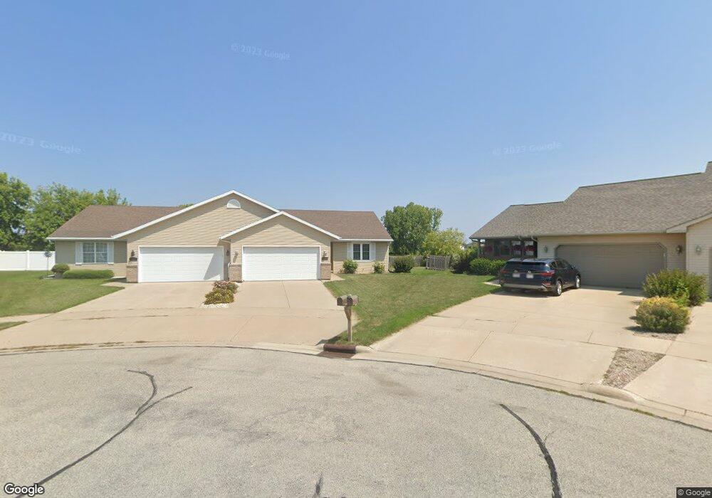
1248 Crown Ct Unit 1 de Pere, WI 54115
Estimated Value: $235,501 - $274,000
2
Beds
1
Bath
1,264
Sq Ft
$205/Sq Ft
Est. Value
About This Home
This home is located at 1248 Crown Ct Unit 1, de Pere, WI 54115 and is currently estimated at $258,875, approximately $204 per square foot. 1248 Crown Ct Unit 1 is a home located in Brown County with nearby schools including Westwood Elementary School, Cms Iacademy at Lincoln Jackson, and Desert Pride Academy.
Ownership History
Date
Name
Owned For
Owner Type
Purchase Details
Closed on
Aug 23, 2011
Sold by
Deterville Holly M
Bought by
Ropson Gerald L
Current Estimated Value
Home Financials for this Owner
Home Financials are based on the most recent Mortgage that was taken out on this home.
Original Mortgage
$73,000
Outstanding Balance
$50,568
Interest Rate
4.58%
Mortgage Type
New Conventional
Estimated Equity
$208,307
Create a Home Valuation Report for This Property
The Home Valuation Report is an in-depth analysis detailing your home's value as well as a comparison with similar homes in the area
Home Values in the Area
Average Home Value in this Area
Purchase History
| Date | Buyer | Sale Price | Title Company |
|---|---|---|---|
| Ropson Gerald L | $100,000 | Area Title Llc |
Source: Public Records
Mortgage History
| Date | Status | Borrower | Loan Amount |
|---|---|---|---|
| Open | Ropson Gerald L | $73,000 |
Source: Public Records
Tax History Compared to Growth
Tax History
| Year | Tax Paid | Tax Assessment Tax Assessment Total Assessment is a certain percentage of the fair market value that is determined by local assessors to be the total taxable value of land and additions on the property. | Land | Improvement |
|---|---|---|---|---|
| 2024 | $2,763 | $199,300 | $23,000 | $176,300 |
| 2023 | $2,454 | $173,800 | $23,000 | $150,800 |
| 2022 | $2,476 | $156,600 | $23,000 | $133,600 |
| 2021 | $2,218 | $130,500 | $19,200 | $111,300 |
| 2020 | $2,320 | $124,300 | $19,200 | $105,100 |
| 2019 | $2,103 | $115,100 | $19,200 | $95,900 |
| 2018 | $2,084 | $109,600 | $19,200 | $90,400 |
| 2017 | $1,928 | $97,900 | $19,200 | $78,700 |
| 2016 | $1,927 | $97,900 | $19,200 | $78,700 |
| 2015 | $2,101 | $97,900 | $19,200 | $78,700 |
| 2014 | $2,042 | $97,900 | $19,200 | $78,700 |
| 2013 | $2,042 | $97,900 | $19,200 | $78,700 |
Source: Public Records
Map
Nearby Homes
- 1264 Franco Ct Unit 1266
- 1276 S 9th St
- 1208 Meadow View Ln
- 1213 Danena Dr
- 1653 Crimson Ct
- 1002 Aldrin St
- 978 Saint Anthony Dr Unit 2
- 0 Scheuring Rd
- 1410 S 7th St
- 1509 S 7th St
- 1120 S 6th St
- 657 Reid St
- 634 Grant St
- 0 Main Ave
- 2045 Lost Dauphin Rd
- 806 4th St
- 3644 E Hank Ave
- 555 Main Ave Unit 110
- 555 Main Ave Unit 104
- 555 Main Ave Unit 111
- 1250 Crown Ct Unit 2
- 1255 Crown Ct Unit 1257
- 1254 Crown Ct Unit 1256
- 1248 Franco Ct Unit 1250
- 1263 Crown Ct Unit 1265
- 1260 Crown Ct Unit 1262
- 1240 N Franco Ct
- 1242 N Franco Ct Unit 2
- 1240 N Franco Ct Unit 1
- 1271 Crown Ct Unit 1273
- 1258 Franco Ct
- 1256 Franco Ct
- 1256 N Franco Ct
- 1266 Crown Ct Unit 1268
- 1266 N Crown Ct
- 1279 Crown Ct Unit 1281
- 1272 Franco Ct Unit 1274
- 1296 Crown Ct
- 1298 Crown Ct
- 1233 Franco Ct Unit 1235