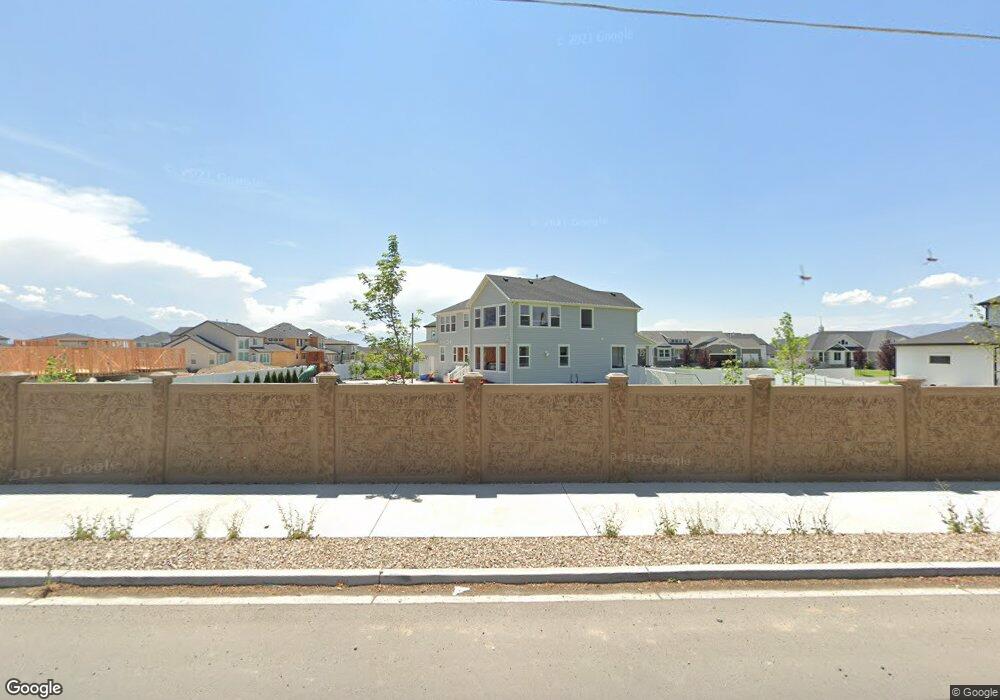
1248 E Candy Ln American Fork, UT 84003
Estimated Value: $1,680,000 - $1,938,000
6
Beds
5
Baths
5,774
Sq Ft
$312/Sq Ft
Est. Value
About This Home
This home is located at 1248 E Candy Ln, American Fork, UT 84003 and is currently estimated at $1,802,599, approximately $312 per square foot. 1248 E Candy Ln is a home located in Utah County with nearby schools including Deerfield Elementary School, Mountain Ridge Junior High School, and American Fork High School.
Ownership History
Date
Name
Owned For
Owner Type
Purchase Details
Closed on
Apr 22, 2022
Sold by
Brandon Nesbit
Bought by
Nesbit Brandon H and Nesbit Trisha
Current Estimated Value
Home Financials for this Owner
Home Financials are based on the most recent Mortgage that was taken out on this home.
Original Mortgage
$1,492,000
Outstanding Balance
$1,403,949
Interest Rate
4.42%
Mortgage Type
New Conventional
Estimated Equity
$398,650
Purchase Details
Closed on
Jan 25, 2021
Sold by
Sandberg Barbara H
Bought by
Blake Sandberg Sidney Merrill and Sandberg Barbara Jane
Home Financials for this Owner
Home Financials are based on the most recent Mortgage that was taken out on this home.
Original Mortgage
$65,000
Interest Rate
2.67%
Mortgage Type
Credit Line Revolving
Purchase Details
Closed on
Aug 13, 2019
Sold by
Jaster Rick C
Bought by
Jaster Rick C and Jaster Rebecca L
Home Financials for this Owner
Home Financials are based on the most recent Mortgage that was taken out on this home.
Original Mortgage
$839,166
Interest Rate
3.73%
Mortgage Type
New Conventional
Purchase Details
Closed on
Aug 12, 2019
Sold by
Cadence Homes Building Cor
Bought by
Jaster Rick C
Home Financials for this Owner
Home Financials are based on the most recent Mortgage that was taken out on this home.
Original Mortgage
$839,166
Interest Rate
3.73%
Mortgage Type
New Conventional
Create a Home Valuation Report for This Property
The Home Valuation Report is an in-depth analysis detailing your home's value as well as a comparison with similar homes in the area
Home Values in the Area
Average Home Value in this Area
Purchase History
| Date | Buyer | Sale Price | Title Company |
|---|---|---|---|
| Nesbit Brandon H | -- | First American Title | |
| Nesbit Brandon | -- | Old Republic Title | |
| Blake Sandberg Sidney Merrill | -- | None Available | |
| Jaster Rick C | -- | Artisan Title | |
| Jaster Rick C | -- | Artisan Title |
Source: Public Records
Mortgage History
| Date | Status | Borrower | Loan Amount |
|---|---|---|---|
| Open | Nesbit Brandon | $1,492,000 | |
| Closed | Nesbit Brandon H | $1,492,000 | |
| Previous Owner | Blake Sandberg Sidney Merrill | $65,000 | |
| Previous Owner | Jaster Rick C | $839,166 |
Source: Public Records
Tax History
| Year | Tax Paid | Tax Assessment Tax Assessment Total Assessment is a certain percentage of the fair market value that is determined by local assessors to be the total taxable value of land and additions on the property. | Land | Improvement |
|---|---|---|---|---|
| 2025 | $6,573 | $870,760 | -- | -- |
| 2024 | $6,573 | $730,290 | $0 | $0 |
| 2023 | $6,235 | $734,470 | $0 | $0 |
| 2022 | $5,799 | $674,190 | $0 | $0 |
| 2021 | $4,875 | $885,300 | $249,600 | $635,700 |
| 2020 | $4,732 | $833,300 | $231,100 | $602,200 |
| 2019 | $2,224 | $222,800 | $222,800 | $0 |
| 2018 | $2,326 | $222,800 | $222,800 | $0 |
Source: Public Records
Map
Nearby Homes
- 1125 N 1270 E
- 1058 N 930 E Unit 64
- 1077 N 950 E
- 1045 N 930 E Unit 58
- 1089 N 950 E
- 9587 N 4500 W
- 9617 N 4500 W
- 1121 E 580 N
- 4675 W Ferguson Way
- 9752 N Dorchester Dr
- 9506 N 4000 W
- 4552 W Windsor Cir
- 4531 W Cambridge Dr
- 681 W 2760 N
- 9481 N 3830 W
- 3810 W Valley View Dr
- 462 N 950 E Unit 5
- 912 E Ellens St Unit 1
- 9547 N Canyon Rd
- 472 W 2760 N
- 1248 E Candy Ln Unit 6
- 1236 E Candy Ln
- 1249 E Candy Ln Unit 5
- 1249 E 1030 N
- 1028 N 1250 E
- 1222 E Candy Ln
- 1235 E Candy Ln
- 1235 E 1030 N
- 1221 E Candy Ln Unit 3
- 1223 E 1030 N
- 1206 E Candy Ln
- 1022 N 1250 E
- 1211 E 1030 N
- 3196 N 1650 W
- 1207 E Candy Ln
- 1101 N 1270 E
- 1101 N 1270 E Unit 62
- 1021 N 1250 E
- 3164 N 1650 W
- 1114 N 1270 E
Your Personal Tour Guide
Ask me questions while you tour the home.