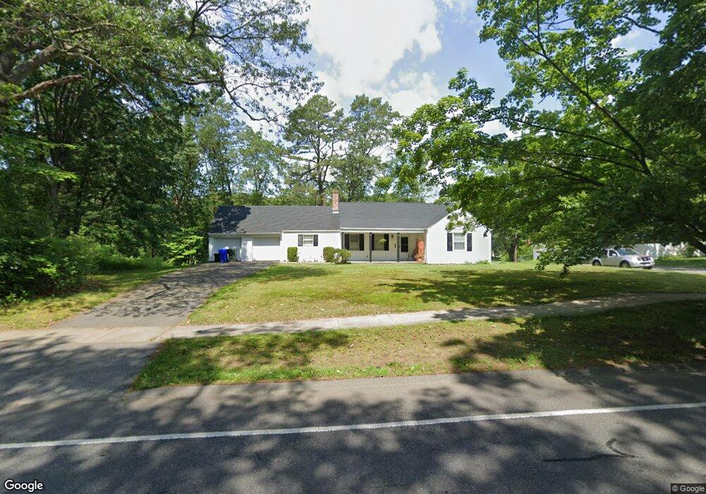
1248 Plumtree Rd Springfield, MA 01119
Sixteen Acres NeighborhoodEstimated Value: $325,675 - $382,000
3
Beds
2
Baths
1,412
Sq Ft
$252/Sq Ft
Est. Value
About This Home
This home is located at 1248 Plumtree Rd, Springfield, MA 01119 and is currently estimated at $355,169, approximately $251 per square foot. 1248 Plumtree Rd is a home located in Hampden County with nearby schools including Glickman Elementary, M Marcus Kiley Middle, and Springfield High School of Science and Technology.
Create a Home Valuation Report for This Property
The Home Valuation Report is an in-depth analysis detailing your home's value as well as a comparison with similar homes in the area
Home Values in the Area
Average Home Value in this Area
Tax History
| Year | Tax Paid | Tax Assessment Tax Assessment Total Assessment is a certain percentage of the fair market value that is determined by local assessors to be the total taxable value of land and additions on the property. | Land | Improvement |
|---|---|---|---|---|
| 2025 | $4,105 | $261,800 | $58,000 | $203,800 |
| 2024 | $4,142 | $257,900 | $58,000 | $199,900 |
| 2023 | $3,577 | $209,800 | $55,200 | $154,600 |
| 2022 | $3,363 | $178,700 | $55,200 | $123,500 |
| 2021 | $3,187 | $168,600 | $50,200 | $118,400 |
| 2020 | $3,293 | $168,600 | $50,200 | $118,400 |
| 2019 | $2,962 | $150,500 | $50,200 | $100,300 |
| 2018 | $3,017 | $153,300 | $50,200 | $103,100 |
| 2017 | $2,927 | $148,900 | $45,900 | $103,000 |
| 2016 | $2,715 | $138,100 | $45,900 | $92,200 |
| 2015 | $2,699 | $137,200 | $45,900 | $91,300 |
Source: Public Records
Map
Nearby Homes
- 55 Old Farm Rd
- 108 Birchland Ave
- 73 Timber Ln
- 46 Puritan Cir
- 86 Wildwood Ave
- 81 W Crystal Brook Dr
- 74 Valley Rd
- 744 Bradley Rd
- 119 Acrebrook Rd
- 120 Bridle Path Rd
- Lot 37 Kane St
- 647 Plumtree Rd
- 228 Acrebrook Rd
- 24 Wands St
- 85 Talmadge Dr
- 86 Talmadge Dr
- 30 W Hill Rd
- 88 Senator St
- 101 Regal St
- 381 N Brook Rd
Your Personal Tour Guide
Ask me questions while you tour the home.