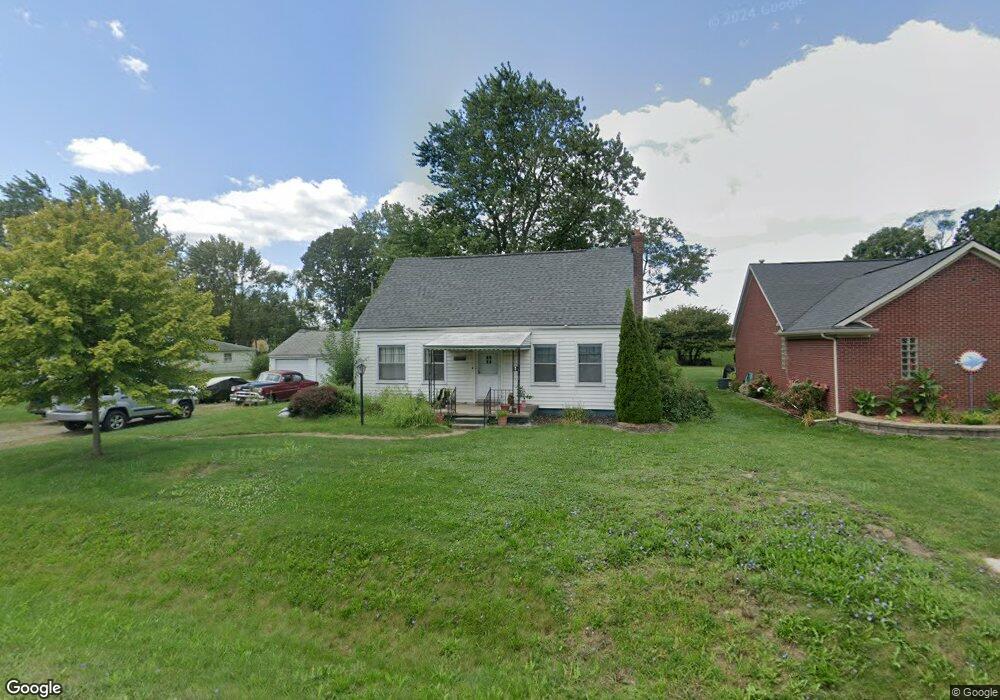
12480 Devoe St Southgate, MI 48195
Estimated Value: $215,418 - $232,000
3
Beds
2
Baths
1,423
Sq Ft
$158/Sq Ft
Est. Value
About This Home
This home is located at 12480 Devoe St, Southgate, MI 48195 and is currently estimated at $224,355, approximately $157 per square foot. 12480 Devoe St is a home located in Wayne County with nearby schools including Shelters Elementary School, Davidson Middle School, and Southgate Anderson High School.
Ownership History
Date
Name
Owned For
Owner Type
Purchase Details
Closed on
Feb 23, 2009
Sold by
Secretary Of Housing & Urban Development
Bought by
Cole Diane
Current Estimated Value
Purchase Details
Closed on
Jul 24, 2007
Sold by
Abn Amro Mortgage Group Inc
Bought by
Hud
Purchase Details
Closed on
Jan 17, 2007
Sold by
Stemen Shawn C and Hiuser Victoria A
Bought by
Abn Amro Mortgage Group Inc
Purchase Details
Closed on
Dec 12, 2003
Sold by
Mouchet Brandi A and Mouchet Jeffrey R
Bought by
Stemen Shawn C
Create a Home Valuation Report for This Property
The Home Valuation Report is an in-depth analysis detailing your home's value as well as a comparison with similar homes in the area
Home Values in the Area
Average Home Value in this Area
Purchase History
| Date | Buyer | Sale Price | Title Company |
|---|---|---|---|
| Cole Diane | $60,000 | None Available | |
| Hud | -- | None Available | |
| Abn Amro Mortgage Group Inc | $154,034 | None Available | |
| Stemen Shawn C | $153,000 | Minnesota Title Agency |
Source: Public Records
Tax History
| Year | Tax Paid | Tax Assessment Tax Assessment Total Assessment is a certain percentage of the fair market value that is determined by local assessors to be the total taxable value of land and additions on the property. | Land | Improvement |
|---|---|---|---|---|
| 2025 | $2,425 | $91,100 | $0 | $0 |
| 2024 | $2,334 | $82,700 | $0 | $0 |
| 2023 | $2,234 | $72,600 | $0 | $0 |
| 2022 | $2,604 | $66,100 | $0 | $0 |
| 2021 | $2,533 | $59,200 | $0 | $0 |
| 2020 | $2,438 | $56,900 | $0 | $0 |
| 2019 | $2,406 | $51,300 | $0 | $0 |
| 2018 | $1,812 | $45,800 | $0 | $0 |
| 2017 | $1,124 | $44,800 | $0 | $0 |
| 2016 | $2,219 | $44,200 | $0 | $0 |
| 2015 | $3,964 | $42,300 | $0 | $0 |
| 2013 | $3,840 | $40,200 | $0 | $0 |
| 2012 | $1,602 | $37,800 | $7,400 | $30,400 |
Source: Public Records
Map
Nearby Homes
- 12630 Churchill Ave
- 12690 Churchill Ave
- 12750 Churchill Ave
- 12900 Churchill Ave
- 15468 Northline Rd
- 15602 Northline Rd
- 15405 Oakleigh
- 16685 Rudgate St
- 16285 Raleigh Square Dr
- 12661 Fordline St
- 12487 First Ave S
- 12100 Helen St
- 12421 Helen St
- 4241 Fordline Rd
- 11367 Suffolk Dr
- 13621 Mulberry St
- 13367 Fordline St
- 14212 Northline Rd
- 12173 Pearl St
- 0000 Reeck Rd